-
Key Takeaways
-
What Is LiDAR?
-
Understanding LiDAR Technology
- How LiDAR Integrates with Drones
- Advantages Over Traditional Methods
-
Top LiDAR Drones for Surveying and Mapping
- DJI Matrice 350 RTK + Zenmuse L2
- DJI Matrice 350 RTK
- Freefly Astro
- Inspired Flight IF1200
- Watts Innovations Prism Sky
- Wingtra One Gen 2
- ArcSky X55
- SkyFront Perimeter 8
-
Other Notable Models
- Harris Aerial H6
- Phoenix LiDAR Systems + Watts Innovations Prism Sky or Freefly Alta X
- Criteria for Selection
- Software Compatibility and Compliance
-
Applications of LiDAR Drones
- Surveying and Mapping
- Construction and Engineering
- Agriculture
- Environmental Monitoring
- Archaeology
-
Factors to Consider When Choosing a LiDAR Drone
- 1. Accuracy and Resolution
- 2. Payload Capacity and Compatibility
- 3. Flight Time and Range
- 4. Data Processing Software
- 5. Cost and Budget Considerations
- 6. Regulatory Compliance
- 7. Support and Training
-
The Future of LiDAR Drones
- Technological Advancements
- Drone Industry Trends
- Emerging Applications
-
Frequently Asked Questions
-
Conclusion
Just a few years ago, LiDAR on drones was out of reach for most.
In the past, a chaotic car wreck with a drunk driver and a family, no witnesses left police struggling to piece together the scene. What once took a team of officers hours can now be done by a single operator with a LiDAR drone.
So, what changed? Sensors got smaller and cheaper. Drones got better. Industries saw how much time and money they wasted on old methods.
Drone mapping 160 acres used to take days—now, it’s done in under an hour with pinpoint detail. For those covering remote, rugged terrain, it’s a revolution.
And in this article, we’ll show you how LiDAR drones are transforming industries.
Key Takeaways
- Learn how LiDAR technology enhances drone capabilities for precise surveying and mapping.
- Explore the leading LiDAR drone models and their unique features.
- Understand key factors to consider when selecting a LiDAR drone for specific applications.
- Discover future trends and advancements in LiDAR drone technology.
What Is LiDAR?
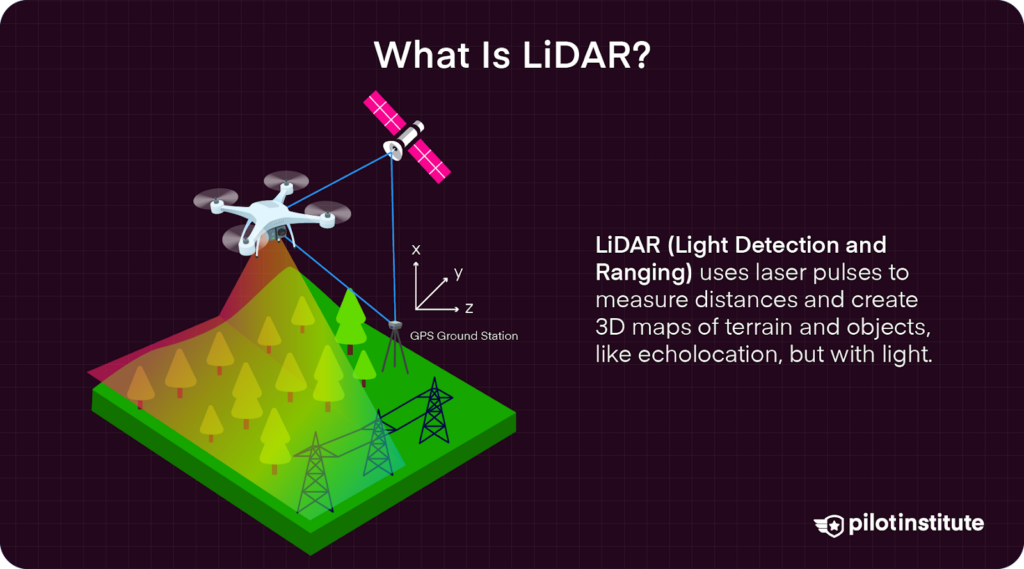
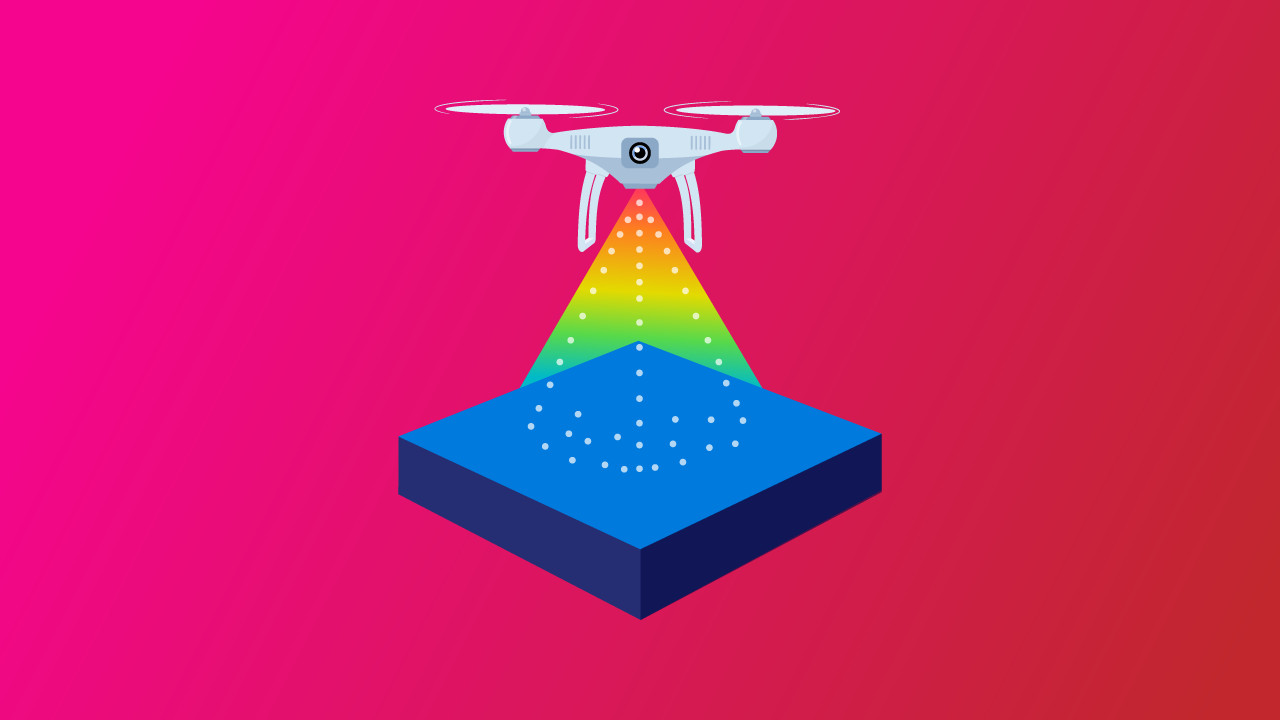
LiDAR, or Light Detection and Ranging, is a remote sensing method that uses laser pulses to measure distances to objects.
By emitting laser beams and calculating the time it takes for each pulse to return after hitting an object, LiDAR systems can determine precise distances. This data is used to generate detailed, three-dimensional information and maps about the shape and characteristics of the terrain and objects.
Analogies to Understand LiDAR:
- Echolocation in Bats: Just as bats emit sound waves to navigate by listening to the echoes that bounce back, LiDAR systems emit laser pulses and measure their return times to map their surroundings. Echolocation in bats is also very similar to submarines using sonar underwater.
- 3D Tape Measure: Imagine using a tape measure to determine the distance between you and multiple objects around you. LiDAR performs this action rapidly and in all directions, creating a full 3D map.
- If you want help understanding this topic better, we recommend checking out our course on Drone LiDAR Made Easy.
Understanding LiDAR Technology
How LiDAR Integrates with Drones
Drones provide an aerial platform for LiDAR sensors, allowing UAS (Unmanned Aircraft System) operators to collect spatial data from areas that are dangerous, difficult, or downright impossible to access on foot.
Since drones can fly low and follow precise flight paths, they’re able to gather high-resolution data very well.
However, there is an ideal distance for each mission that balances accuracy, precision, and cost when capturing data.
To obtain such high levels of accuracy, LiDAR drones rely on GPS to identify their exact location, and an IMU (Inertial Measurement Unit) to track orientation and movement.
These tools work together to align every single point collected by the LiDAR scanner with its real-world position so that you’re able to have high data accuracy.
Advantages Over Traditional Methods
Compared to traditional ground surveys, LiDAR drones can complete jobs in a fraction of the time while offering even greater accuracy.
Instead of sending teams of people into the field with cars, tripods, cameras, and measuring wheels, a single operator can fly a route and generate a 3D map with centimeter-level precision in a few hours.
The pulses of light from the LiDAR sensor(s) allow the system to cut through dense forest canopies and capture true ground elevation beneath the trees, which is a huge advantage for forestry work and environmental monitoring.
According to the FAA, LiDAR systems can “collect elevation data of both the ground surface and vegetation canopy,” which gives them a level of flexibility that traditional mapping and surveying methods just can’t match.
Top LiDAR Drones for Surveying and Mapping
DJI Matrice 350 RTK + Zenmuse L2
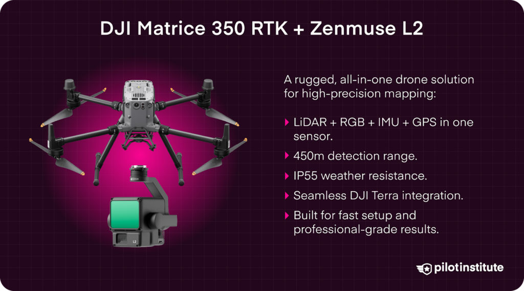
A powerful, all-in-one enterprise solution, the Matrice 350 RTK paired with DJI’s Zenmuse L2 LiDAR sensor is ideal for professionals needing fast setup and streamlined workflows.
The L2 combines LiDAR and RGB imaging with a high-accuracy IMU and built-in GPS capabilities, making it perfect for mapping jobs that require very accurate readings.
- Up to 450 m detection range.
- Compatible with DJI Terra for seamless data processing.
- IP55 weather resistance for tough environments.
These drones are built to handle serious LiDAR work, offering everything from extended flight time to heavy-lift capabilities. Regardless of the project, these platforms offer the performance and flexibility professionals rely on.
DJI Matrice 350 RTK
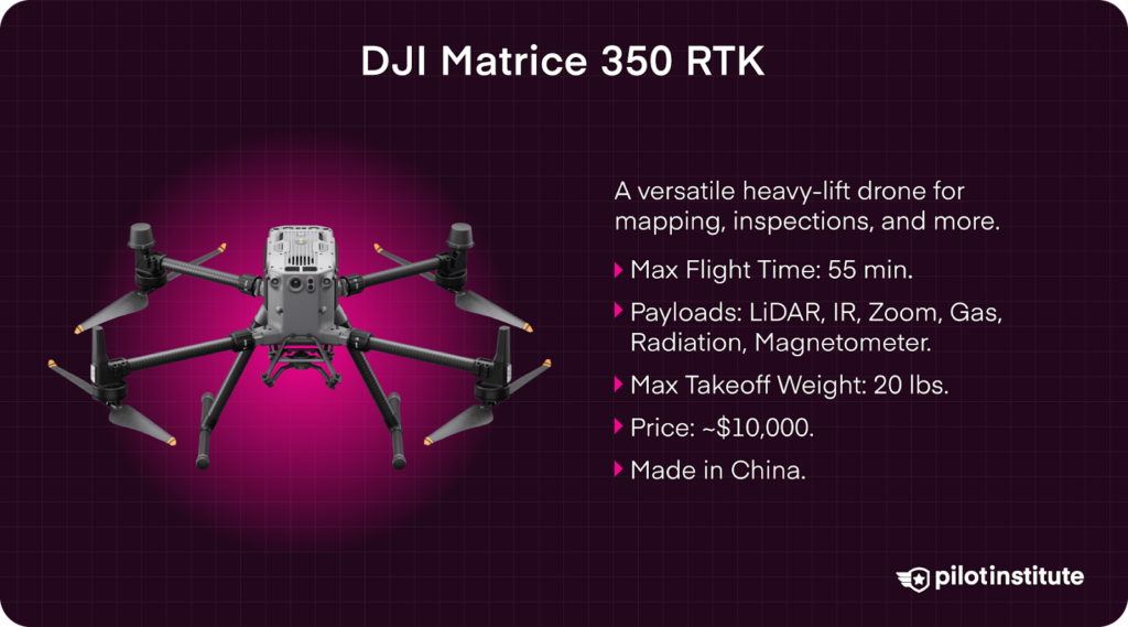
An industry workhorse, the Matrice 350 RTK is one of DJI’s most notable drone platforms. With support for a wide variety of payloads like LiDAR, IRi, and optical gas imaging, this drone is ready for everything from mapping to inspections.
- Max Flight Time: 55 minutes.
- Payloads: Visual, IR, Zoom, LiDAR, Optical Gas Imaging, Magnetometer, Radiation Detection
- Weight / Max Takeoff Weight: 14 lbs / 20 lbs
- Price: $10,000
- Use Case: Multi-use heavy lift aircraft.
- Made in: China
Freefly Astro
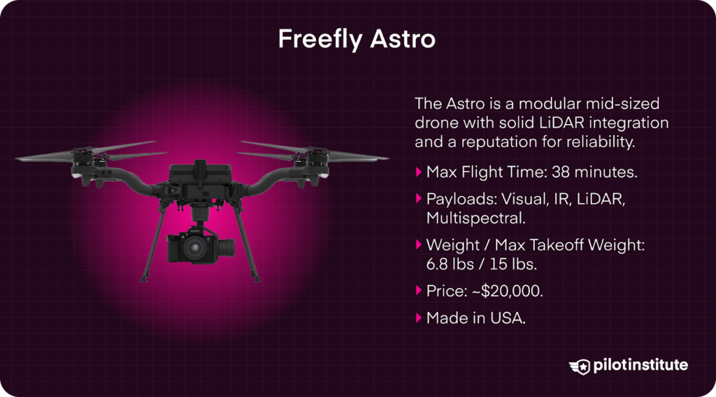
The Freefly Astro is a modular mid-sized drone with solid LiDAR integration and a reputation for reliability. It’s widely used by surveyors who value ease of transport, fast deployment, and battery hot-swapping capabilities.
- Max Flight Time: 38 minutes.
- Payloads: Visual, IR, LiDAR, Multispectral.
- Weight / Max Takeoff Weight: 6.8 lbs / 15 lbs.
- Price: $20,000
- Use Case: Medium lift mapping drone.
- Made in: USA
Inspired Flight IF1200
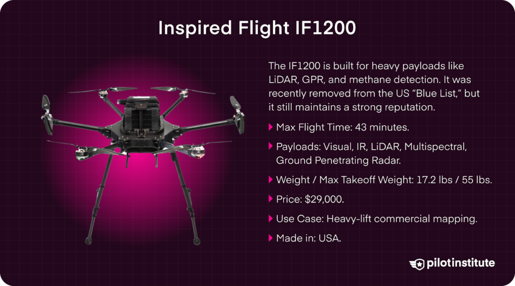
If you’re looking for an American-made drone with a great reputation, the Inspired Flight IF1200 delivers. It supports some of the heaviest payloads in its class and is designed with LiDAR, GPR, methane detection, and other industrial sensors in mind.
Recently, Inspired Flight was removed from the US’s “Blue List” – a list that designates which UAS are cleared for government work in the US. However, their reputation is still outstanding.
- Max Flight Time: 43 minutes.
- Payloads: Visual, IR, LiDAR, Multispectral, Ground Penetrating Radar
- Weight / Max Takeoff Weight: 17.2 lbs / 55 lbs
- Price: $29,000
- Use Case: Heavy-lift commercial mapping.
- Made in: USA
Watts Innovations Prism Sky
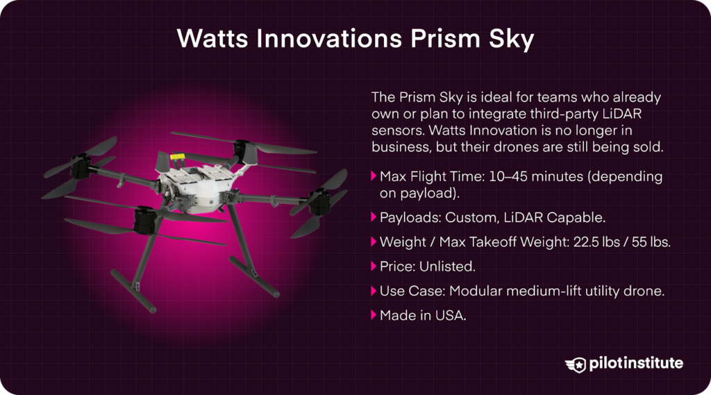
With its modular design and open payload system, the Watts Innovations Prism Sky is ideal for teams who already own or plan to integrate third-party LiDAR sensors. It’s a great platform for medium-lift operations, offering balance and expandability.
NOTE: Watts Innovation is no longer in business, but their drones are still being sold.
- Max Flight Time: 10–45 minutes (depending on payload).
- Payloads: Custom, LiDAR Capable
- Weight / Max Takeoff Weight: 22.5 lbs / 55 lbs
- Price: Unlisted.
- Use Case: Modular medium-lift utility drone.
- Made in: USA
Wingtra One Gen 2
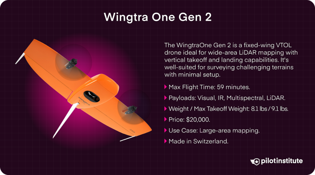
The WingtraOne Gen II is a fixed-wing VTOL drone ideal for wide-area LiDAR mapping with vertical takeoff and landing capabilities. It’s well-suited for surveying challenging terrains with minimal setup.
- Max Flight Time: 59 minutes.
- Payloads: Visual, IR, Multispectral, LiDAR
- Weight / Max Takeoff Weight: 8.1 lbs / 9.1 lbs
- Price: $20,000
- Use Case: Large-area mapping.
- Made in: Switzerland
ArcSky X55
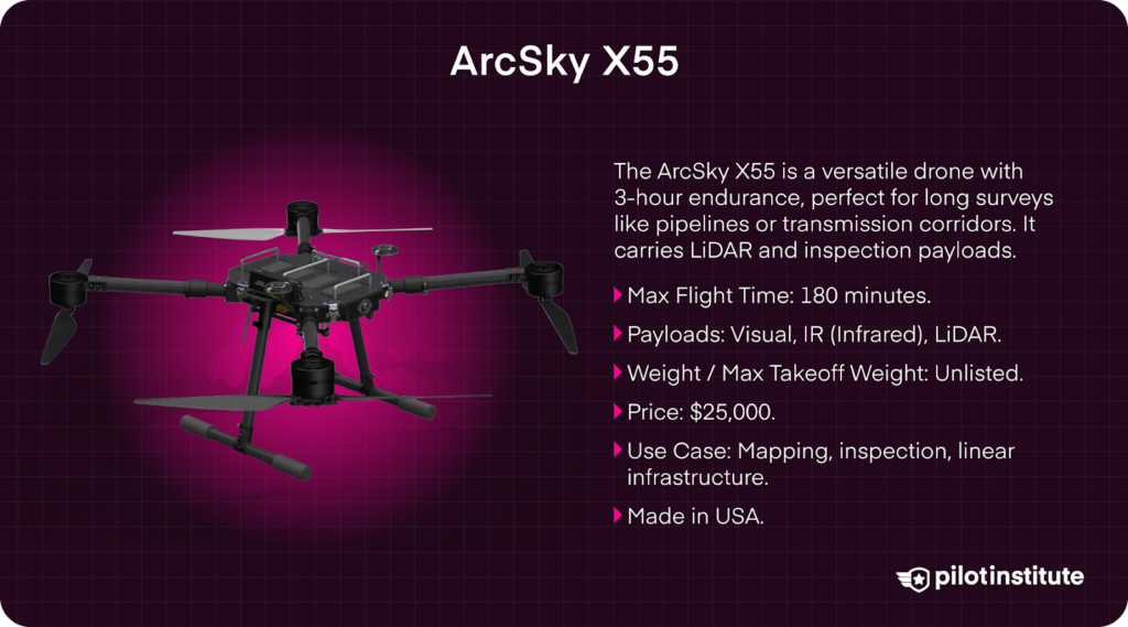
The ArcSky X55 is a versatile drone that was built for extended endurance and can carry LiDAR and inspection payloads for up to three hours. It’s a strong option for long linear surveys such as pipelines or transmission corridors.
- Max Flight Time: 180 minutes.
- Payloads: Visual, IR (Infrared), LiDAR
- Weight / Max Takeoff Weight: Unlisted
- Price: $25,000
- Use Case: Mapping, inspection, linear infrastructure.
- Made in: USA
SkyFront Perimeter 8
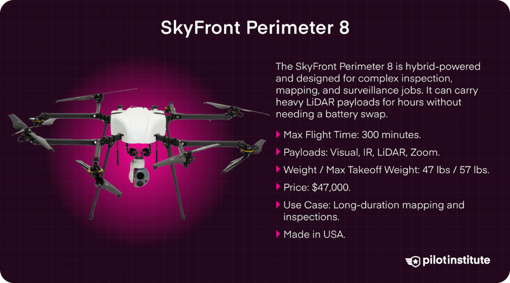
Known for its ultra-long endurance, the SkyFront Perimeter 8 is hybrid-powered and designed for complex inspection, mapping, and surveillance jobs. It can carry heavy LiDAR payloads for hours without needing a battery swap.
- Max Flight Time: 300 minutes.
- Payloads: Visual, IR, LiDAR, Zoom
- Weight / Max Takeoff Weight: 47 lbs / 57 lbs
- Price: $47,000
- Use Case: Long-duration mapping and inspections.
- Made in: USA
Other Notable Models
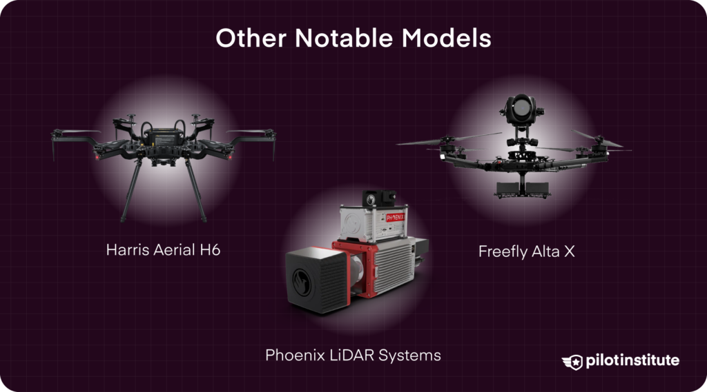
Harris Aerial H6
Built for professionals in mapping and industry, the Harris Aerial H6 supports high-end sensors like hyperspectral and ground penetrating radar alongside LiDAR.
It’s a heavy-lift UAS designed to go where lighter platforms can’t, and with a 48-minute flight time, it is capable of extended mapping missions with only one set of batteries.
- Max Flight Time: 48 minutes.
- Payloads: Visual, IR, LiDAR, Multispectral
- Weight / Max Takeoff Weight: 21 lbs / 55 lbs
- Price: $39,500
- Use Case: Mapping, infrastructure, industrial inspections.
- Made in: USA
Phoenix LiDAR Systems + Watts Innovations Prism Sky or Freefly Alta X
Phoenix LiDAR Systems is widely respected for its customizable, survey-grade LiDAR solutions tailored to the unique needs of each project.
Rather than manufacturing drones themselves, Phoenix specializes in building LiDAR payloads that integrate seamlessly with platforms like the Watts Innovations Prism Sky, Freefly Alta X, and DJI M350 RTK.
Their systems are modular, scalable, and trusted across mining, forestry, utilities, and civil engineering industries.
- Max Flight Time: 10–45 minutes (dependent on platform and payload).
- Sensors: Custom options like the Ranger UL, Ranger LR, or Scout-32, offering 300,000–1.2 million points/sec.
- Mounting Platforms: Compatible with Prism Sky, Alta X, DJI M350 RTK, and more.
- Accuracy: 2–3 centimeters.
- Price: Highly variable depending on configuration (~$150,000–$250,000+)
- Use Case: Corridor mapping, forestry, topographic surveys, mining, infrastructure.
- Made in: USA
What sets Phoenix LiDAR apart is its ability to deliver custom-configured LiDAR payloads that match exact client requirements, whether that means longer range, denser point clouds, or multi-sensor integration with RGB or thermal imaging.
Phoenix also offers ongoing customer support, in-field assistance, and responsive technical help.
Whether you’re new to aerial LiDAR or expanding an established mapping operation, Phoenix LiDAR provides the tools and guidance to get professional-grade results every time.
Criteria for Selection
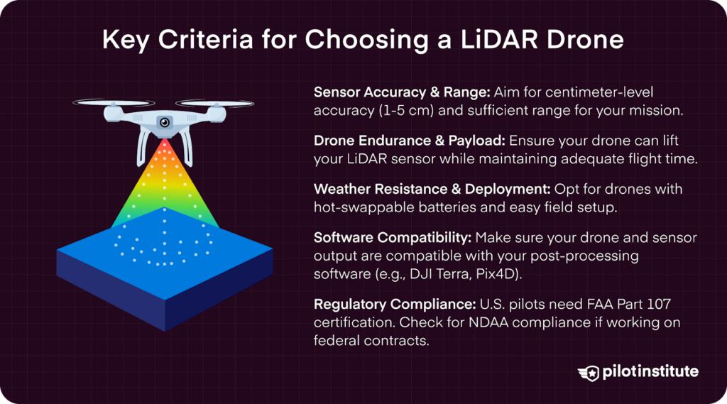
Choosing the right LiDAR drone involves finding the one that fits your mission, your budget, and your workflow. Before making a decision, there are several key criteria to consider.
Sensor accuracy and range should be your top priority, especially for projects that demand high-resolution results.
- Look for sensors with centimeter-level accuracy (ideally within 1 – 5 cm) and the ability to deliver dense point clouds.
The greater the range, the higher you can fly – helpful when covering large areas or flying over sensitive infrastructure. - Next, assess drone endurance and payload capacity. Make sure your drone has enough lift to carry your payload (ie: a LiDAR sensor) while still providing adequate flight time.
Heavy-lift multirotors are great for precision mapping jobs, while fixed-wing VTOL drones offer longer endurance for wide-area coverage. Also, consider weather resistance, hot-swappable batteries, and how easily the system can be deployed in the field. - Equally important is your software ecosystem. The best drone in the world isn’t much help if your post-processing software can’t handle the data.
Make sure your drone and sensor output are compatible with whatever platform you’re using, whether that’s DJI Terra, Pix4D, or a custom program.
Software Compatibility and Compliance
You’ll also need to stay on top of regulatory requirements. In the U.S., commercial drone pilots must hold a valid FAA Part 107 certificate.
Your drone must also be operated within legal guidelines, which include staying below 400 feet AGL, flying within visual line of sight (VLOS), and obtaining airspace authorization when needed. The FAA clearly states:
“Operators must ensure their drones and sensors comply with all applicable regulations.” (FAA Part 107 Guidelines)
If you’re working on public infrastructure projects or federal contracts, you may also need a system that meets NDAA compliance or is listed on the Blue UAS list. This is especially true for jobs involving utilities, defense installations, or other sensitive assets.
Choosing the right LiDAR drone involves making sure that every piece of your operation works together, from flight planning to data delivery. When your hardware, software, and regulatory compliance are all in sync, you’ll be able to fly with confidence and deliver results your clients can count on.
Applications of LiDAR Drones
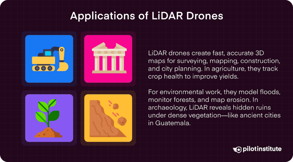
Surveying and Mapping
LiDAR-equipped drones are changing the game when it comes to topographic surveys and 3D mapping.
They can generate high-resolution Digital Elevation Models (DEMs) and Digital Surface Models (DSMs), which are essential for planning infrastructure projects like highways, city developments, and mining operations.
What used to take days or weeks in the field can now be done in a single flight, with data ready for processing shortly after. That speed doesn’t just save time, it cuts costs and reduces the margin for human error.
Construction and Engineering
In construction and engineering, LiDAR drones give teams a fast and accurate way to assess job sites, plan out projects, and track progress over time.
They’re commonly used to measure the volume of materials, check structures like buildings, and spot any issues before they become costly.
The data collected integrates seamlessly with BIM (Building Information Modeling) systems, which helps architects, engineers, and contractors stay on the same page.
Teams that don’t communicate across multiple departments on construction and engineering projects often encounter issues with their LiDAR data being misaligned.
Agriculture
Farmers are using LiDAR to take precision agriculture to the next level. From crop spraying to LiDAR, UAS are turning the agriculture industry upside-down. These drones can detect subtle changes in crop height, canopy density, and spacing, all of which are indicators of crop health and growth.
With that information, growers can fine-tune how they apply water, fertilizer, and pesticides, ensuring resources are used efficiently.
Environmental Monitoring
When it comes to environmental monitoring, LiDAR provides a way to gather detailed elevation data that can’t be matched by traditional tools. In forestry, it’s used to estimate biomass, assess forest health, and monitor deforestation.
For flood risk analysis, drones equipped with LiDAR can map out terrain with enough precision to model how water might move through an area, helping communities plan and prepare for extreme weather.
It’s also used in coastal erosion studies, tracking how shorelines shift over time to guide conservation and land-use planning efforts.
Archaeology
LiDAR has opened up an entirely new chapter in archaeological discovery. Dense vegetation that once hid ancient cities and ruins is no longer a barrier, LiDAR can see right through it. Researchers have uncovered massive complexes, roadways, and irrigation infrastructure.
One such example was from a mission in Guatemala where researchers mapped out thousands of square kilometers as they are “producing the largest LiDAR data set ever obtained for archaeological research”.
The team working on that project has found evidence of ancient civilizations, and how they lived over 1,000 years ago.
Factors to Consider When Choosing a LiDAR Drone

1. Accuracy and Resolution
The heart of any LiDAR drone is the sensor itself. If you’re working in forestry, construction, or topographic mapping, sensor accuracy can make or break the project. When businesses are dealing with projects that cost anywhere from $10,000 to $10,000,000, accuracy is essential at such a large scale.
Higher-end LiDAR units produce denser point clouds, offer longer ranges, and support multiple returns per pulse, all of which improve ground detail, especially in vegetated or complex environments.
Look for precision under 5cm. Anywhere from 1-5 cm accuracy is generally considered a good sensor for LiDAR applications. Sensors with high pulse rates offer better definition and faster coverage.
2. Payload Capacity and Compatibility
Not all drones can support the weight of a full-featured LiDAR system. It’s important to choose a platform with enough lift capacity to carry your sensor while maintaining a safe, stable flight.
3. Flight Time and Range
If you’re using heavier sensors, you’ll need a heavy-lift multirotor or hybrid drone to match. For large-scale mapping projects, fixed-wing VTOL drones are ideal because they offer longer flight times and better fuel or battery efficiency.
Make sure your drone’s maximum takeoff weight leaves enough room to carry your full payload safely and legally.
4. Data Processing Software
Even the best LiDAR data is only as useful as your ability to process and apply it. That’s why seamless software integration is key when selecting your setup.
Look for LiDAR systems that are compatible with industry-standard software platforms such as Pix4D, DJI Terra, Global Mapper, or one of many different GIS software available.
If high accuracy is a priority, make sure your system supports RTK (Real-Time Kinematic) or PPK (Post-Processed Kinematic) correction. These methods reference other data points in order to align point clouds with extremely high accuracy.
Your system should also integrate well with ground control points (GCPs) and base stations to ensure consistent georeferencing throughout your workflow.
5. Cost and Budget Considerations
LiDAR drone systems range widely in price, and it’s important to think past the initial cost. A budget for LiDAR equipment must also include the cost of a drone, spare batteries, travel cases, accessories, post-processing software, and insurance.
A complete LiDAR setup could cost anywhere from $25,000 for an entry-level system to more than $250,000 for a high-end, fully customized configuration.
Open-platform drones can offer more flexibility, but they may require more time and technical experience to set up properly.
Planning for long-term costs, like maintenance, software updates, and future sensor upgrades, will help you stay sustainable and competitive as your business grows.
6. Regulatory Compliance
In the U.S., drone pilots must follow FAA Part 107 regulations, and any drone or sensor used commercially needs to meet those legal requirements. This includes operating within approved airspace, staying below altitude limits, and maintaining visual line of sight.
Countries outside of the U.S. have their own rules and regulations, so any time you want to operate a drone in a country other than your own, check online for the most up-to-date information.
The FAA specifically states that “operators must ensure their drones and sensors comply with all applicable regulations”.
7. Support and Training
LiDAR workflows can be complex, especially for teams who are new to drone surveying. That’s why strong vendor support and proper training are key to getting your system up and running smoothly.
Some companies, like Phoenix LiDAR Systems, go a step further by providing in-depth workflow coaching, software tutorials, and real-time support as you begin flying and processing data.
Having access to knowledgeable support staff can prevent costly mistakes and help you build confidence in the field, whether you’re working for yourself or for a company.
The Future of LiDAR Drones
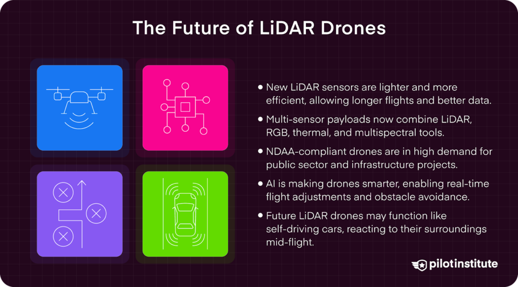
Technological Advancements
One of the biggest changes is the development of smaller, lighter, and more efficient LiDAR sensors.
New sensors can still collect very detailed 3D data, but they don’t weigh as much or drain the battery as fast. That means drones can fly longer and cover more ground in a single mission.
Some systems now include LiDAR, RGB cameras, thermal sensors, and multispectral tools all in one payload, saving time and improving results.
Drone Industry Trends
As LiDAR drones become more common in government and infrastructure jobs, there’s a growing demand for systems that meet U.S. security and compliance standards.
Many agencies now require NDAA-compliant hardware, which means using drones and sensors that are approved for federal use. This is especially important if you plan to work on public contracts or around sensitive areas like utilities, bridges, or airports.
Emerging Applications
Drones are becoming smarter. New systems now use artificial intelligence (AI) and advanced software to change flight paths in real time.
A good example comes from outside the drone industry: Waymo, the self-driving car company backed by Google’s Alphabet.
Waymo’s vehicles rely on LiDAR, AI, and real-time data to make quick decisions while navigating busy streets.
This level of autonomy is gradually entering the drone world. In the future, LiDAR drones may not just follow set routes. They could react to their surroundings in real-time, changing flight paths to gather better data or avoid obstacles.
Frequently Asked Questions
- Do I need a Part 107 license to fly a LiDAR drone commercially?
Yes. If you’re using a drone for any kind of commercial work in the U.S., including LiDAR surveying, you’ll need an FAA Part 107 remote Pilot Certificate. This applies even if you’re only flying occasionally, or in the middle of nowhere.
- How accurate is LiDAR drone data compared to traditional ground surveys?
Drone-based LiDAR can be incredibly accurate, often within 1–5 centimeters, depending on your setup, flight plan, and ground control points. While total station surveys may still be used for legal boundary work, LiDAR is more efficient for covering large areas and gathering dense elevation data.
- What software do I need to process LiDAR data?
You’ll need post-processing software that can handle point cloud data. Popular options include DJI Terra, Pix4D, Global Mapper, LiDAR360, and CloudCompare.
Some drone and sensor packages, like those from Phoenix LiDAR, include proprietary software for managing workflows from start to finish.
- Can LiDAR see through trees?
Not exactly, but it can “see” the ground under trees better than cameras can. LiDAR sensors send laser pulses that can pass between leaves and branches. As long as some pulses reach the ground, the system can build an accurate elevation model even in dense vegetation.
- How much does a LiDAR drone cost?
Pricing varies widely. Entry-level systems start around $20,000–$30,000, while high-end setups can run $150,000 or more.
The total cost depends on the drone, payload, sensor accuracy, and software tools included. You’ll also want to budget for training, accessories, and miscellaneous items, like SD Cards. You’ll need a lot of SD cards.
- Is LiDAR better than photogrammetry?
It depends on the job. LiDAR is generally more accurate for elevation mapping, works better in vegetation, and doesn’t rely on lighting conditions.
On the other hand, photogrammetry is great for visual models and mapping, but it can struggle in forests or uneven terrain. Many professionals use both together to get the best results.
- What industries use LiDAR drones?
LiDAR drones are used in construction, civil engineering, agriculture, forestry, environmental monitoring, utilities, mining, and even archaeology. Anywhere you need accurate 3D mapping or terrain modeling, LiDAR has a place.
Conclusion
LiDAR sensors and drones have transformed how we gather and analyze 3D data. Tasks that once needed large teams, costly aircraft, or long days in the field can now be done by one trained operator in just a few hours.
Using the right drone, sensor, and software can help you get survey-grade results. This is great for tasks like construction planning and environmental monitoring.
Today, you don’t need a big budget or a large team to start using LiDAR. Smaller businesses, solo operators, and local agencies are already using drone-based LiDAR. They save time, cut costs, and obtain better data.
Whether mapping rugged terrain or flat farmland, there’s a drone setup that can handle the job. It’s all about choosing tools that help you work smarter, move faster, and deliver reliable results to your clients.