-
Key Takeaways
-
The Growing Role of Drones in Firefighting
-
Benefits of Drones for Fire Departments
- Assessing Fire Behavior
- Increased Firefighter Safety
- Search and Rescue Operations
- Emergency Communication and Coordination
- Improved Operational Efficiency
- Cost-Effectiveness and Resource Optimization
- Drone News Update
- Post-Fire Assessment and Recovery
- Prescribed Fire Prevention Strategies
-
Practical Applications of Drones in Firefighting
- Case Studies
- Types of Drones and Technologies Used
-
Challenges and Limitations
- Flight Time and Battery Constraints
- Weather and Environmental Factors
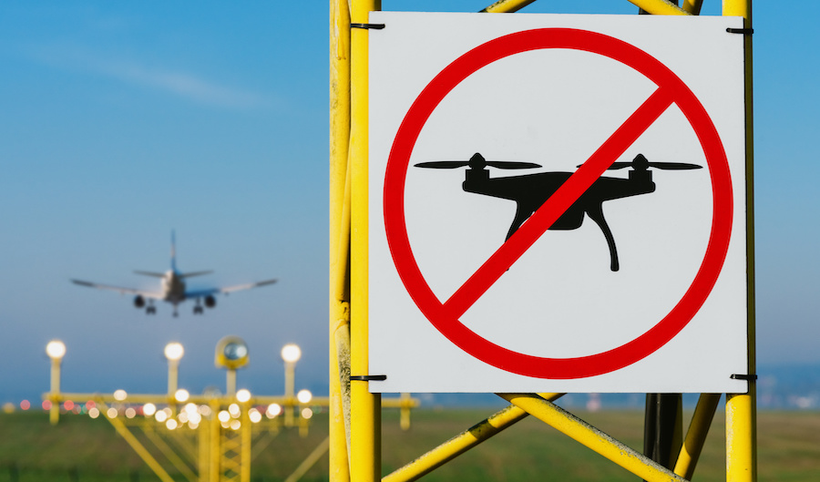
- Airspace Regulations and Safety Concerns
- Data Management and Privacy Concerns
-
Implementing a Drone Program in Your Fire Department
- Selecting the Right Equipment
- Training and Certification
- Developing Policies and Procedures
-
Future of Drones in Firefighting
- Technological Advancements
- Expanding Applications
-
Part 107 and Public Safety COA Course
-
Conclusion
With wildfire risks increasing, drones now play a fundamental role in combating them. They relay real-time data to first responders, guide water drops, redirect ground crews, and locate citizens in danger before flames overtake critical areas.
Fire departments across the globe are adopting drone technology to revolutionize firefighting strategies, enhance safety, and save lives.
Key Takeaways
- Drones are becoming an increasingly efficient strategy in firefighting operations.
- They can efficiently measure fire behaviors, increase firefighter safety, and aid in search and rescue operations.
- UAVs are also incredibly cost-effective compared to traditional aerial firefighting techniques.
- New advancements in camera sensors, AI technologies, and swarm algorithms are expanding drone efficiency in emergency relief efforts.
- Putting out the initial investment for the right drone is a smart addition to any firefighting arsenal.
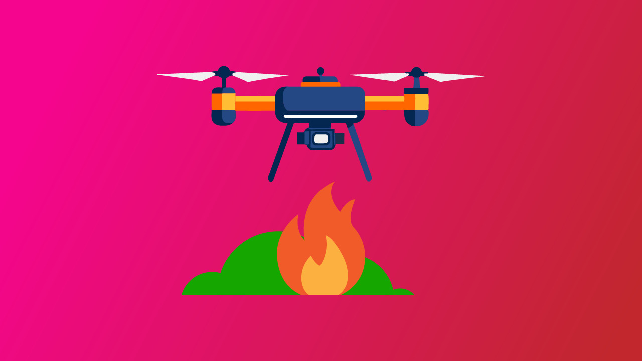
The Growing Role of Drones in Firefighting
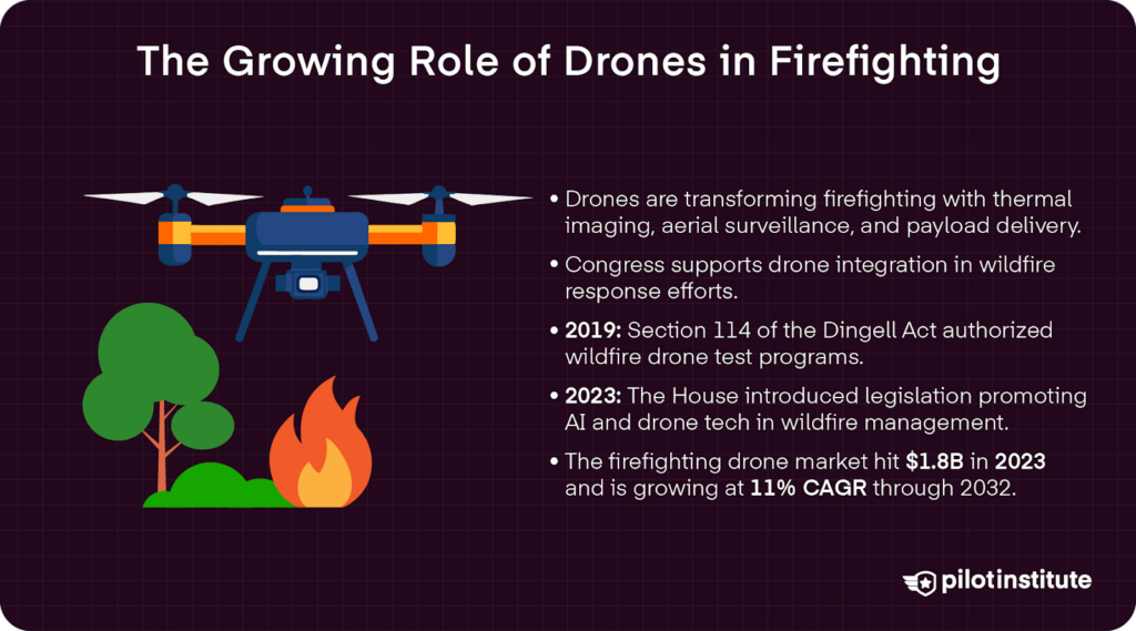
Drones continue to demonstrate incredible importance in public safety efforts, including firefighting strategies. With technology for aerial surveillance, thermal imaging, and even increased payload capacity, drones are increasingly becoming an essential tool in any firefighter’s arsenal.
Today, Congress has been pushing to integrate drone technologies further within firefighting efforts. In 2019, the John D. Dingell, J. Conservation, Management, and Recreation Act expanded the modernization of technological tools used in combating wildfires.
Section 114, Wildfire Technology Modernization, opened the door for the Department of the Interior and the Department of Agriculture to develop a test program exploring drones as a key resource in wildfire management.
Later in 2023, the House of Representatives introduced the Wildfire Technology Demonstration, Evaluation, Modernization, and Optimization Act, where legislators encouraged the adoption of drones and innovative AI technologies in wildfire efforts across the country.
The use of drones in firefighting agencies has increased significantly in recent years. According to Global Market Insights, in 2023, the firefighting drone market was valued at $1.8 billion, with an 11% CAGR growth expected from 2024 to 2032.
Benefits of Drones for Fire Departments
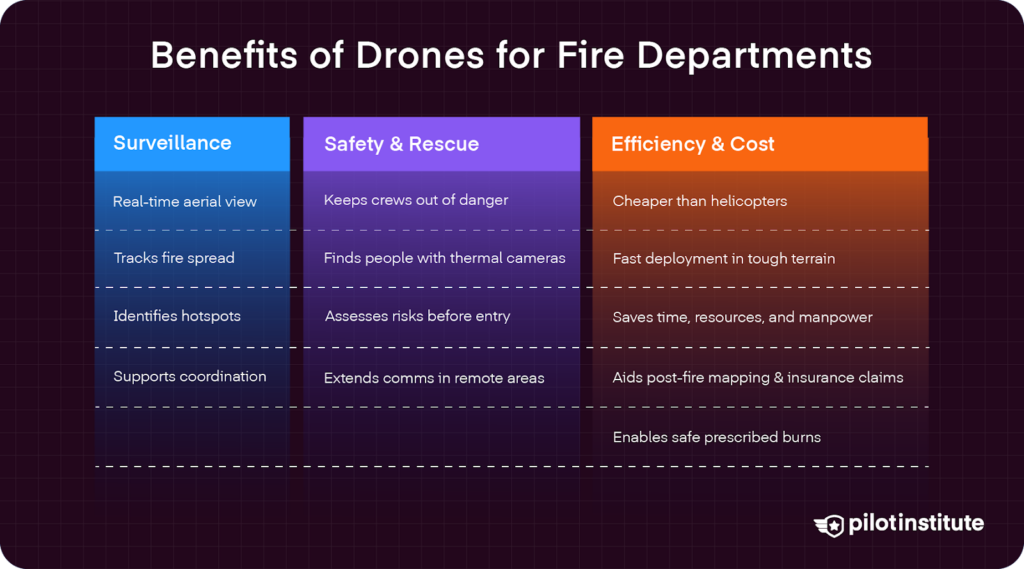
Drones deliver real-time aerial surveillance, giving incident commanders a comprehensive view of the fire scene and empowering them with the information they need to make critical decisions in combating fires.
Assessing Fire Behavior
By providing a bird’s eye view, drones are extremely effective in monitoring the spread of fires, identifying hotspots, and anticipating the fire’s movements.
Deployed in mere seconds, drones are impressive tools for aerial reconnaissance. A quick flight over an affected area can provide firefighters with information about the terrain, location of people in the area, any structural damage occurring in real-time, and a fire’s growth potential.
Drones equipped with thermal imaging sensors can detect heat signatures and give critical insight into the direction and scope of a fire’s spread. This is especially useful in the low-visibility conditions associated with smoky environments.
In the 2024 Oak Ridge Fire in Colorado, an Anafi Parrot equipped with a thermal imaging sensor helped firefighters quickly assess the fire’s perimeter and detect dangerous hot spots outside that perimeter that could have drastically increased the fire’s scope.
Increased Firefighter Safety
According to a study published in Drones, “the main disadvantage of direct attack is the risk to human life due to the short distance from the fire.” The best solution is to minimize human contact.
Drones reduce the need for human firefighters to enter dangerous environments without prior assessment. They can identify structural weaknesses or hazardous materials before personnel deployment.
As payload capacity and swarm technology increase in modern drones, firefighters on the ground and in the air can stay further away from the flames. Drones now play a key role in releasing extinguishing liquids, without the need for putting first responders in the line of fire.
Search and Rescue Operations
The advanced cameras on today’s drone models prove essential in search and rescue operations. They make it easier to spot individuals in distress in areas difficult for ground teams to cover, such as rugged forests or mountains.
Drones equipped with thermal imaging cameras locate missing or trapped individuals. Thermal sensors can not only detect heat signatures from fires, but also from potential victims in the fire’s path, thus making it more efficient to find people in low-visibility conditions.
Emergency Communication and Coordination
Moreover, drones can act as communication relays in areas where infrastructure is damaged. They can create temporary networks using Wi-Fi, RF, or cellular service when fires damage traditional communication networks.
Drones can also work to extend lines of communication over long distances and across rugged terrain. This makes them essential in relying on real-time information essential for implementing firefighting strategies and keeping crews on the ground out of danger when a fire’s path changes or intensifies.
Drones’ real-time data can also improve interagency coordination. When all decision makers in a multi-agency response team are empowered with up-to-date information, they are best equipped to mitigate the damage potential.
Improved Operational Efficiency
Rapid deployment of drones to incident scenes provides more immediate situational data. This speed can mean the difference in life-saving efforts.
Moreover, drones have a greater capacity to reach remote areas. Rough, remote terrains and even high-rise buildings are no problem for an eye in the sky compared to the significantly longer times it would take for human responders to reach fire zones.
Drones can also navigate much more efficiently in smoke-filled environments. Their complex GPS technology and obstacle avoidance sensors help them navigate with ease.
Given these characteristics, drones play a fundamental role in certain applications. For example, drones are key in monitoring roof integrity and fire spread in structure fires. T
hey also help map wildfire perimeters and can pinpoint the best evacuation route for those in harm’s way. Drones are essential in fires involving hazardous materials, as they can assess spills or leaks from a safe distance.
Cost-Effectiveness and Resource Optimization
Given their small form factor and power efficiency, drones are incredibly more cost-efficient than traditional aerial firefighting techniques, such as the use of manned aircraft like helicopters.
Aerial tankers can cost agencies over $6,000 per hour, according to Frontline Wildfire Defense.
While the initial investment in drones can be expensive, sometimes up to $10,000 or $20,000 for cutting-edge models, this pales in comparison to the upfront and operating costs of aerial tankers and specialized helicopters.
For example, a DJI Matrice 30T drone, purchased by the Salisbury Fire Department in Massachusetts, cost $13,000. While this was a big investment for the small agency, it is expected to save thousands more over the next few years.
Looking beyond price tags alone, cost savings also include resource allocation, where drones help free up other vital resources and personnel for other critical tasks. There is great potential for efficiency gains in terms of savings in deployment and data collection compared to traditional methods.
Post-Fire Assessment and Recovery
Drones can also assist in damage assessment by capturing high-resolution images and videos of the affected areas. LiDAR and photogrammetry mapping can produce detailed 3D maps and models that aid in assessing what happened and how to prevent similar emergencies in the future.
Such mapping technology can also aid in recovery planning and rebuilding efforts. Geographic Information Systems (GIS) can help with rapid debris removal and track recovery progress as it unfolds. Detailed maps from a bird’s-eye perspective can also assess the larger environmental impact of wildfires.
Drone footage can even provide valuable records for insurance claims and investigations.
Prescribed Fire Prevention Strategies
Drones can also assist in proactive fire management strategies, such as the use of prescribed burns. According to the US Forest Service, drones can play a key role in aerial ignition, where they use “aerial ignition spheres to start intentional fires from above.” Chemicals warm up upon release and ignite in the air to start a prescribed burn in the vegetation below.
For hard-to-access, high-risk areas, prescribed fires can significantly reduce damage potential by clearing out dead vegetation that would otherwise serve as kindling for raging wildfires. This is exactly what the Forest Service did in the Rocky Mountain region, proactively burning at-risk areas around Beulah, Colorado.
Practical Applications of Drones in Firefighting
Case Studies
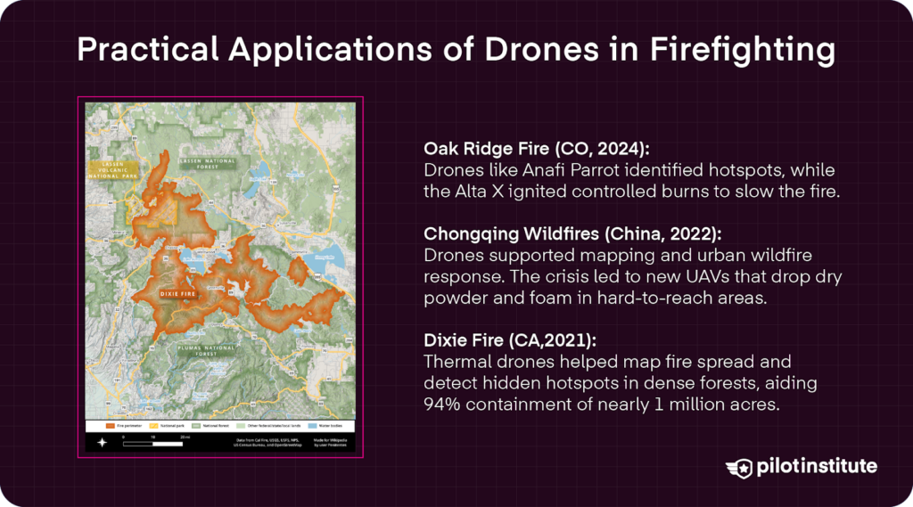
Oak Ridge Fire in Colorado
A massive wildfire ignited after lightning strikes on June 22, 2024, near Beulah, Colorado. Drones were implemented both for reconnaissance and for proactive firefighting strategies. An Anafi Parrot was used to detect heat signatures in the area to identify hotspots.
Additionally, an Alta X helped with aerial ignition, starting prescribed burns in high-risk areas to stamp out fuel for the Oak Ridge Fire. This comprehensive use of UAVs helped manage the fire and reduce its overall impact.
Chongqing Wildfires in China
In August 2022, a record-breaking heatwave in China’s Chongqing region fueled massive wildfires that threatened densely populated urban areas. Over 5,000 firefighters and other first responders were called to the scene. With quick actions and advances in drone technology, the fire was eventually contained.
Drones were utilized for reconnaissance work during the fires. This was a unique case because it involved dense forested regions, as well as urban areas with high-rise buildings.
The damage also inspired a Chongqing-based drone manufacturer to develop UAVs capable of dropping dry-powder extinguishant and pressurized air foam at hard-to-reach locations.
Dixie Fire in California
In July of 2021, the Dixie Fire raged in five counties in Northern California. Drones used infrared cameras to root out hot spots, containing the fire from spreading beyond manageable borders. By the time 94%containment was reached, the fire had burned 963,276 acres.
Drones played a key role in aerial reconnaissance and mapping of the fire’s growth. Even under dense vegetation in old-growth forests, thermal imaging technology was able to identify hot spots and reduce the fire’s spread significantly by alerting firefighters on where to establish effective fire-containment lines.
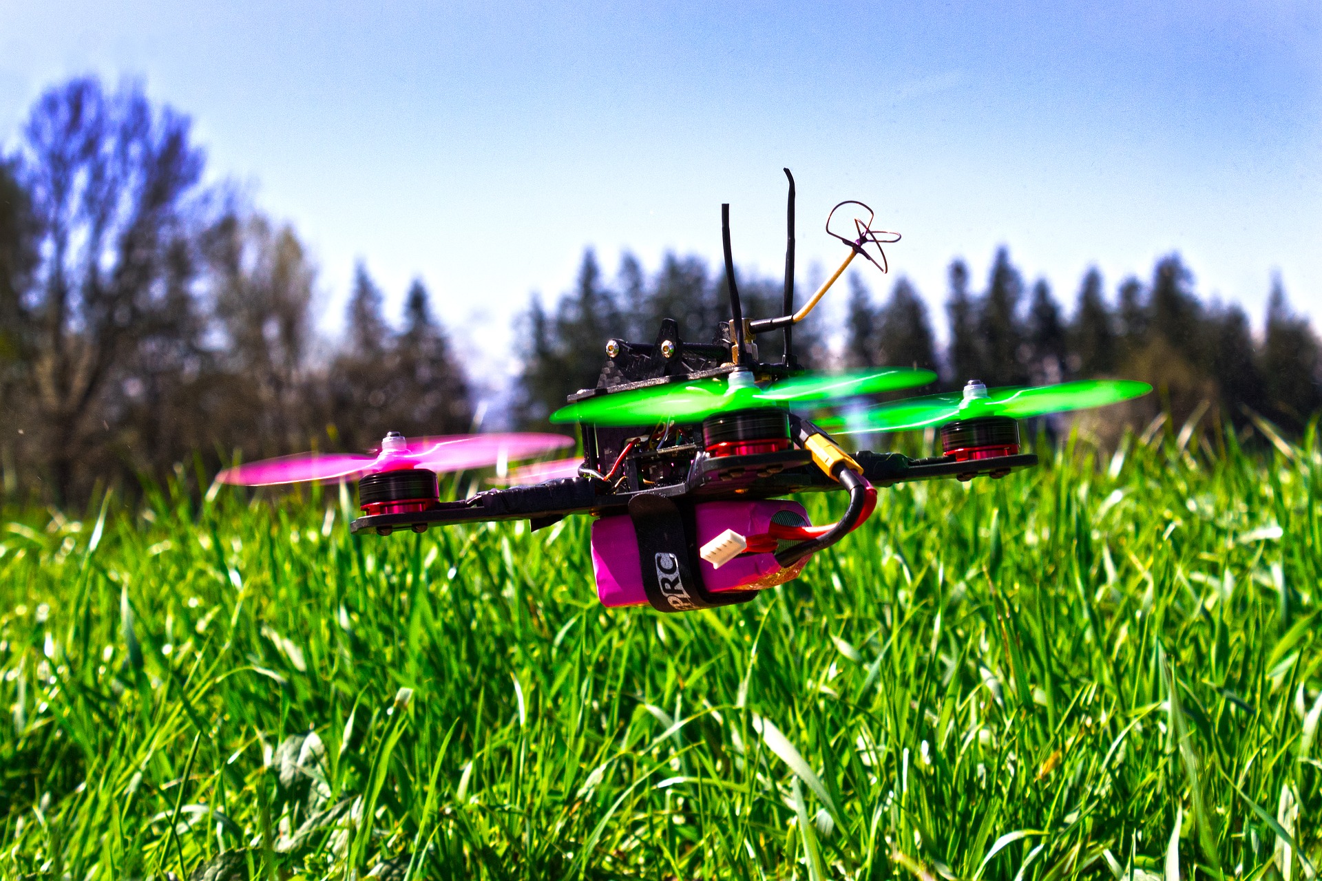
Types of Drones and Technologies Used
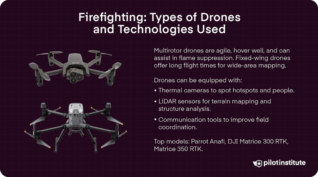
Drone Design
Different body designs offer specific firefighting benefits. For example, the typical commercial design of multirotor drone bodies offers greater maneuverability and hovering capabilities. These designs perform well over rugged terrain and maximize their agility to quickly assess a scene and identify hotspots, even in complex terrain.
Multirotor designs also often have impressive payload capacity, empowering drones to not only survey fire-burnt areas but also actively work in suppressing the flames as well.
While not as maneuverable as multirotor drones, fixed-wing UAVs offer first responders longer flight times, covering larger areas. This provides long-range surveillance over vast high-risk areas.
Payloads and Equipment
Today’s impressive range of firefighting drones is equipped with cutting-edge payloads, such as impressive thermal imaging cameras, LiDAR, or other payloads that allow first responders to truly get a detailed eye in the sky.
Thermal imaging cameras detect heat signatures, alerting authorities to potentially risky hotspots outside the main fire’s perimeter or the presence of individuals within the fire’s path.
These come standard on Anafi’s Parrot drone that can detect hot spots from up to 40 meters in the air.
LiDAR, also known as Light Detection and Ranging, sensors map even the most rugged of terrains and help assess the density of vegetation in the line of fire. LiDAR mapping can also be a critical tool for assessing structural analysis in cases of structural fires.
Along with Anafi’s Parrot, DJI’s Matrice 300 RTK has an impressive range of 15 km (9.3 miles) and is a great choice for firefighting agencies looking to implement detailed mapping technology into their arsenal.
Additionally, dones can be equipped with specialized communication devices for relaying messages and enhancing coordination. DJI’s Matrice 350 RTK is an excellent mixture of payload configurations, as it offers the capacity for thermal imaging or LiDAR cameras along with the impressive DJI O3 Transmission module, which extends signal range to 20 km (12.43 miles).
Challenges and Limitations
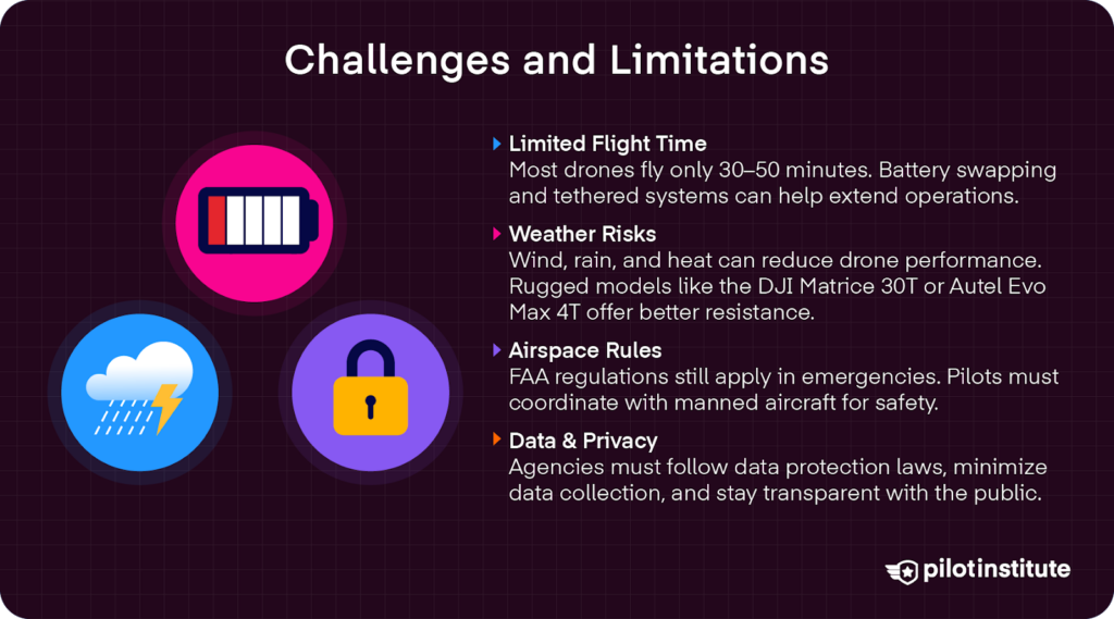
While drones offer impressive options for firefighting strategies, they are not perfect. Concerns about flight time and weather factors can still limit the potential for drones to best serve firefighting efforts.
Flight Time and Battery Constraints
Drones are worth their weight in, well, batteries. While lithium battery configurations offer impressive power capacity, this is still limited in terms of the long-haul of a fire flight.
Average flight times range between 30 and 50 minutes, which limits critical firefighting activities and search and recovery efforts.
To maximize power potential, first responders can implement innovative strategies like having quick battery swapping options or even tethering drones to a ground station to provide a continuous power supply.
Weather and Environmental Factors
Another limiting factor in drone deployment is the weather. High winds, which often accompany out-of-control wildfires, reduce power capacity and maneuverability of drones.
Additionally, precipitation can have a detrimental impact on drone batteries and camera systems. Such environmental factors can limit drone deployment and reliability.
Investing in more weather-resistant drones with robust navigation systems can help mitigate these weaknesses. For example, DJI’s Matrice 30T utilizes rugged materials and features IP55 protection against the elements.
Autel Robotics Evo Max 4T is another rugged option with an IP43 weather rating and a maximum of 42 minutes of flight time.

Airspace Regulations and Safety Concerns
Even in emergencies, drone operators need to be aware of airspace regulations and other safety concerns. There are certain restrictions in controlled airspace. While these restrictions may be waived for emergency operations, there are still safety concerns around large airports and other sensitive areas.
Pilots must follow the FAA’s guidelines and coordinate with manned aircraft to prevent interference or complications of disaster relief efforts.
Data Management and Privacy Concerns
There are also challenges in terms of handling, storing, and securing data collected by drones in emergency operations. There are legitimate public concerns about security and privacy issues with the implementation of foreign-manufactured drones, like DJI models.
Subsequently, it is important for firefighting agencies to be transparent in their policies for data collection and management with the communities that they serve.
All data storage and management should also adhere to laws governing data protection and privacy, where only the minimal data to fight fires should be collected and stored.
Implementing a Drone Program in Your Fire Department
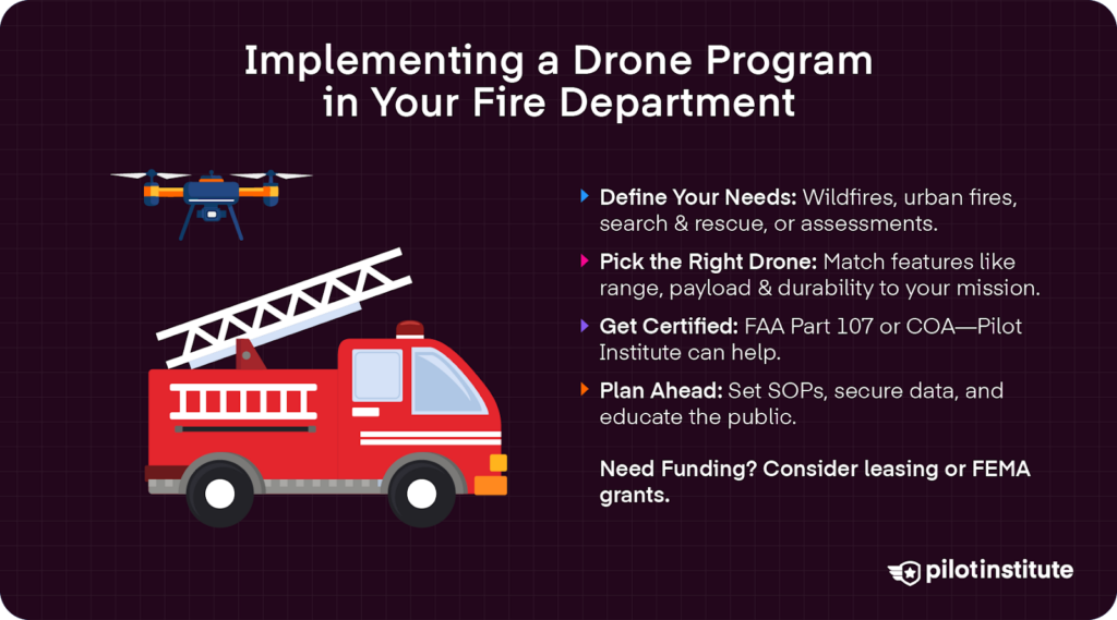
Looking to add a drone to your agency’s firefighting arsenal? It is key to evaluate operational needs and define areas where drones can enhance capabilities.
Whether it’s wildfire response, urban firefighting, search and rescue, or damage assessment, it is important to identify the specific tasks where drones can augment your agency’s capabilities.
It is important to set operational goals, identify gaps, and involve stakeholders in decisions about investing in drone technology for firefighting efforts.
Selecting the Right Equipment
Factors to consider when choosing the best drone for your operation include payload capacity, flight time, range, durability, and weather resistance.
In rural areas surrounded by dense forests and vegetation, long-range fixed-wing drones are key for aerial mapping and fire assessment in real-time.
Urban firefighting agencies can benefit most from maneuverable multirotor drones that feature not only impressive camera payloads but also the potential to release extinguishants as well.
Budget issues are always a concern as well, so it is important to balance desired features with available funds.
There are always options to lease UAVs. Additionally, federal programs like FEMA offer grant resources and other funding opportunities for local agencies to acquire drone technology.
Training and Certification
Many pilots working with fire departments for emergency services hold a Part 107 Certification from the FAA.
Fortunately, we here at the Pilot Institute have successful and detailed Part 107 training programs to ensure first responder drone pilots are up to date with regulations to best serve firefighting efforts.
While many public safety agencies operate under 14 CFR Part 107, it is not the only legal method. Fire departments, as government entities, can also conduct “public aircraft operations” under a Certificate Waiver or Authorization (COA) from the FAA. These COAs have their own set of operating rules and pilot requirements, which may not require a Part 107 Certificate.
Developing Policies and Procedures
Firefighting agencies that adopt drones into their lineups should establish clear standard operating procedures (SOPs) for drone usage.
This includes preflight checks before drone operations to ensure that UAvs operate smoothly and engage in firefighting capacities to the best of their abilities.
Agencies should also establish clear procedures for data storage and security to protect the public interest. Including the public in drone strategies will help ease public concerns about data and safety issues. Agencies can engage in educational campaigns through social media outlets and publicly held town meetings.
Future of Drones in Firefighting
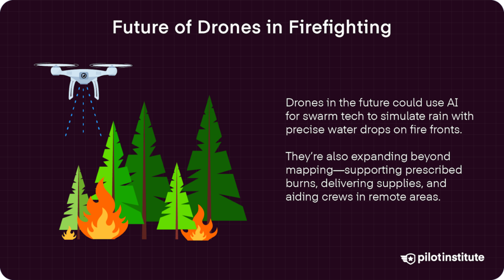
Technological Advancements
Drone technologies are advancing rapidly, opening up new opportunities for emergency response efforts.
AI technologies, for example, increase the accuracy of object recognition and enhance decision-making processes in emergency situations that require quick thinking.
Moreover, increasing advances in swarm technology allow small drones to make a big impact. Drones emphasize how swarm algorithms can empower self-organized drones to carry carefully curated water drops to remote, hard-to-access areas.
Authors Elena Ausonio, Patrizia Bagnerini, and Marco Ghio explained how swarm algorithms can “transport large quantities of fractionated extinguishing liquids to release on fire fronts, simulating rain effect.” Fires do not stand a chance when drone swarms rain down to reign in fast-moving flames.
Expanding Applications
Drones are quickly moving beyond surveillance and mapping in firefighting operations. Innovative uses like aerial ignition help fire cres to conduct prescribed burns with impressive precision, even in the most rugged terrains.
Similarly, drones are also being used to deliver critical supplies, such as medical kits, communication gear, and fire shelters. Crews operating in remote locations can now enjoy the support of drone operations while mitigating risks in the field.
Part 107 and Public Safety COA Course
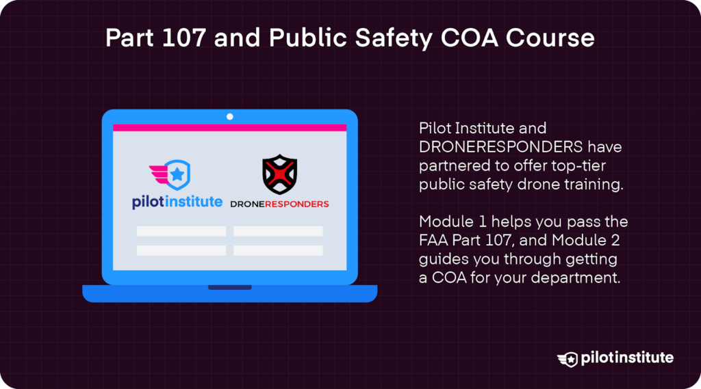
DRONERESPONDERS, the world’s largest non-profit dedicated to helping public safety drone users, and Pilot Institute have partnered to offer the industry’s most comprehensive training.
This first module focuses on passing the FAA’s Part 107 exam, and it comes with 15 hours of videos, a cheatsheet, a flashcard app, and much more.
The second module will dive into Certificate of Authorizations (COAs) and provide you with a roadmap to follow to get your department set up. Learn more about our drone public safety course.
Conclusion
Ultimately, drones can benefit fire departments by enhancing safety, efficiency, and operational effectiveness. They offer impressive mapping and active firefighting actions while minimizing risk to human first responders.
Fire departments should take advantage of emerging drone technologies and explore the benefits of adopting UAVs as a vital tool in their firefighting efforts.
As drone technology evolves, its roles in firefighting are expected to become even more hands-on. In the not-so-distant future, we may see fleets of autonomous drones coordinating in real time to monitor, manage, and even directly fight wildfires.