-
Key Takeaways
-
What Is Drone Mapping?
-
Benefits of Drone Mapping
- Efficiency and Speed:
- Cost-Effectiveness
- Enhanced Accuracy
- Accessibility
-
Applications of Drone Mapping
- Construction
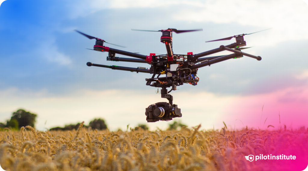
- Agriculture
- Environmental Monitoring
- Real Estate and Urban Planning
- Mining and Quarrying
-
Essential Equipment for Drone Mapping
- Key Features to Consider:
-
Cameras and Sensors
- Importance of High-Quality Imaging:
- Specialized Sensors:
- Software Requirements
-
Planning Your Drone Mapping Mission
- Defining Project Objectives
- Understanding Airspace and Weather Conditions
- Flight Planning Steps
-
Executing the Flight
- Best Practices During Flight
- Safety and Emergency Procedures
-
Processing and Analyzing the Data
- Transferring and Organizing Data
- Introduction to Photogrammetry
- Using Data Processing Software
- Interpreting and Utilizing Results
-
Legal Considerations and Regulations
- Privacy and Ethical Considerations
- Insurance and Liability
-
Challenges and Troubleshooting
- Common Issues in Drone Mapping
-
Frequently Asked Questions
-
Conclusion
Drone mapping has transformed how land is surveyed, making it faster, safer, and more accessible.
What was once a complex and costly process, requiring large teams and heavy equipment, has now been automated with easy-to-use drones.
How does it work? How can a drone take basic photos and turn them into a 2D map or 3D model?
Whether you’re a hobbyist or a business looking to harness this technology, this guide will break it down in an easy-to-understand way. Keep reading to discover how drone mapping works, and why it’s becoming an essential tool across a growing number of industries.
Key Takeaways
- Understand the fundamentals of drone mapping and its applications.
- Learn about the essential equipment and software required.
- Discover how to plan and execute a successful drone mapping mission.
- Gain insights into processing data to create maps and 3D models.
- Learn about legal considerations and best practices in drone mapping.
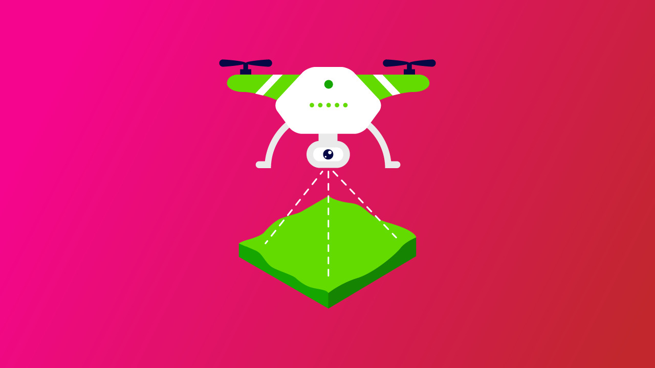
What Is Drone Mapping?
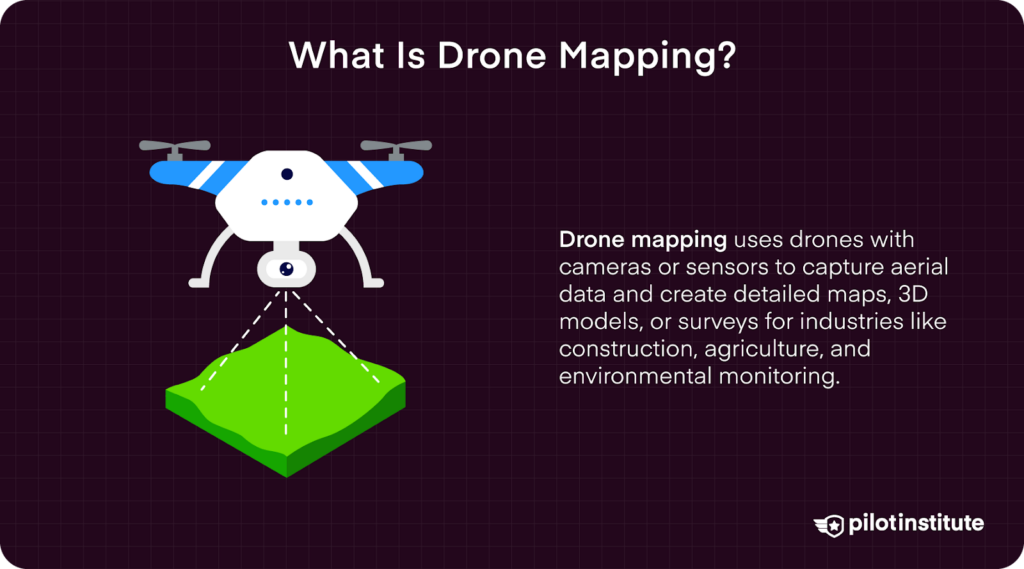
Drone mapping involves using UAVs (Unmanned Aerial Vehicles) to capture detailed aerial images converted into accurate maps and 3D models.
UAVs systematically capture overlapping photos, which are processed through specialized software—making precise measurements from photographs—to generate detailed visual representations.
Benefits of Drone Mapping
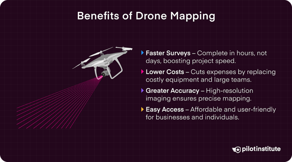
Efficiency and Speed:
Drones accelerate the surveying process dramatically. What traditionally took days with manual methods, like construction or agriculture surveys, now takes mere hours.
This speed directly translates to quicker project completions, faster data delivery, and enhanced overall productivity.
Cost-Effectiveness
Drone mapping significantly reduces costs compared to traditional surveying. The costly equipment rentals and large teams, once required, are replaced by quick drone deployment, drastically cutting project expenses.
One team of standard survey specialists may cost several thousand dollars, while an experienced surveyor utilizing current UAS technology could complete the job at a fraction of the price.
Managing equipment operations at Zeitview reinforced how drones offer considerable cost benefits, which reduce operational budgets while improving the precision of data collected.
In the past, after having discussions with industry leaders, it became very obvious how much drones are cutting costs in the surveying sector.
Enhanced Accuracy
Modern drones equipped with high-resolution imaging and advanced GPS systems capture precise imagery essential for accurate mapping.
In my previous roles inspecting transmission lines and solar arrays, the high-resolution data captured by drones significantly enhanced the reliability and accuracy of infrastructure assessments, reducing errors and rework.
Accessibility
One of drone mapping’s greatest advantages is accessibility for individuals and small businesses.
Decreasing costs and increasingly user-friendly software allow virtually anyone to perform professional-quality aerial surveys.
When operating in remote areas, an up-to-date map can save lives in an emergency.
Applications of Drone Mapping
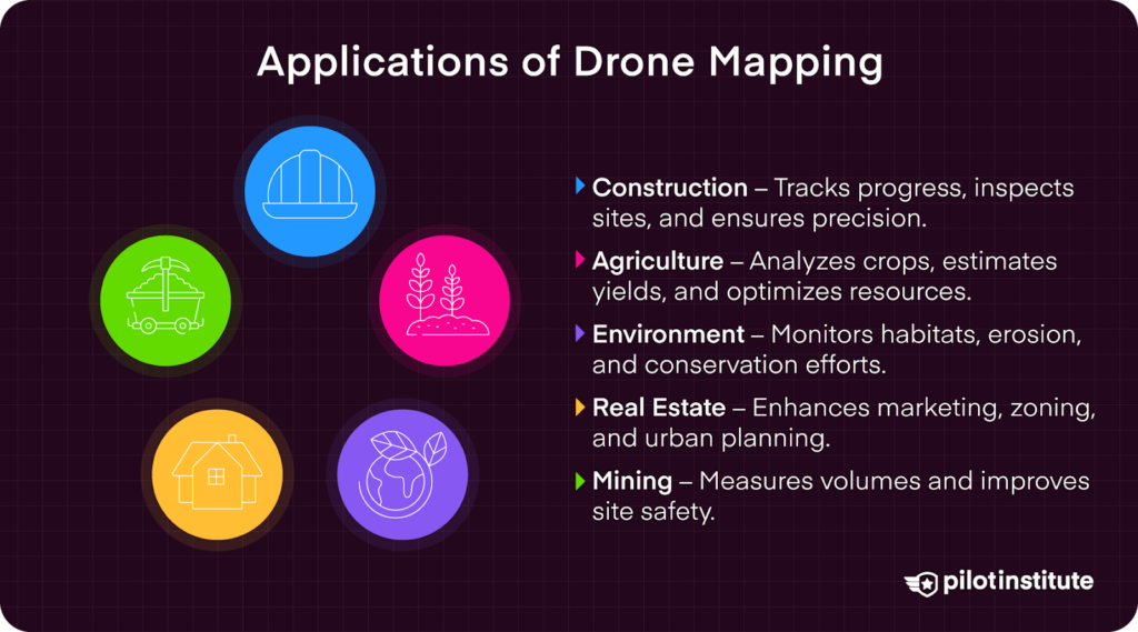
Construction
Drones significantly enhance construction operations by providing timely visual data, site inspections, and precise measurements for earthworks.
Companies like Turner Construction leverage robotics and photogrammetry software for daily updates on project status, ensuring projects stay on schedule and budget.
For instance, DroneDeploy software is widely used to analyze drone-captured data. Photogrammetry software like Propeller Aero, DroneDeploy, and DJI simplify site management and decision-making for high-value projects.
Agriculture
Agricultural uses include crop health analysis through multispectral imaging and precise yield estimation. The FAA recognizes drone applications in agriculture, provided operators obtain certifications like Part 137 (FAA AIM, Chapter 11, 14 CFR Part 137).
Agricultural giants like Corteva Agriscience and Bayer CropScience regularly utilize drone-based multispectral imaging for detailed crop analysis.
Precise, timely data collection significantly improves agricultural productivity and resource management.
Environmental Monitoring
Environmental organizations, such as Ducks Unlimited and WWF, leverage drone mapping to monitor ecosystems, assess environmental changes, and manage conservation projects effectively.
Drone-derived data aids significantly in habitat mapping, erosion tracking, and disaster assessment, providing actionable insights that traditional methods struggle to deliver promptly and cost-effectively.
Drones have become a game-changer for conservation, providing detailed habitat assessments that help experts make informed decisions.
During a project with Ducks Unlimited, drones were used to document lakes that had completely dried up. The aerial view gave specialists a level of detail they had never seen before, transforming how they analyzed the landscape and planned for restoration efforts.
Real Estate and Urban Planning
Drone mapping has transformed real estate marketing and urban development.
Companies like Zillow and Redfin increasingly use drone-derived 3D models to create engaging visualizations for properties, significantly enhancing buyer experiences and aiding in informed decision-making.
Urban planners also employ drones to efficiently assess infrastructure, support zoning, and development decisions.
Mining and Quarrying
UAVs and the 3D modeling software combined can be used to calculate the amount of volume within an area. This is useful in large construction operations, where large amounts of material are frequently moved.
Propeller Aero is just one of the companies in charge of site management for large-scale construction projects.
Drone-based mapping significantly mitigates risks by minimizing human presence in hazardous environments.
Essential Equipment for Drone Mapping
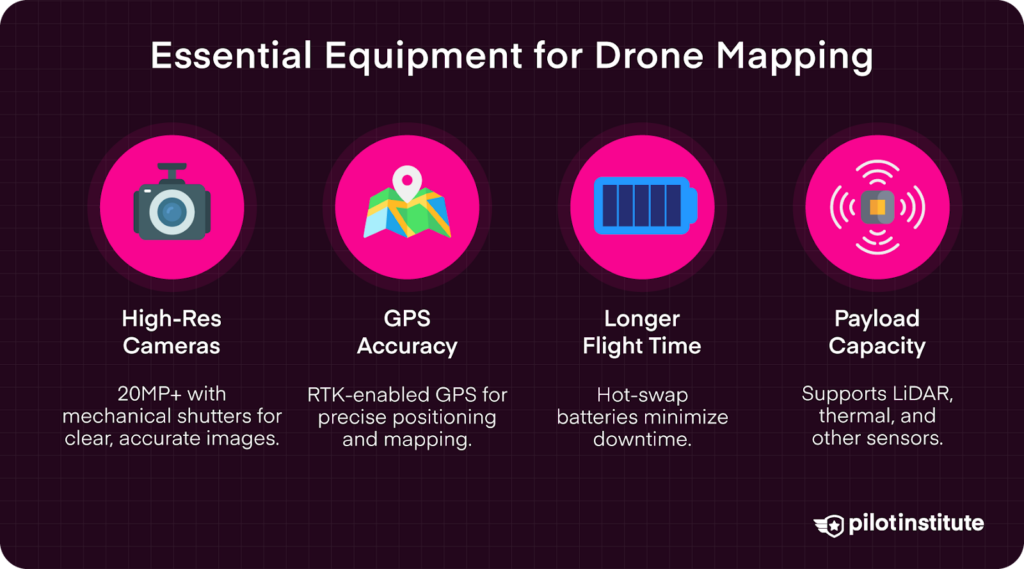
Key Features to Consider:
Camera Quality and Resolution
High-resolution cameras (in 2025, this would be ~20MP or higher, depending upon the project) provide clear, detailed images crucial for accurate mapping.
Cameras with larger sensors and mechanical shutters significantly reduce distortion, improving precision during mapping missions and orthomosaic reconstruction.
Flight Stability and GPS Accuracy
Reliable GPS modules allow precise geotagging of images, which is necessary for accurate positioning and data accuracy. To allow the highest level of accuracy, an RTK (real-time kinematic positioning) base station should be utilized.
Flight Time and Battery Life
Drones with longer flight times increase operational efficiency by minimizing downtime for battery swaps. Hot-swap battery technology enables aircraft to have significantly lower downtime by keeping an aircraft powered on, while an operator swaps one battery at a time.
Payload Capacity for Additional Sensors
Some mapping tasks require specialized equipment, such as LiDAR scanners or thermal imaging cameras.
Always guarantee the drone can handle additional payload weight without compromising flight performance. The payload used will depend upon the operational requirements.
- Popular Drones for Mapping:
- DJI Mavic 3 Enterprise
- Features like a mechanical shutter, a telephoto lens, and a 20MP camera.
- DJI Matrice 350 RTK
- Swappable payloads and large airframe for stable inspections over large areas.
- Wingtra One Gen II
- VTOL fixed wing drone, compatible with most major mapping software options.
- Phantom 4 Pro V2.0
- While it’s a bit older now, the Phantom 4P V2 is still a very capable mapping tool.
- DJI Mavic 3 Enterprise
Cameras and Sensors
Importance of High-Quality Imaging:
High-resolution cameras ensure detailed and accurate mapping results, providing clear imagery necessary for photogrammetric processing.
Larger sensors and mechanical shutters further enhance image quality by reducing rolling shutter effects, essential for accurate, reliable measurements.
Specialized Sensors:
Multispectral Cameras: Particularly valuable in agriculture, multispectral cameras detect wavelengths beyond visible light, helping analyze crop health, soil moisture, and nutrient distribution.
Companies like MicaSense specialize in such sensors, widely adopted in precision agriculture.
Thermal Cameras: Utilized in inspections, search-and-rescue missions, and environmental monitoring, thermal sensors detect temperature variations, making them indispensable for infrastructure inspections and wildlife conservation.
LiDAR Sensors: LiDAR (Light Detection and Ranging) technology measures distances by illuminating targets with laser pulses.
Ideal for penetrating trees, LiDAR accurately maps terrain under dense cover, greatly benefiting forestry management, environmental studies, and urban planning.
Manufacturers like Velodyne and DJI have introduced compact LiDAR sensors designed specifically for UAV use.
Software Requirements
Flight Planning Software
Software solutions like DroneDeploy, DJI Terra, and Pix4Dcapture streamline flight planning by enabling pilots to set waypoints, altitude, image overlap, and flight paths precisely.
Properly planned missions ensure optimal data collection for mapping accuracy.
Data Processing Software
Processing images into usable maps and 3D models requires advanced software. Pix4Dmapper and Agisoft Metashape are industry leaders, offering both local processing and cloud-based options.
Cloud-based solutions provide flexibility, scalability, and ease of data sharing, whereas local processing offers enhanced data control and privacy.
GIS Software
Geographic Information System (GIS) software, including ArcGIS and QGIS, is crucial for analyzing and visualizing geospatial data.
GIS software integrates drone-generated mapping data with additional spatial data layers, allowing detailed analysis and informed decision-making across various industries.
Planning Your Drone Mapping Mission
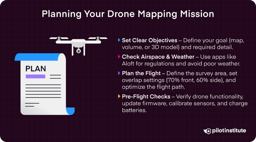
Defining Project Objectives
Clearly identifying project objectives is crucial for mission success. Decide whether your goal is a detailed map, accurate volume calculations, or an interactive 3D model.
Determine the precise area size and the level of detail required, guiding decisions on flight altitude, overlap settings, and sensor choices.
Understanding Airspace and Weather Conditions
Before launching a drone mapping mission, check compliance with airspace regulations by using apps like Aloft – Air Control for no-fly zones and airspace classifications.
Secure necessary authorizations, such as FAA Part 107 waivers for specific scenarios like Beyond Visual Line-of-Sight (BVLOS) operations (FAA Part 107 Waivers).
Weather conditions critically affect drone operations—avoid flying in strong winds, precipitation, or extreme sunlight to maintain data quality and operational safety.
Flight Planning Steps
- Mapping the Survey Area: Utilize flight planning software to define boundaries by drawing polygons around the survey area, clearly outlining coverage requirements.
- Setting Flight Parameters: Adjust flight altitude to balance coverage area with required image resolution. Typically, drone mapping missions use a front overlap of about 70% and side overlap of 60% to ensure robust photogrammetric reconstruction.
- Optimizing Flight Path: Efficiently plan flight paths considering drone battery limitations. Divide larger sites into manageable sections and incorporate terrain-following modes for uneven or varied landscapes, enhancing the consistency and quality of captured imagery.
Always confirm drone and equipment functionality before flights:
- Verify drone and sensor operations.
- Ensure firmware and software are updated.
- Calibrate drone sensors and compass as needed.
- Fully charge batteries and keep spare batteries available.
With meticulous planning, appropriate equipment selection, and adherence to best practices, drone mapping becomes an accessible, powerful tool for beginners and professionals alike.
Executing the Flight
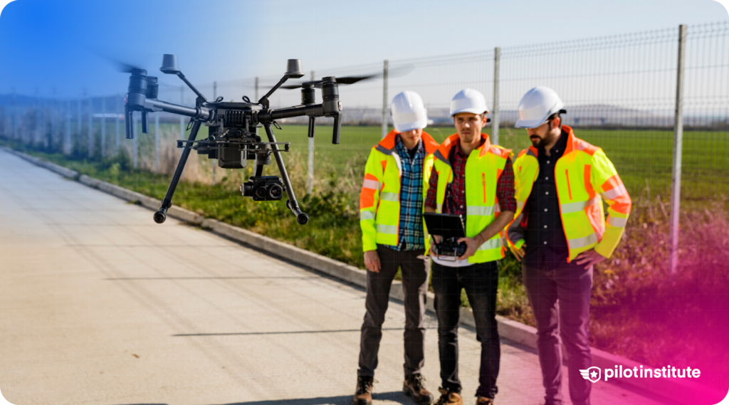
Best Practices During Flight
Always keep the drone within visual range to ensure you can quickly respond to any situation that arises during flight. According to FAA Part 107 regulations, a visual line of sight (VLOS) must be maintained at all times to enhance safety.
Utilize a visual observer if necessary to help monitor the drone, particularly when operating near obstacles or in complex environments.
Regularly check critical systems such as battery level, GPS signal strength, altitude, speed, and heading. Continuous monitoring allows prompt action to avoid potential problems or emergency landings.
Safety and Emergency Procedures
Maintain a strong awareness of your surroundings to prevent collisions with hazards like power lines, trees, structures, or other aerial vehicles.
Modern drones such as the DJI Mavic 3 Enterprise include advanced 360 degree obstacle avoidance sensors, greatly reducing collision risks. Double-check that these safety features are enabled and properly calibrated before flight.
Additionally, always set your drone’s Return-to-Home (RTH) function when available, before flight, verifying the accuracy of your home point.
Clearly understand emergency procedures, including safely landing your drone if connection issues or mechanical failures occur.
Backup plans are always a valuable commodity when working in unpredictable environments.
Processing and Analyzing the Data
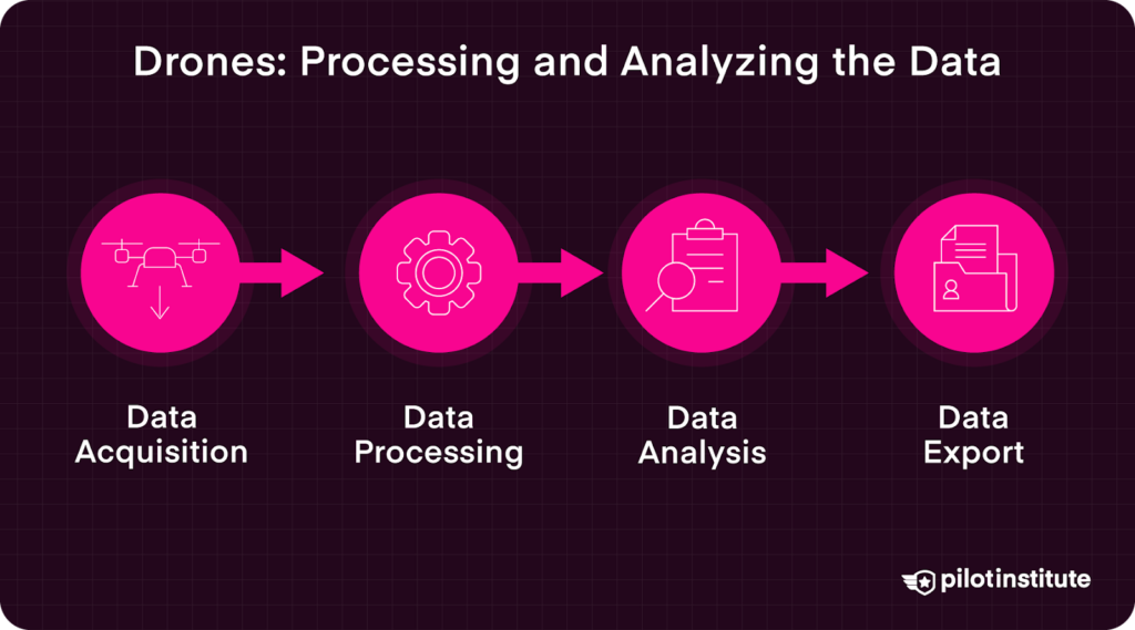
Transferring and Organizing Data
Upon completing your drone mapping mission, safely retrieve images from the drone’s storage by carefully removing the SD card or using software designed for wireless data transfer.
Immediately organize your files by clearly naming and categorizing them into structured folders labeled by project name, date, and specific location. Effective data organization streamlines processing and maintains clarity throughout the project’s lifecycle.
Introduction to Photogrammetry
Photogrammetry is the core technology behind drone mapping, using overlapping aerial images to produce detailed maps and realistic 3D models.
The software works by matching common points across multiple images to accurately reconstruct the surveyed area.
Two critical concepts in photogrammetry include Ground Sampling Distance (GSD)—which directly influences the resolution and accuracy of the resulting map—and the creation of point clouds and 3D meshes.
Point clouds represent surfaces as collections of data points, while 3D meshes provide detailed digital representations of physical objects and terrain.
Using Data Processing Software
After completing your mapping flight, securely transfer images from the drone’s storage. This can be done by safely removing and reading the SD card or using specialized software for wireless transfer.
Clearly organize your data by:
- Making an organized file structure for data.
- Systematically creating folders labeled by project name, date, and location.
Proper organization significantly simplifies data processing and management.
Photogrammetry, the foundational technology behind drone mapping, involves stitching together overlapping images to generate precise maps and accurate 3D models.
This process relies on identifying and matching common reference points across multiple images.
Critical concepts in photogrammetry include Ground Sampling Distance (GSD), which determines the resolution and accuracy of your data.
Lower GSD values yield higher-resolution results. Additionally, photogrammetry produces outputs such as point clouds—collections of points representing surfaces—and 3D meshes, which make realistic models of 3D structures.
Interpreting and Utilizing Results
When using data processing software, follow a structured workflow to achieve the best results. Begin by importing images into the software and selecting the appropriate coordinate system.
Carefully set up processing parameters, choosing optimal output formats and quality settings. Initiate the photogrammetry processing, closely monitor progress and address any errors or warnings immediately.
Processing can take an extensive amount of time, depending upon the size of the project.
Conduct thorough quality assurance checks afterward, identifying and rectifying issues such as:
- Gaps
- Holes
- Distortions
- Misalignments
Once processing is complete, analyze your resulting maps and models to measure distances, calculate volumes, and find additional insights.
Use the software’s built-in tools to overlay additional data layers if needed.
Finally, export your results in formats such as GeoTIFF for maps and OBJ or LAS files for 3D models, ensuring compatibility with client requirements or further analytical tools like GIS systems.
Legal Considerations and Regulations
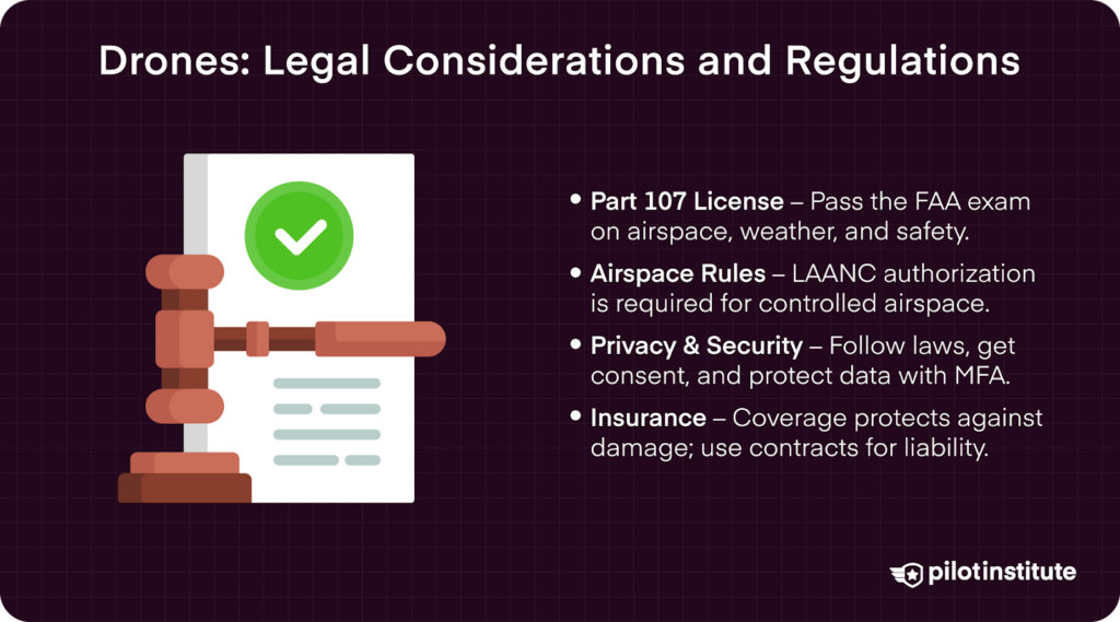
Operating drones commercially in the United States requires obtaining a Part 107 license. Certification involves passing a knowledge exam covering critical topics like airspace rules, weather impacts, and operational safety (FAA Part 107 Information).
When operating in controlled airspace (Classes B, C, D, or E), secure proper airspace authorization through tools, such as a LAANC, which facilitates rapid approval for restricted-area operations (FAA LAANC Information).
The FAA strictly regulates operational limits, setting a maximum flight altitude at 400 feet Above Ground Level (AGL), mandating a visibility minimum of three statute miles, and enforcing cloud clearance requirements—500 feet below and 2,000 feet horizontally from clouds (FAA Advisory Circular 107-2A).
Privacy and Ethical Considerations
When conducting drone operations, carefully consider privacy and ethical responsibilities. Clearly communicate your objectives and obtain explicit consent when capturing imagery involving private properties or individuals.
Always follow local privacy laws and protect the data you collect by using strong security measures to keep personal information safe.
MFA (Multi-Factor Authentication) is a method of securing data behind more than one login prompt.
MFA is often used in businesses to add additional security to cover sensitive information, such as client addresses.
Insurance and Liability
Operating drones professionally involves potential risks, making drone liability insurance necessary. Insurance coverage protects operators against claims related to property damage, personal injury, or privacy violations arising during drone operations.
Familiarize yourself thoroughly with your insurance policy, clearly understanding coverage limits, exclusions, and responsibilities.
Also, explicit contracts or agreements should be established with clients outlining each party’s liability and responsibilities in the event of accidents or incidents during drone operations.
Challenges and Troubleshooting
Common Issues in Drone Mapping
While drones have simplified a portion of survey methods, they are not without fault. Some common issues that must be considered are GPS inaccuracies, image quality issues, and environmental factors, such as rain or wind.
GPS Inaccuracies, Image Quality issues, Environmental factors
Solutions:
- Use GPS correction methods to improve the accuracy of your model.
- Adjust camera settings for clear images.
- Conduct mapping missions in favorable weather conditions to get the best data possible.
- Schedule flights according to weather forecasts to avoid hazardous flight conditions.
Frequently Asked Questions
- What is the average cost of drone mapping?
The cost of drone mapping services varies based on factors such as project size, complexity, and the technology employed.
While specific pricing can differ, industry discussions suggest that basic mapping projects can start around $500, with more advanced services potentially reaching thousands of dollars.
- Can you make money with drone mapping?
Yes, drone mapping offers viable commercial opportunities across various industries, including agriculture, construction, and real estate. To operate drones commercially in the United States, you must obtain the FAA Part 107 Remote Pilot Certificate, which permits legal commercial drone operations.
- How much do drone mappers make?
Earnings for drone mapping professionals vary based on experience, location, and industry demand.
According to recent job compensation data on Glassdoor, drone pilots in the United States earn an average salary of approximately $131,000 per year. However, salaries can range from $98,000 to $183,000.
These amounts are not typically indicative of all work opportunities, however.
Certain operations and contracts can allow you to net six figures within a short period. It’s all dependent upon the individual job, but the salary estimates are a great place to start.
For more detailed insights into the drone pilot profession, you might find the following article from Pilot Institute informative: Drone Pilot Jobs.
Conclusion
Drone mapping has significantly transformed industries, offering faster, safer, more accurate, and cost-effective surveying capabilities compared to traditional methods.
Continuous advancements in drone technology and software have made aerial mapping accessible to professionals and hobbyists alike, enabling sophisticated mapping tasks previously considered complex and costly.
To begin exploring drone mapping opportunities, obtain your FAA Part 107 certification, select suitable drone equipment, and familiarize yourself with mapping software.
Comprehensive training programs, such as those offered by Pilot Institute, significantly enhance your skills and competitive advantage in this expanding industry.
Drone mapping technology provides extraordinary potential for innovation, productivity, and informed decision-making across numerous sectors.
Embrace continuous learning and professional development as drone technology evolves, to make sure you stay up-to-date on the latest developments in the UAS industry.