-
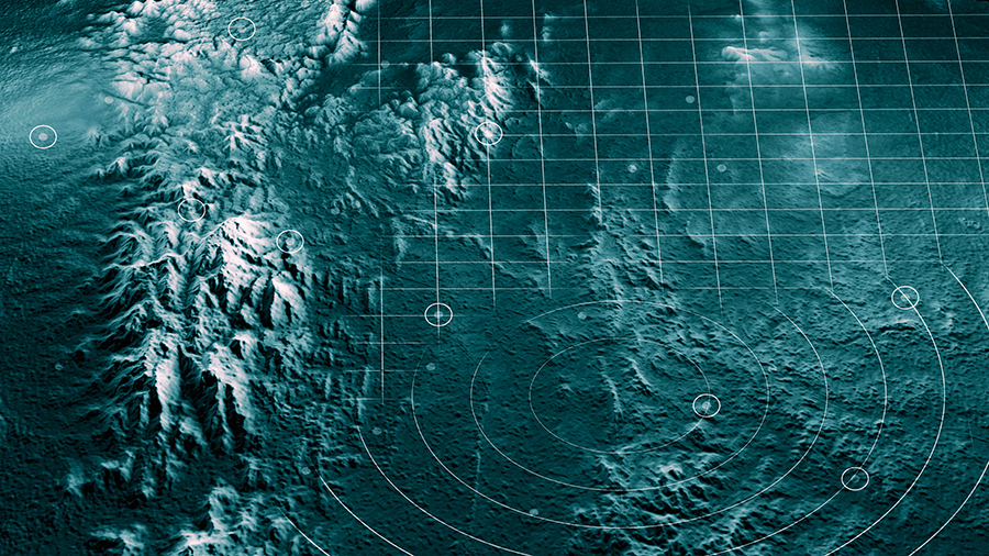
The Basics of Mapping Theory
-
Other Related Concepts
- Satellite Positioning Systems
- RTK vs PPK
- Coordinate Systems
- Mapping vs. Modeling
-
Typical Deliverables
-
Challenges to Anticipate
- Visibility Limitations
- The Importance of Daylight
- Wind, Weather, and Terrain
- Maintaining the Visual Line of Sight
-
Planning a Mapping Survey
- Defining the survey area
- Location
- Weather
- Time
- Gear
-
Setting Ground Control Points
-
Which drone should you get?
-
Essential apps and software
-
Final Thoughts
Drone mapping is one of the more exciting fields that professional drone pilots can get into. With a wide range of clients and applications, it can be potentially very lucrative. Improvements in hardware and software have also made this fairly technical field a bit more accessible.
If you have no background in mapping or GIS, there are a couple of things you will need to learn before you can start building a career in mapping. There are also other considerations like hardware, software, and field logistics. Check out this basic guide on how to get started in drone mapping.
Our Drone Mapping, Modeling, and Surveying Bundle course have everything you will need to get started with professional drone mapping. With more than 9 hours of video instruction, the course will take you through the theory of mapping, how to plan a mapping survey, best practices on the field, and processing data using the software. Buying all three courses together saves you $75. The courses can also be purchased separately.
The Basics of Mapping Theory
To better understand how mapping works, it is often easier to look at it within the context of how the resulting maps are used. Maps are a rich representation of visual and spatial data that are massively valuable for planning and monitoring. Even with just visual data, maps are useful for event planning, monitoring of construction projects, damage assessment after calamities, or search and rescue efforts.
However, a map is not just a large aerial photo. Through sophisticated data processing, maps also contain elevation data. This data can take the form of terrain representation or 3D representations of large structures including buildings and houses. This makes maps even more valuable for making accurate distance, area, and volume calculations.
This leads us to the question – how is the data for maps collected?
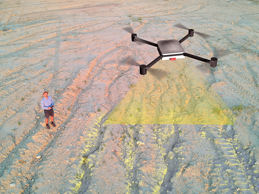
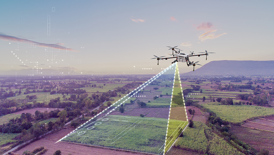
As far as drone operations go, all the drone does is take a series of overlapping geotagged aerial images of the survey area. The drone does this by flying along a prescribed path while taking still images at set intervals. This is typically done automatically by programming the survey details using a flight planning app.
The basis for most drone mapping operations is a process called photogrammetry. This is a technique that uses a series of overlapping photos to generate a 3D representation of any object. It is a technology that applies to mapping large areas and also for 3D modeling at a desktop scale.
Photogrammetry software can identify individual features in overlapping images and use spatial data and triangulation to determine the size and shape of these features. This involves a combination of stereo imaging and image rectification and is actually the phenomenon by which we use our two eyes to determine the depth of objects in space.
Other Related Concepts
There are a few other technical fields of knowledge that you will need some background on if you’re planning to offer professional drone mapping services. You do not need to be an expert in these fields, but knowing more than an average person will help you with the planning and execution of mapping surveys. It can also help make a good impression on potential clients.
Satellite Positioning Systems
The Global Positioning System (GPS) technology that has become ubiquitous with smartphones and wearable devices is just one of a handful of satellite positioning systems that are operational today. As the name implies, it allows for the accurate location of any device on the planet by receiving signals from satellite constellations orbiting the Earth.
GPS systems are absolutely essential in drone mapping. It allows drones to fly along pre-programmed flight paths, fly within the designated survey area, and geotag photos as they are captured. Thus, images captured during mapping contain both visual data and spatial data that are processed during image rectification.
The GPS systems used for drone mapping are a little more sophisticated than the ones on your phone. Consumer devices typically have a location accuracy of about 16 meters. For mapping purposes, that accuracy can be increased to the centimeter level.
Aside from the US-operated GPS network, there are several other satellite positioning systems that a receiver can tap into. The most notable would be the Russian GLONASS constellation, China’s Beidou network, and the European Union’s GALILEO network. Many drone GPS receivers can access more than one of these systems, allowing for redundancy.
At any point, a GPS antenna receives time-of-flight data from several GPS satellites in the Earth’s orbit. The consolidation of this data allows for the accurate location of any device on the Earth’s surface. Much like other radio signals, GPS signals can be influenced by large obstacles, trees, cloud cover, or sources of signal interference.
The problem with a typical GPS receiver is that every reading it makes has an inherent error. This is more problematic when we consider the fact that a drone is constantly moving and has very little time to get better signals from GPS satellites. To reduce this error, the common practice is to correct the drone’s GPS reading against the locational data of a “base station”. This is in contrast to a moving receiver, typically called the “rover station.”
RTK vs PPK
With our knowledge of base stations and rover stations, we can now look at exactly how locational data is corrected for better accuracy. There are two available methods for drone pilots for to be done – RTK or PPK.
RTK refers to “Real-Time Kinematics” while PPK stands for “Post-Processing Kinematics.” The major difference between these two is that RTK makes the correction in real time or as the data is collected. On the other hand, PPK allows for correction after the field survey such as when the data has been uploaded. Both methods result in huge improvements in locational accuracy.
A major limitation of an RTK workflow is that it requires an uninterrupted connection between the base station and the rover station. This also means that the drone needs to have an onboard RTK module, increasing its takeoff weight. In settings with large or many obstacles, it can be difficult to ensure that an RTK workflow will perform as intended.
PPK allows for more flexibility by allowing for post-processing correction that is also relative to a fixed base station. It simplifies data gathering and does not require a dedicated module on the drone. For this reason, many firms and professionals prefer to use PPK as it is less prone to failure.
Conversely, drones or GPS receivers with cellular connectivity capabilities can apply corrections by getting their corrections data from the Internet. This is called the NTRIP or Networked Transport of RTCM via Internet Protocol technology. In such a case, no base station will be necessary, making field operations far simpler. The availability of this service may vary from one State to another, or you may need to sign up for a subscription-based NTRIP network.
Coordinate Systems
Coordinate systems allow us to define the exact location of any point on the surface of the Earth using a rudimentary set of numbers. This is actually quite a complex topic, considering how irregular the surface of the Earth is. One of the most important things in mapping is knowing which coordinate system the client needs the output to be on so that you can adjust your workflow accordingly.
On a global scale, the WGS84 is used as the standard coordinate system. This is good enough for defining any specific location in the world, but there can be deviations at smaller scales that can be better represented with other coordinate systems.
These coordinate systems are known as projected coordinate systems. These are created by projecting a specific area on the surface of the Earth into a flat surface – a map, in other words. Since the Earth is a geoid, projecting any part of it onto a flat surface will create some distortion. However, this distortion can be minimized by limiting the scope of projected coordinate systems.
In the U.S., the NAD 83, or North American Datum is the most widely used coordinate system. This is offset from WGS84 by a few meters in both the X and Y directions. A different datum applies to measurements made along the Z-axis. In the U.S., the datum used is NAVD 88. This “vertical datum” takes into account changes in elevation or “orthometric height” due to terrain and significantly departs from the ellipsoid Earth model.
In local settings, you may need to use “state plane” coordinate systems. Each individual state may comprise several state planes depending on its size and shape. There are 127 different state planes across the U.S. This is a way for geocentric coordinate systems like the NAD 83 to be projected to Cartesian coordinate systems. Locations in state planes are typically expressed in US survey feet.
Knowledge of coordinate systems will help you communicate with potential clients and ensure that you are doing the mapping job based on their needs. It is also very important to know the coordinate systems being used by your drone by default and how these measurements can be translated to the coordinate systems needed by your clients.
Mapping vs. Modeling
At this point, it is worth defining the difference between mapping and modeling. As we have discussed so far, mapping involves taking a series of overlapping aerial photos of an expansive survey area. The output of such a job can vary but is typically a 3D model or map with both horizontal and vertical features.
Modeling is a more general term that is used for the creation of digital twins of real-world objects. This can range from entire buildings to a toy that fits in the palm of your hand. Although generally done at a smaller scale, modeling takes a bit of experience to do correctly because it needs more manual work. In contrast, mapping can be done with the drone flying completely autonomously.
Typical Deliverables
What do clients expect to receive after a mapping job? This can vary from one job to another, but there are a few basic deliverables that are considered standard for the mapping industry.
The orthomosaic is the basic map that is produced from orthorectified images from the photogrammetry process. It is basically a top-down view of the survey area where perspective changes have been corrected and geometric distortion has been removed. Think of it as the type of image you would see from a Google Earth Satellite.
The Digital Surface Model (DSM) is a representation of the elevation or terrain of the survey area as well as above-ground features like buildings, towers, houses, vegetation, and other infrastructure. DSMs are 2D representations of a 3D image that uses different colors or shades to highlight different elevation values.
A point cloud is a set of data points in space that typically represent a 3D shape or object. Each point in this cloud corresponds to the X, Y, and Z positions of a single data point that was collected or generated during the survey. Point clouds can be edited, scaled up or down, or colorized depending on your needs.
Finally, the mesh or 3D model is a combination of the point cloud and orthomosaic. The mesh is generated by creating surfaces connecting the points in the point cloud. Imagery from the orthomosaic is then draped over this mesh to add texture and color to the mesh.
Challenges to Anticipate
When planning a mapping survey, it is prudent to also anticipate challenges and know the limitations of the technology. This is useful for setting the expectations of the client or for adjusting your plans to compensate for technological limitations.
Visibility Limitations
Photogrammetry relies on images captured by a standard RGB camera. This means that it can only capture features that are normally visible to a camera. If there are features concealed by structures or other natural features, then they simply will not show up on the map.
This can be problematic in some cases, such as when you need topography data for a heavily forested area. Unfortunately, visibility is a limitation of this mapping technique. There are ways to overcome it but this will typically involve using more sophisticated and expensive technology.
The Importance of Daylight
Since visibility is important in photogrammetry, it also follows that good lighting is essential. The best time to do mapping would be at the time of day when lighting is even and dispersed to avoid harsh shadows. Of course, rain and very dark clouds are less than ideal.
The importance of daylight also limits the number of hours that you can feasibly execute a mapping survey. This is something that you will need to consider when discussing project timelines and the delivery of results.
Wind, Weather, and Terrain
Aside from daylight, there are a few other natural and weather conditions to consider. Doing a survey on very windy days can result in your drone drifting from its pre-programmed path. While GPS correction can handle minor drifting, very strong winds can cause more significant departures, resulting in poor-quality data. Rain is naturally problematic because it degrades lighting and can cause damage to your equipment.
Rough terrain can be challenging to access, especially if you need to move around to complete a survey area. This can be a problem in a remote area where road access is not possible. You may have to consider setting up a base station where you can charge your drone and stock up on supplies.
Maintaining the Visual Line of Sight
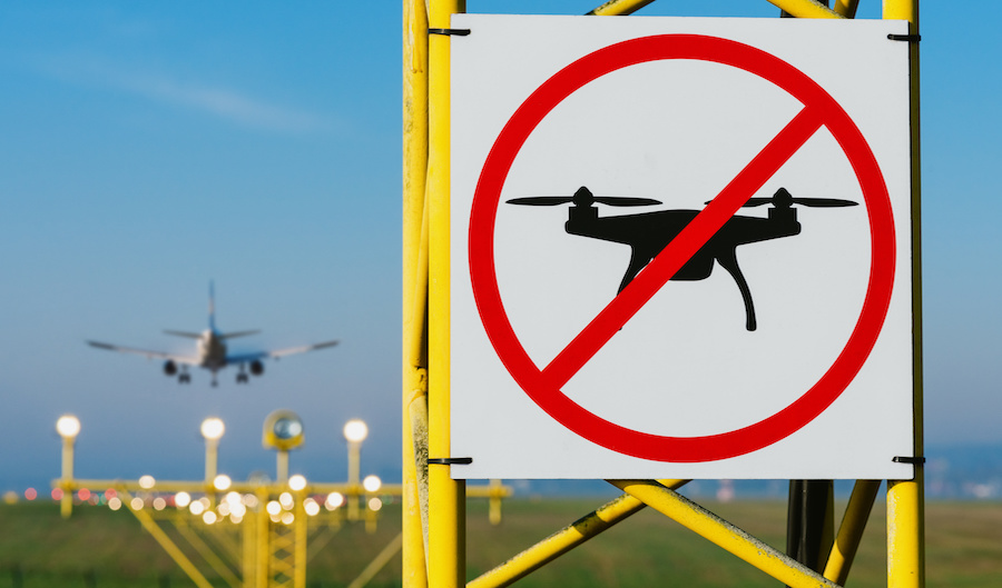
Keep in mind that Part 107 requires that a drone pilot or a co-located visual observer maintain visual contact with the drone. This can be a crucial limitation in mapping jobs, especially when they involve particularly large survey areas or if there are large obstacles in the way.
The practical solution to this problem is to plan multiple base stations for the survey. This is something you will need to consider when coming up with the lead times for the project, as well as your field logistics. Can you carry all your gear around or will you need a vehicle? Do you need to acquire a mobile charging station for your drone? A mobile base station may require additional equipment which in turn will affect the pricing of your services.
Planning a Mapping Survey
Planning is a very important step in the mapping process. This is during this phase that you define the extent of your survey, anticipate the conditions in the field, and prepare accordingly.
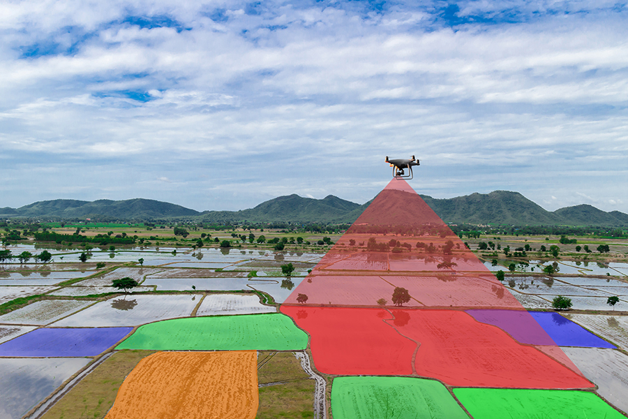
Defining the survey area
The first thing you should do before planning is to get good drone flight planning software. There are lots of good options out there – DJI GS Pro and Pix4Dcapture are free to use while DroneDeploy and Maps Made Easy require a subscription.
These flight-planning apps are quite intuitive. The app will provide a satellite view of your survey area where you can just pinpoint and drag around the borders for the survey. Using the defined area, the app will automatically generate the flight path for the drone to follow.
The app determines the flight paths based on the data and parameters that you have provided. This means that you need to give the app the proper parameters for it to work properly. You may need to specify the resolution of the drone’s camera, its sensor size, and its focal length. You will also need to provide mission parameters like flight altitude, how often the camera will take images, overlap ratio, and capture angle.
Location
Many of the planning considerations have to do with the location of the survey. With this in mind, it is always a good idea to do a pre-survey just to scout some of the possible issues you may encounter. Here are some things to keep in mind:
- Is the survey area within controlled airspace? You may need to request airspace authorization prior to flying. If there is an altitude ceiling, will this work for your planned survey? Or will you need to request a higher ceiling? This type of request is a bit more complicated and you may not receive an instant response.
- Is there cell service available in the survey area? This may affect how data from the drone is transmitted. This can be a more serious limitation if your software relies on a cloud-based service.
- Are there any obstacles within the survey area that can pose a risk to your drone or cause visibility issues? Are there any potential sources of signal interference? Will you need to fly over people or across a busy road? Take note that there are ways to perform mapping without having to fly directly over features that have to be avoided.
- Is the survey area a large tract of land or a long corridor? Will you have to move your base station to complete the survey?
Weather
As we had already briefly discussed, the weather is a major consideration when executing mapping surveys. You will want to avoid weather conditions that can result in reduced visibility. Strong winds are particularly problematic as it may become difficult to fly along a straight path. Also, keep in mind that winds at 300 or 400 feet elevation are much stronger than they are on the ground.
Take note of the effects of extreme heat or extreme cold on your drone’s flight performance and battery levels. You may need to pack a couple of extra batteries when flying out in temperatures that are not optimal for drone flight.
A very bright and sunny day actually is not the best weather for drone mapping, as harsh lighting can cause your images to be over-exposed. Instead, you want to fly out on a partly cloudy day, as this disperses sunlight and makes the scenery more evenly lit. Apps like UAV Forecast, Sun Surveyor Lite, and Astrospheric are very popular for getting weather forecasts with respect to drone flight and photography.
Time
What time of the day is best for doing mapping surveys? The key thing to remember is that you should have optimal visibility but also avoid harsh lighting. Obviously, these are factors that vary from day to day but you will want to target getting your drone mapping done within solar noon, between 10 AM to 3 PM. This is an excellent window to get good lighting and rich colors on your images.
Gear
The size and shape of the survey area, location, and weather all play a role in determining the logistics of your survey. Will you need to move around to different base stations throughout the survey? Then you might need to invest in multiple batteries, a portable charging station, and a rugged carrying case for your equipment.
Ground control point (GCP) markers are some of the most important parts of a drone mapper’s gear. We will discuss this in greater detail later on, but these basically act as “anchor points” for the map to ensure its accuracy. GCP points need to have very specific, high-contrast designs to make them visible from hundreds of feet away. You will also need the means to pin them semi-permanently in place.
Setting Ground Control Points
Ground control points (GCPs) are an essential part of the aerial mapping process. GCPs are semi-permanent and visibly marked targets that serve as “known points” for the map. These serve as anchors for the map that you will be generating, akin to pinning down the corners of a picnic blanket. GCPs improve the quality of maps by ensuring that all points between individual GCPs are accurately interpolated.
GCPs are points where high-precision GPS measurements are taken and used as references during the creation of the map. It also follows that these GCPs must be visible in the overlapping aerial photos. For this reason, it is very important that GCPs are marked using high-visibility targets and that they stay in position, even in strong winds. You will also want to be easily able to pinpoint the center of a GCP, as this is where GPS measurements are taken.
The conventional wisdom is to set at least five GCPs for any survey area – four at the corners and one at the center. However, the optimal number can increase depending on the size and shape of a survey area. It is not uncommon to use up to eight or ten GCPs.
Which drone should you get?
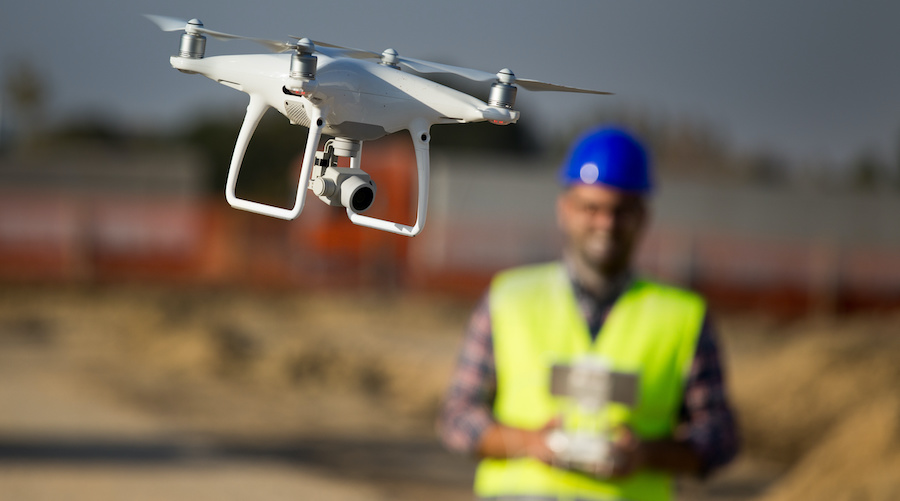
When it comes to hardware, there is no piece of gear more important than the drone itself. The standard for which drone is suitable for mapping is actually quite low. Since you will be relying on images captured from an RGB camera, all you need is a drone with a camera that can be tilted down to take aerial imagery. Practically all modern drones can do this.
However, not all drones can be programmed to work with a drone flight planning app. Take note that this interface makes it possible to fly drones automatically across pre-determined flight paths and take a series of overlapping photos. Having all these steps done automatically is a much more foolproof alternative than doing them manually yourself.
Therefore, you will need a drone that can communicate with the flight software using a Software Development Kit (SDK). Not all drones have this feature, particularly the models designed for casual use.
Camera quality and specifications also matter when it comes to drone mapping. You will want to get a drone with a mechanical shutter or global shutter, as this exposes the whole image sensor all at once. This will avoid you from taking images with a rolling shutter effect. Naturally, a larger image sensor is also beneficial for capturing more light and recording more detail with each still.
Despite its age, the Phantom 4 Pro V2 is still considered by many to be the best drone for mapping. The workhorse of the commercial drone industry for many years, the P4P V2 has a 1-inch image sensor, a mechanical shutter, OcuSync transmission technology, and upgraded propellers compared to the original P4P.
For a newer and more compact solution, the DJI Air 2S is also considered to be a very good mapping drone. Although it lacks SDK compatibility, some software providers have been able to figure out a workaround to make the Air 2S work with flight planning apps. The Air 2S also has a 1-inch image sensor. It does have a rolling shutter, though, so there are limitations to using the Air 2S when it comes to mapping quality and accuracy.
There are more than a dozen other drones out there that can be used for mapping with reasonably good performance. You can go with the newer Mavic models, or even go for a fixed-wing drone for large-scale mapping jobs. As the saying goes, the best drone for the job is the one you have with you. It’s normal to start with a mid-range prosumer drone before upgrading to enterprise-grade drones.
Essential apps and software
Hardware is important, but the software you’re using is just as crucial as any part of your gear. Mapping software can be classified into two broad categories – data acquisition and data processing.
Data acquisition apps or software refer to those that you use to plan a survey and execute them on the field. As mentioned earlier, DJI GS Pro, Pix4Dcapture, and Maps Made Easy are some of the most popular options for this category.
Processing software is responsible for taking all the images and data that you have collected on the field and stitching them together to produce the output that you need. Processing software can use either local or cloud-based processing. Each option has pros and cons – local processing does not need an active Internet connection, but needs to run on a fairly powerful computer. Cloud-based processing requires no fancy hardware but you will need a robust and fast Internet service.
A popular option for map processing software is WebODM, mostly because it is free to download and use. However, this is open-source software that is not exactly beginner-friendly. It is useful for just about any type of map output and runs data processing locally. WebODM does not have any data acquisition or flight planning capabilities.
SkyeBrowse takes a different approach to map processing. Instead of using still images, SkyeBrowse uses videos of the survey area. This significantly speeds up the data acquisition process as the drone can fly at faster speeds without any concerns about blurred photos. SkyeBrowse works with a large selection of DJI and Autel drones.
Agisoft Metashape is a popular standalone program for photogrammetry processing. It can handle basically any type of spatial data and can generate orthomosaic maps, 3D models, point clouds, digital elevation models, and multispectral imagery. At only $179 for a perpetual single-user license, Agisoft is still considered one of the more affordable go-to-software platforms for photogrammetry.
Both Pix4D and DroneDeploy are platforms that provide end-to-end software solutions for mapping. This means that you can potentially use just a single platform to do everything from planning to data processing and map generation. This helps in establishing a seamless workflow and not having to worry about file structure, organization, and compatibility.
Final Thoughts
Mapping is easily one of the most profitable fields that you can get into if you’re a professional drone pilot. However, it is also a field that is quickly becoming more competitive despite the wealth of potential clients. If you want to stand out in this market, it is important to get started on the right footing with theoretical knowledge, industry-standard gear, and proper practices.
This summary of the most important points to get started in mapping really only scratches the surface. If you need more detailed pointers, we recommend signing up for the Drone Mapping, Modeling, and Surveying Bundle course.