-
Key Takeaways
-
The 400-Foot Rule at a Glance
- What “400 ft AGL” Really Means
- Who Must Follow It
-
Why the FAA Chose 400 Feet
- Airspace Structure & Manned Traffic Separation
- Safety Data & Close-Call Statistics
- Persistent Myths
-
Legal Pathways to Fly Above 400 Feet
- The “400 ft + Structure” Rule (Part 107 Only)
- Altitude Waivers (§107.200)
- LAANC “Further Coordination” in Controlled Airspace
- Fixed Sites & CBO-Sanctioned Events (Recreational)
-
Measuring & Managing Altitude in the Real World
- Terrain Challenges: Mountains, Valleys, Cliffs
- Geofencing and Firmware Limits
- Apps, Alerts, and On-Board Sensors
- Weather & Performance Above 400 ft
-
Consequences of Breaking the Limit
- FAA Fines & Enforcement
- Liability & Insurance Exclusions
- Community Impact
-
Global Altitude Limits at a Glance
-
Practical Tips to Stay Compliant
- Pre-Flight Planning Checklist
- In-Flight Best Practices
- Post-Flight Documentation
-
FAQs & Myth-Buster Box
-
Conclusion
It’s all too easy to get caught up in the thrill of flying. Just like Icarus, pilots today can lose track of common-sense altitude rules, only to experience tragic results.
One terrifying example of a drone incident occurred in late 2024 at Piarco International Airport in Port-of-Spain, the capital of Trinidad and Tobago. A commercial aircraft in its landing pattern came within 20 feet of a drone at 3,500 feet in the air!
While some drone models can reach impressive heights, such as DJI’s Mavic 3, which can fly up to 19,685 feet MSL, the reality is that most drone operations have no business at these altitudes.
The FAA’s 400-foot AGL maximum is a standard but not an absolute. Part 107 holders have some flexibility to fly above that standard maximum if the circumstances permit such high-altitude operations.
Let’s dissect the FAA’s rules and a few fully legal methods to exceed 400 feet.
Key Takeaways
- Learn the difference between AGL and MSL.
- Gain clarity on the FAA’s 400-foot AGL maximum rule.
- Understand why the FAA chose 400 feet to separate manned from unmanned aircraft operations.
- Know how to circumvent the FAA’s standard rules legally.
- Implement key best practices to avoid flying over 400 feet.
The 400-Foot Rule at a Glance
What “400 ft AGL” Really Means
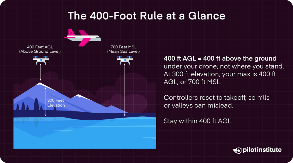
AGL refers to above-ground level measured from directly underneath the drone, not from the ground where the pilot is standing.
Meanwhile, MSL, or mean sea level, is the height above sea level, based on the global average.
Let’s say you are at a location that is 1,000 feet above sea level (1,000 ft MSL) and has standard rules about not flying over 400 feet AGL. That means your maximum flight altitude would be 400 AG, but also 1,400 MSL.
Altimeter Readings on Controller May Not Reflect True AGL
Unfortunately, the altimeter on most UAS controllers uses the point of take-off as the base altitude (0), which may not always reflect true AGL.
According to the FAA, this means that when flying over landscapes with an incline, the controller can read higher than 400 feet, while still being in the green zone. For example, if you take off at sea level and fly your drone at 400 feet AGL over a 1,000-foot mountain, controllers may show 1,400 feet.
On the other hand, however, if your flight takes off on top of a hill and flies over a valley, you may run into problems staying within that 400-foot maximum rule. Even though your controller may still read 400 feet, the true AGL would be much different.
Altimeter readings can even produce “negative altitude” readings. For example, when a drone is launched near a cliff, the aircraft may descend below the altitude of the take-off point. The negative readings indicate that the UAS is below its original launch elevation.
It is a pilot’s responsibility to take into account elevation changes by staying informed about terrain and altitude changes in the operating zone.
Who Must Follow It
Recreational (§44809) Flyers
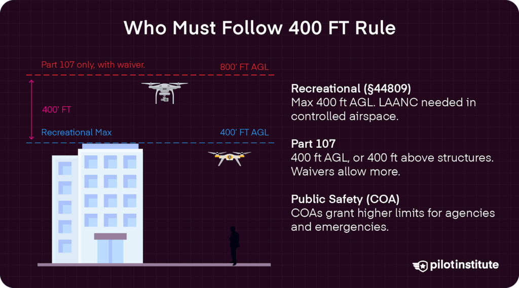
49 USC §44809 states that recreational pilots must stay below 400 feet above the natural ground in uncontrolled airspace, not buildings or other structures.
That means, when recreational drone pilots fly from the top of a 200-foot building, they only have 200 feet from that location before overstepping their boundaries. The FAA already considers the take-off point as 200 feet AGL, not 0, despite what your controller’s altimeter may say.
Section 4 of the Aeronautical Information Manual (AIM) does leave open the chance for recreational flyers to get approved for flight above that 400-foot maximum, where “the operator must obtain prior authorization from the Administrator or designee before operating.”
Recreational pilots looking to fly in controlled airspace must seek FAA approval before flight operations. Currently, the FAA allows recreational pilots to seek approval through the LAANC process. Recreational flyers cannot fly in areas with a zero grid rating.
Part 107 Remote Pilots
Fortunately, Part 107 pilots have a lot more wiggle room. Section 4 of the Aeronautical Information Manual (AIM) reads, “Part 107 grants certain flight permissions and altitudes in excess of those provided under 49 USC 44809.”
In uncontrolled airspace, the 400 feet AGL applies, but with certain loopholes. For one, if a pilot is within 400 feet of a structure, he or she can fly 400 feet AGL starting from the top of that structure. In other words, imagine a 400-foot radius extending outward and upward from the structure’s highest point.
Part 107 holders can also seek altitude waivers that also expand their flight potential.
Public-Safety COA Operations
Public safety agencies can operate under different height restrictions with a Certificate of Authorization (COA), which grants abilities beyond Part 107 restrictions.
The FAA “conducts a comprehensive operational and technical review” of all COA requests, meaning applications should provide sound reasoning for needing additional altitude ceilings.
As such, COAs are typically granted to government and public safety agencies. There are three basic types of COAs, including a blanket COA that is not dependent on location, jurisdictional COAs that do depend on location, and emergency COAs for emergency services.
Why the FAA Chose 400 Feet
Airspace Structure & Manned Traffic Separation
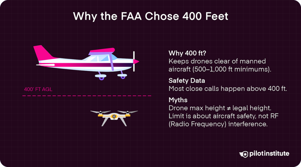
The FAA based its 400-foot AGL maximum on the minimum safe altitudes for manned aircraft set by 14 CFR §91.119.
In congested areas, the statute limits altitudes to “1,000 feet above the highest obstacle within a horizontal radius of 2,000 feet of the aircraft.”
Rural areas have a lower minimum altitude, set at 500 feet “above the surface, except over open water or sparsely populated areas.”
These 14 CFR 91.119 set standard minimums for manned aircraft, meaning that the airspace from 500 feet to the surface is largely free for drones. The FAA added a 100-foot safety buffer to ensure separation of the two types of aircraft.
Safety Data & Close-Call Statistics
UAVs operating above 400 feet AGL risk facing off with manned aircraft.
A 2015 study reviewing incidents between drones and crewed aircraft around Los Angeles International Airport (LAX) found that 90 percent of close calls occurred when drones were flying above the 400-foot AGL maximum.
Despite risks, more and more UAVs are flying above 400 feet AGL. A 2023 FAA-sponsored study at Embry-Riddle Aeronautical University found frequent violations of the FAA’s altitude limit.
Out of 6,037 recorded drone flights, 573 passed 400 feet, and 781 even flew higher than 500 feet. Many of these high flyers were later discovered to be recreational pilots.
More recently, an SAE International Journal of Aerospace study was conducted near Dallas-Fort Worth International Airport between 2018 and 2021. A total of 24 near-midair collisions were reported, many of which occurred above the FAA’s 400-foot limit.
Persistent Myths
There are, unfortunately, some common myths that must be busted. Many assume that it is legal for them to fly their drones as high as they can reach. My DJI can reach 19,000 feet–that must be legal, right? Nope.
Some also place the blame on RF interference, where flying above 400 feet AGL could result in potentially catastrophic signal interference. In reality, the limiting factor is the radio horizon, not signal radiation. As altitude increases, maintaining a stable communication link proves to be the main challenge.
Legal Pathways to Fly Above 400 Feet
The “400 ft + Structure” Rule (Part 107 Only)
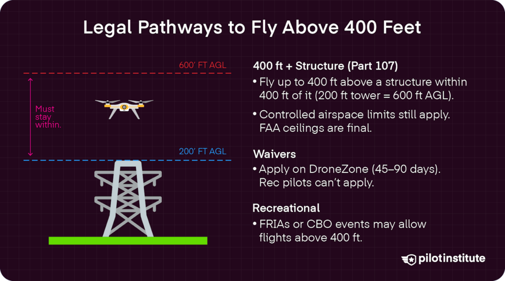
Thanks to 14 CFR §107.51, Part 107 pilots are not limited to 400 feet AGL above the natural ground. In Class G or E airspace, they can fly up to 400 feet above the highest point of a structure when operating within a 400-foot radius of that structure.
That means that if a drone is being flown within a 400-foot radius of a 200-cell tower building, the legal ceiling is 600 feet AGL.
This is true even if the top of the structure technically enters Class E airspace. In our example, that means that even if Class E airspace began at 500 feet, a pilot could still fly to 600 feet AGL within 400 feet AGL of a 200-foot building. Class E2 airspace, however, still needs approval.
Drone pilots also need to seek approval for entering Class B, C, and D airspace, even in the 400-foot zone above a designated structure.
For example, if a pilot were trying to inspect a structure that was 1,100 feet tall, but Class B airspace started at 900 feet AGL, he or she would be restricted to a maximum of 899 feet AGL, unless there was prior approval to enter that airspace.
It is important to note that in controlled airspace, pilots cannot fly above the approved maximum height limit approved by the FAA, regardless of any structures. Whatever the FAA gives you in an approved LAANC is absolute.
Altitude Waivers (§107.200)
According to §107.51(b), to exceed altitude limits, drone pilots can seek altitude waivers using the FAA’s DroneZone website. Waivers are necessary for flight operations above 400 feet AGL or 400 feet above the highest point of a structure within 400 feet of a drone operator.
Applications for waivers should be submitted at least 90 days before the proposed start of the flight operation. Approval takes anywhere between 45 to 90 days.
The approval process is tough, so being detailed and thorough with the waiver application ensures a smoother outcome. We recommend including a risk matrix, contingency triggers, and any appropriate NOTAM filings with your waiver application.
Unfortunately, recreational pilots cannot apply for waivers to fly above 400 feet AGL, the way Part 107 pilots can.
LAANC “Further Coordination” in Controlled Airspace
In controlled airspace, including Class B, C, and D airspace, the maximum height levels will often differ, ranging from 0 to 400 feet AGL. Exact altitude ceilings are published on the UAS Facility Map, accessible on apps like Aloft. Pilots can seek approval for flights up to the grid value through the LAANC process.
Requests for flights above altitude ceilings in controlled airspace need a“further coordination” request to the FAA. The FAA reviews the operation and facilitates coordination in a more hands-on manner.
Part 107 pilots need to submit a detailed flight plan and protocol on the FAA’s DroneZone website.
Fixed Sites & CBO-Sanctioned Events (Recreational)
For recreational pilots really wanting to reach new heights, there are some options for flying above that 400-foot AGL maximum.
FAA-Recognized Identification Areas (FRIAs) offer expanded flight opportunities. They are designed for UAVs that lack Remote ID equipment, but can sometimes offer recreational pilots the chance to fly above traditional height limits. FRIAs are designated blue grids on the FAA’s Recognized Identification Areas Map.
Additionally, fields run by the Academy of Model Aeronautics (AMA) are also sometimes cleared for flights above 400 ft.
Section 4 of the AIM also offers recreational pilots the chance to fly higher than 400 feet AGL during CBO Sanctioned Events. These are sponsored events that take place at a fixed site.
Measuring & Managing Altitude in the Real World
Terrain Challenges: Mountains, Valleys, Cliffs
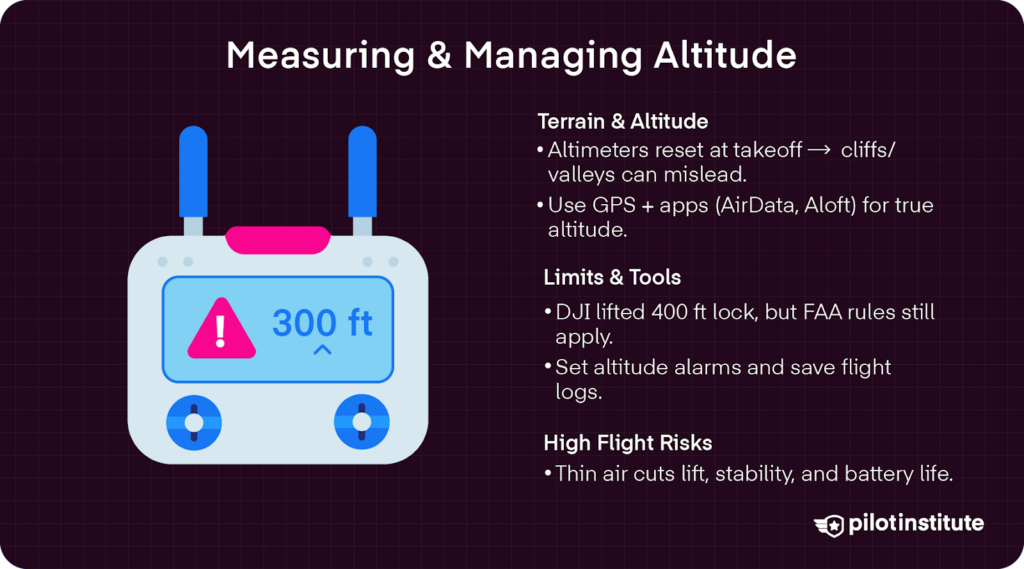
As discussed earlier, most drone controllers use barometric altimeter technology to measure altitude from the ground.
These systems gauge altitude based on pressure changes associated with increases or decreases in height. Thus, altitude readings typically start at 0 at the drone’s take-off point, no matter the pilot’s positioning in terms of true AGL.
This is a much different reading compared to the GPS altitude, which is calculated using satellite positioning to measure a drone’s height from the true ground level.
Barometric altimeters can also experience abnormalities, such as pressure drops near a cliff’s edge or ridge line, which is caused by wind being constricted as it flows over a mountain ridge.
This can create false, or “extra” altitude. These altimeters can also give negative altitude readings if a pilot descends into a valley or gorge.
To mitigate such issues, monitor topography in apps like Airdata. Make sure to set the RTH value to the lowest terrain possible to get better readings.
Geofencing and Firmware Limits
Some drone models have a 400-foot altitude limit baked into geofencing systems..
DJI previously had very strict geofencing in place that hindered pilots from flying above 400 feet AGL. Since January of 2025, however, geofencing limitations have been lifted in the DJI Fly App. While it may still warn you about exceeding height limits, DJI’s software will no longer physically stop pilots from flying higher than allowed.
It is always critical to remember that the FAA, not drone manufacturers, sets compliance. Just because you can fly higher than the legal limit does not mean that you should.
Apps, Alerts, and On-Board Sensors
Fortunately, there are a ton of tools pilots can use to keep them compliant.
Mobile apps like Aloft easily display the FAA’s UAS Facility Maps, making it easy to see altitude ceilings and request LAANC approval in certain controlled airspace scenarios. Other apps approved by the FAA’s B4UFLY service can be used both on mobile and desktop applications.
It is also helpful to set an audible altitude warning on your drone’s controller. Setting it at 365 feet, for example, provides time to act when you are getting close to that 400-foot AGL maximum.
Just in case, you can save telemetry data from your flight logs for proof of compliance.
Weather & Performance Above 400 ft
Higher altitude flights face unique weather and performance challenges.
When flying above 400 feet, for example, you may encounter air that is noticeably less dense than the air at ground level. This can affect your drone’s lift, requiring it to spin faster to stay aloft. Drone stability can also be affected, as air that is less dense makes a UAV more sensitive to wind gusts.
All of these eat into battery performance times.
Consequences of Breaking the Limit
FAA Fines & Enforcement
Penalties can be harsh if the FAA catches pilots flying above altitude limits without the appropriate approvals or waivers.
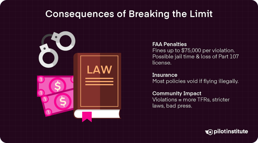
According to the FAA itself, “drone operators who conduct unsafe or unauthorized operations face fines up to $75,000 per violation.” Along with civil penalties, pilots can also face real jail time for egregious offenses.
Part 107 holders caught flying above FAA altitude limits can face the suspension or revocation of their certification.
Liability & Insurance Exclusions
Even if the FAA does not catch up with you, your insurance company might. Most UAS hull and liability policies are void if an incident occurs in violation of Part 107 or 49 USC §44809.
Community Impact
Disregarding altitude restrictions has a ripple effect throughout the community as well. When more pilots ignore altitude ceiling rules, the rate of incidents with manned aircraft increases. This results in increased TFRs, stricter state laws, and overall bad press for drone operations.
Global Altitude Limits at a Glance
| Country | Max Height | Notes |
| U.S. | 400 ft (120 m) | Higher allowed for Part 107 pilots with a waiver or near structures |
| Canada | 400 ft (122 m) | Exceptions require a Special Flight Certificate (SFOC) |
| UK | 400 ft (120 m) | Up to 160 ft above structures under PDRA-01 |
| EU | 400 ft (120 m) | While some national variations exist, EASA regulations have largely harmonized the maximum altitude to 120 meters (approx. 400 feet) across member states for most ‘Open’ category operations. |
| Australia | 400 ft (120 m) | Above-limit requires CASA ReOC |
Practical Tips to Stay Compliant
Pre-Flight Planning Checklist
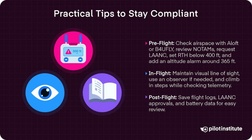
When building a preflight checklist, you can include the use of a mobile app like Aloft or another certified B4UFLY service to check airspace altitude ceilings, NOTAMS, and request LAANC approvals.
Make sure to also set your low-battery RTH altitude below 400 feet, unless a structure exemption applies. This will ensure that your drone stays within the legal height limits, even if it returns to home automatically because of low battery.
Programming an alarm on your controller to audibly provide altitude warnings also helps when you get lost in flight. Set an alarm for something close to 400 feet, like 365, to be reminded when you’re getting close to that maximum altitude ceiling.
In-Flight Best Practices
While flying, make sure to keep the drone in your visual line of sight (VLOS). You can also ask someone on your crew to serve as a visual observer to help monitor altitude stats.
Incremental climbs are also a great practice. Briefly stop climbing every 100 feet or so to confirm telemetry readings and signal strength before proceeding upwards.
Post-Flight Documentation
Make sure you keep all flight logs, LAANC authorizations, and even battery data for possible review. Most drone models make this data really easy to access through their mobile apps. Saving this information in PDF or Excel formats makes it easy to pull up if there is ever a need.
FAQs & Myth-Buster Box
- Does the 400-foot limit change at night?
The answer is no. The rules stay the same regarding the 400-foot maximum, structure exceptions, and other considerations. Just make sure to add anti-collision lights that are visible for at least three statute miles. - Are balloons or cranes considered “structures?”
Yes, if they are permanent in a fixed position and charted by the FAA. - Can I fly over my neighbor’s house at 300 feet?
Yes, but with some considerations. If you are a recreational pilot flying in uncontrolled airspace, you must stay below 400 feet AGL, giving you 100 feet of wiggle room. - As a Part 107 pilot in uncontrolled airspace, if operating within a 400-foot radius of your neighbor’s house, you have up to 700 feet AGL.
When flying near residential buildings, always make sure to respect all local privacy laws.
Conclusion
Ultimately, 400 ft is a flexible safety buffer, not a creativity wall. It aims to keep manned and unmanned aircraft separate from each other, reducing potential incidents. Yet, there are ways to fly higher. Informed pilots can navigate certain circumstances to fly at the altitudes their operations demand.
All pilots have a responsibility to respect FAA rules and maintain appropriate altitude management during flight operations. Doing so will ensure the national airspace continues to be a playground for tomorrow’s drone innovation.
