
- Key Takeaways
- Parks and Their Regulations
- City/County “Public” Parks
- State Parks
- National Parks & Wilderness Areas
- Rules That Follow You Everywhere
- Basic Flight Regulations
- Recreational Flyers (49 U.S.C. §44809)
- Part 107 Operators
- Airspace Authorizations
- Why Park Rules Can Ground You
- Legal Basis for Ground Bans
- Finding the Rules Faster
- Contacting Park Authorities
- Permit Pathways
- Other Options
- Build a Bulletproof Pre-Flight Checklist
- Three-Tier Flowchart
- Environment & Events
- Safety & Courtesy
- Common Scenarios & Solutions
- Family Picnic Flight
- Client Wants Real-Estate B-Roll
- Charity 5K Coverage
- Penalties & Public Perception
- Conclusion
Picture yourself flying on a bright, clear day at your favorite state park. You really want to get that perfect shot of the waves crashing along the coastline during golden hour.
Everything is going great until you are approached by a ranger who demands that you land immediately. You forgot to get the required permit, and now that perfect golden hour moment has passed. Meanwhile, you face a stern scolding and a hefty fine.
Flying drones in public parks can come with unknown restrictions and steps. Let’s unpack what you need to stay compliant with federal, local, and state laws on public park property.
Key Takeaways
- By default, flying a drone is not illegal over city, county, or state parks–but it IS generally prohibited in National Parks.
- We explain the difference between public parks, so you can contact the right authorities and stay compliant with local laws.
- Make sure you have the proper certifications and authorizations before you fly.
- Understand the reasons behind ground bans. Avoid costly penalties by knowing the laws.
Parks and Their Regulations
City/County “Public” Parks
Public parks are recreational or conservation areas open to the general public. They are managed by various levels of government agencies.
City parks “serve as critical public places for recreation and civic engagement,” according to the National Recreation and Park Association. Local municipalities own and manage them through city park departments.
The next step up are county parks, owned and managed by a county government.
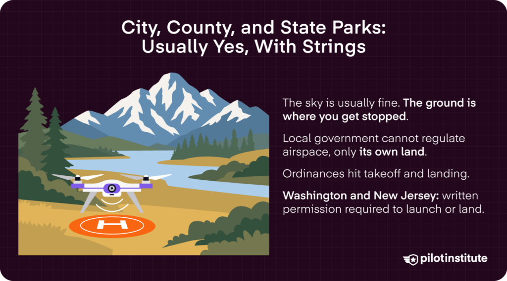
City and county authorities cannot regulate airspace. Still, local ordinances can impact land use. This could limit drone take-off and landing on park property, even in Class G airspace.
In Tennessee, Nashville Metro Parks prohibits drone flights in city parks, “except in three designated areas: Warner Park, Peeler Park, and Cane Ridge.” A permit is required for all other city parks. In the larger Davidson County area, Ordinance §13.24.400 states that “no person shall voluntarily bring, land, or cause to descend” any “flying machine, balloon, parachute, or other apparatus for aviation.”
State Parks
State parks are owned and managed by larger state governments. In most states, you can fly your drone at state parks, beaches, or recreational areas.
However, some parks may post explicit regulations limiting or banning drone flights. In California, “drones are currently allowed” on State Park property, but individual parks may prohibit drones to protect wildlife, prevent fire risk, and ensure public safety.
In more extreme cases, the state’s park agency may ban take-off or landing activities. For instance, Washington Administrative Code 352-32-130 states that “no aircraft shall land or take off from any body of water or land area in a state park area not specifically designated for landing aircraft.” Flying in Washington State Parks is allowed, but “only upon issuance of a one-time basis permission granted by the Director or designee.”
Similarly, the New Jersey State Park Service prohibits drone take-off and landing unless “prior permission has been granted by the State Park Service Assistant Director.”
National Parks & Wilderness Areas
Federal lands are managed by several agencies. The National Park Service (NPS) manages National Parks and many national monuments. Congressionally designated Wilderness Areas are managed by the NPS as well as the U.S. Forest Service, the U.S. Fish and Wildlife Service, and the Bureau of Land Management.
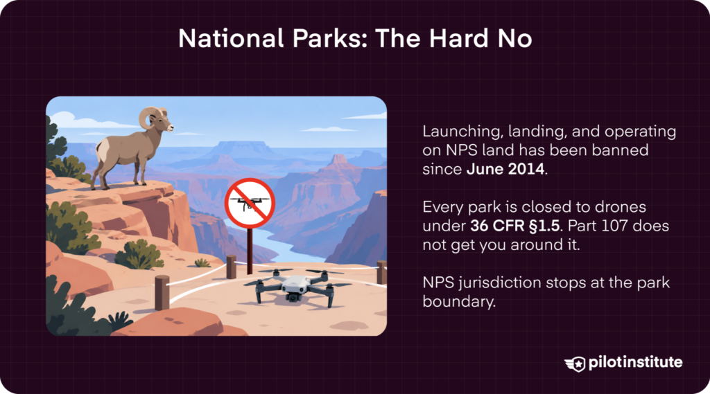
In accordance with 36 CFR § 1.5, National Park supervisors can “impose public use limits” on park property. This allows them to impose bans on take-off and landing activities to protect wildlife and delicate ecosystems.
In 2014, the NPS issued Policy Memorandum 14-05, prohibiting take-off and landing within National Parks. This essentially banned drone flights, even for commercial Part 107 operations.
It is extremely rare for the NPS to offer special permission for drone operations. Most approved flights involved surveying and wildlife conservation efforts.
Rules That Follow You Everywhere
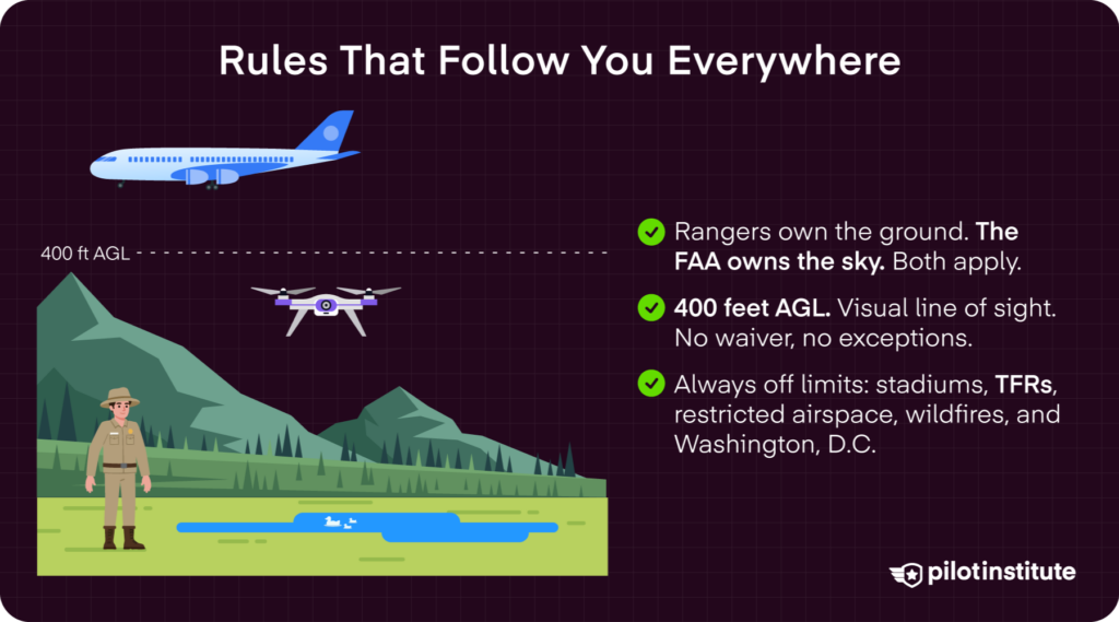
The truth is, park rangers don’t have authority in the sky–the FAA does. So, no matter where you fly, you’re going to have to follow FAA guidelines for drone operations. Let’s break down the basics.
Basic Flight Regulations
In uncontrolled Class G airspace, pilots can fly up to 400 feet Above Ground Level (AGL). This altitude is measured from the ground directly beneath the drone. The altitude limitation of 400 feet AGL (above the ground) aims to keep drones out of the way of manned aircraft.
The FAA also requires drone operators to fly within Visual Line of Sight (VLOS), unless granted a Part 107 waiver. VLOS means that drone pilots or visual observers (VOs) must be able to see the drone without the use of visual aids or obstructions.
Other airspace restrictions prohibit flight around:
- Stadiums and sporting events.
- Controlled airspace near airports and other sensitive areas.
- Restricted or special-use airspace.
- In Washington, D.C.
- Near natural disasters, such as wildfires.
Pilots must also check Notice to Airmen (NOTAMS) and Temporary Flight Restrictions (TFRs) in their flight areas.
Recreational Flyers (49 U.S.C. §44809)
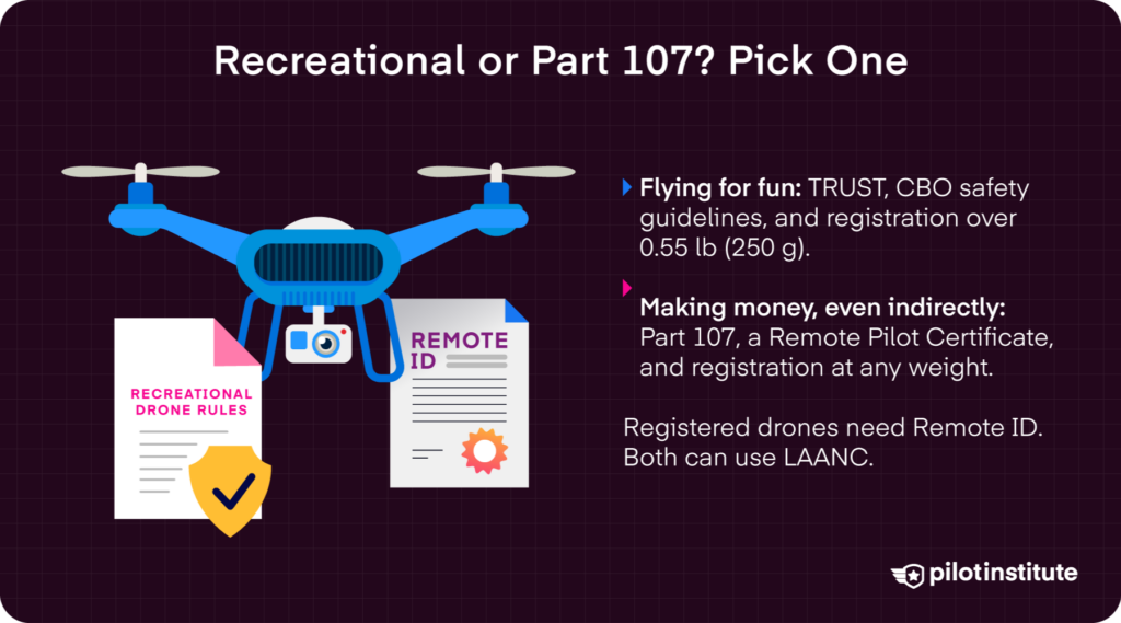
Recreational flyers are those pilots who fly for the fun of it. But that doesn’t mean there are no rules at all.
All recreational pilots are “responsible for the safe operation of the unmanned aircraft” and must “operate in accordance with the safety guidelines of an accepted” Community Based Organization (CBO), like the AMA, that sets “guidelines and safety precautions for flight near people” (AIM, § 11-8-3).
The FAA now requires that recreational flyers demonstrate basic aeronautical and safety knowledge with The Recreational UAS Safety Test (TRUST). The test is free to take and is made up of four short quizzes.
You’re in luck! We are an FAA-approved test administrator of the TRUST exam!
Additionally, if your drone weighs more than .55 lbs (250 g), you’ll have to register it with the FAA using the DroneZone web portal.
Part 107 Operators
If you plan on making any money with your drone, you fall under the commercial Part 107 regulations.
You will need to take the Part 107 test and obtain a Remote Pilot Certificate. Again, we have incredible resources for studying for the Part 107 exam. 99.8% of Pilot Institute students pass!
Drones flown under Part 107 must be equipped with Remote ID and use anti-collision lighting for night flights.
Part 107 pilots have a bit more wiggle room in terms of altitude restrictions, compared to recreational pilots. They can fly 400 feet above structures, not just ground level. Waivers to Part 107 and Public Safety COAs also grant higher altitude limits.
Ops Over People Categories 1-4 offer Part 107 pilots the ability to fly over people based on the weight of the drone, the level of injury risk, and compliance with FAA-approved designs (no exposed rotating parts).
Pilots can also apply for waivers for Beyond Visual Line of Sight (BVLOS).
Airspace Authorizations
The FAA imposes tiered altitude ceilings that step down toward ground level closer to a towered airport. The idea is to reduce the risk of traffic conflicts for incoming manned aircraft.
Airspace is broken into different letter categories, from A to G.
- Class A: Begins at 18,000 feet Mean Sea Level to 60,000 MSL.
- Blass B: Several tiers near major airports that look like an upside-down cake, from the ground to 10,000 feet MSL.
- Class C: An inner core and outer shelf near busy airports that extends from the surface to 4,000 feet.
- Class D: Near towered airports from the surface to 2,500 AGL.
- Class E: Widespread controlled airspace that can begin at the surface, 700 feet AGL, or 1,200 feet AGL.
- Class G: Uncontrolled airspace that extends from the surface up to the floor of the overlying controlled airspace, which is often 700 or 1,200 feet AGL.
Both recreational and Part 107 pilots can apply for authorizations to fly higher than posted altitude ceilings. You will need to apply for LAANC approval through a third-party service like ALOFT.
Why Park Rules Can Ground You
Legal Basis for Ground Bans
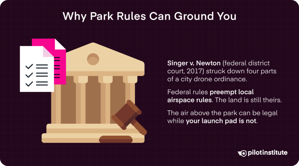
Getting back to flying in public parks, the primary legal basis for restrictions in any type of park is based on land-use authority.
As we said earlier, local, county, and state governments can’t regulate airspace, but they can regulate activities on the ground they own and maintain. That means they can implement rules on taking off, landing, and other on-the-ground operations.
The current precedent was set in 2017 by a Supreme Court case, Singer v. City of Newton. In 2016, the city of Newton, Massachusetts, passed tight regulations that basically banned drone operations in the city. One of the most contentious components was the ban on drone flight below 400 feet AGL over private property without the property owner’s permission.
In response, Dr. Michael Singer sued the city, arguing that the ordinance ignored the FAA’s authority over airspace. The Court agreed on several of Singer’s arguments in the suit, confirming that federal airspace laws preempt local drone ordinances.
Yet, this does not mean that local authorities cannot make any laws on drone operations within their jurisdictions. As we saw earlier, many cities, counties, and states implement laws limiting drone operations. However, these laws must focus on land-use, meaning local authorities can only make laws limiting what drone operators can do on the ground.
So, while you may be able to fly in airspace above public parks, you may not be able to take off or land from them. Unless you have a drone with an incredible range, you may need to find an approved launch site outside of a park’s boundaries or get permission from the park’s governing agency to take off or land.
In fact, the FAA claims that “while the FAA is designated by federal law to be a regulator of the National Airspace (NAS), some state and local authorities may also restrict access to local airspace. UAS pilots should be aware of these local rules.”
Finding the Rules Faster
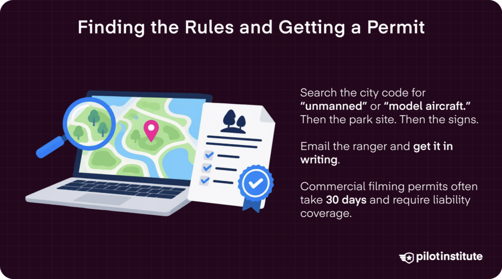
So, how do you find these local rules? Start by searching the city/ county ordinance code for terms like “unmanned” or “model aircraft” to pull up any relevant ordinances that may limit your ability to fly in public parks.
Then check the park’s website itself. The FAQ section typically posts rules and guidance for drone flights in that specific park.
When you head to the park, check for any posted signs that may indicate limitations on drone use.
Contacting Park Authorities
If you are still unclear, contact the ranger’s office directly by phone or email. Make sure to keep a record of the person’s name and the date you call in case you are approached on-site.
Be prepared to explain the purpose of your flight, the type of drone you are using, and how long you will be flying for.
Sometimes an email is better than calling. Obtaining written approval whenever possible provides a clear record that you are authorized to launch, land, and operate within the park.
Permit Pathways
Commercial filming with drones often requires a film permit.
In Los Angeles, for example, a permit filed through FilmLA is required for commercial aerial photography/ videography. You will need to submit your Part 107 Remote Pilot Certification, a drone questionnaire, drone registration, a written plan of activity with maps, and a certificate of insurance (COI).
Some California State Parks, like Leo Carillo in Malibu, require drone operators to acquire a film permit from the California Film Commission. Hopeful operators need to submit the UAS/Drone Use Questionnaire along with their film permit application.
In New York City, you’ll need a permit to take off or land within city limits. Permits for flying in public parks are filed with the NYPD and the New York Department of Transportation.
Applying for such permits can take up to 30 days to secure approval. Costs range from free to $400 per permit.
Many permits also require proof of insurance (typically $1-2 million in liability insurance), along with pilot certifications (Part 107). Some permit applications may also ask for a detailed site sketch or plan of operations.
Other Options
Want to avoid the headache of jumping through hoops to fly your drone?
Check out the Academy of Model Aeronautics (AMA) clubs and FAA-Recognized Identification Areas (FRIAs) that offer more freedom without all the red tape. You won’t need to worry about city ordinances or even being compliant with federal Remote ID regulations.
Build a Bulletproof Pre-Flight Checklist
Three-Tier Flowchart
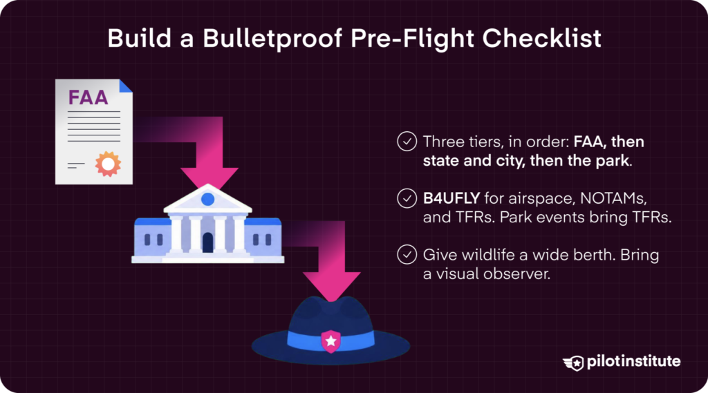
Remember, authority flows from federal (FAA) to local. So first, ensure your operation complies with FAA regulations.
Then, check for state/city ordinance codes through your local government websites or municipal code databases. Confirm any takeoff, landing, or ground restrictions in your launch location.
The third tier is even more local. Get a local park ranger to sign off on your operations to prevent on-site misunderstandings and ensure your flight aligns with park-specific rules.
Environment & Events
Next, check for environmental concerns. Parks were often designed to protect wildlife and sensitive environmental areas. So, note things like migratory bird nesting seasons and other wildlife migration times. Make sure you always keep a buffer of at least 100 meters between you and wildlife.
Use the FAA’s B4UFLY service, provided by third parties like ALOFT, to check for airspace restrictions, NOTAMs, and TFRs. Parks often hold public events, so make sure your operation does not conflict with public crowds and TFRs.
Safety & Courtesy
Public parks are, well, public! So, taking a few extra steps to be courteous in these public spaces we all share is important.
Use a speaker or strobe to announce your launch/landing site. When there are people nearby, use propeller guards for extra safety and compliance with Ops Over People regulations.
Take a friend with you to serve as a visual observer (VO). A keen spotter can defuse anxiety and help you avoid obstacles.
Common Scenarios & Solutions
Family Picnic Flight
So, you’re having a family picnic at your neighborhood park and want to remember it.
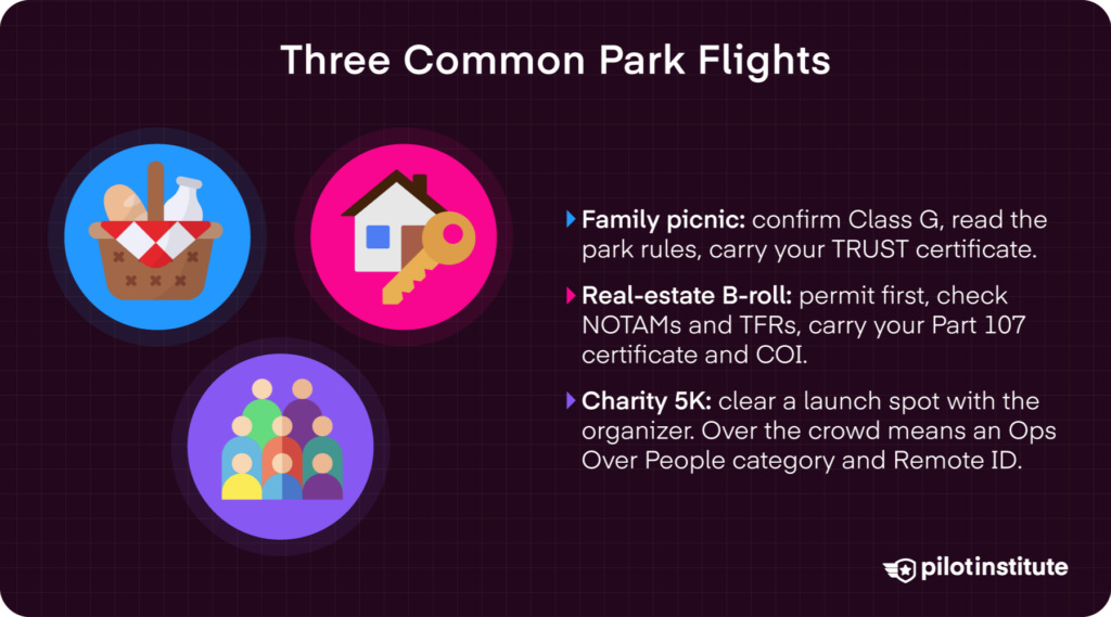
First, check what airspace your local park falls in. If you’re in the green with a Class G airspace, then scan the park rules online and in person.
Make sure you have your TRUST card on hand.
Think about flying when it is less crowded, and avoid extra safety concerns.
Client Wants Real-Estate B-Roll
Let’s say your client wants B-roll of the neighborhood to help sell their listing. A local park is a great amenity to document.
Check whether permits are required for your location. If they are, schedule the shoot with plenty of time to apply. Conduct a quick check for NOTAMs and TFRs.
Keep your Part 107 Remote Pilot Certificate and COI document with you to show any rangers who may inquire about the operation.
Think about shooting during lull hours. Dawn offers a great golden hour glow for gorgeous footage!
Charity 5K Coverage
Coordinate with the event’s organizer for a safe, secure launch spot.
Apply for any required permits and make sure there are no NOTAMs or TFRs at the park on event day.
Make sure you follow FAA Ops Over People regulations if you are flying over a crowd. Use a Category 2 or 3 drone to stay compliant, or think about using a tethered system for extra safety.
Penalties & Public Perception
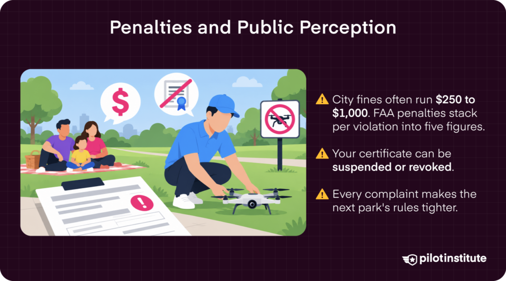
Typical city fines can range from $250 to $1,000. More serious violations with the FAA can result in substantial fines. While the maximum civil penalty for a single violation is typically lower, total fines for a case involving dozens of illegal flights have been proposed for over $75,000. Your drone and certifications may also be up for grabs.
Penalties aside, don’t be inconsiderate. Public parks are for all of us. It is important to practice community stewardship, safety, and respect.
People get understandably annoyed when drone operators ignore laws and fly without safety in mind. So, staying compliant and respectful keeps more opportunities for drone flight for all of us.
Conclusion
Before you head out to your local park to fly, make sure you check all the boxes. First, stay compliant with FAA regulations. Then, check for any local ordinances or state laws using a city ordinance code checker or the park’s website.
If you’re still unclear, take the extra step to contact park authorities and get clarification. Fly with confidence, not confusion!
Every responsible flight today is a vote to keep tomorrow’s parks drone-friendly—fly as if the future depends on it.