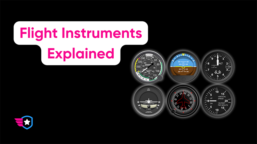
In the world of aviation, everything is about precision. Part of that precision comes through two key types of altitude: MSL and AGL.
What sets them apart?
In short:
- Mean Sea Level (MSL): An aircraft’s altitude above the average level of the world’s oceans.
- Above Ground Level (AGL): An aircraft’s height above the Earth’s surface directly beneath it.
In other words, MSL tells you how high you are relative to sea level, while AGL tells you how high you are relative to the ground directly below.
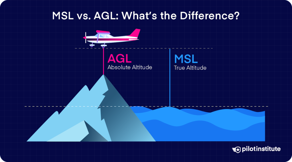
MSL altitudes are generally higher than AGL altitudes; the ground is usually above Mean Sea Level (how high the ground is above MSL is known as elevation).
Key Takeaways
- MSL measures altitude above average sea level, while AGL measures altitude above the ground directly below.
- Pilots use MSL for charts, ATC communication, and standardized references.
- AGL is most useful for low-level flight, obstacle clearance, and weather reporting.
- Instruments like altimeters display MSL, while radar altimeters, TAWS, and GPS systems provide AGL.
What Is MSL (Mean Sea Level)?
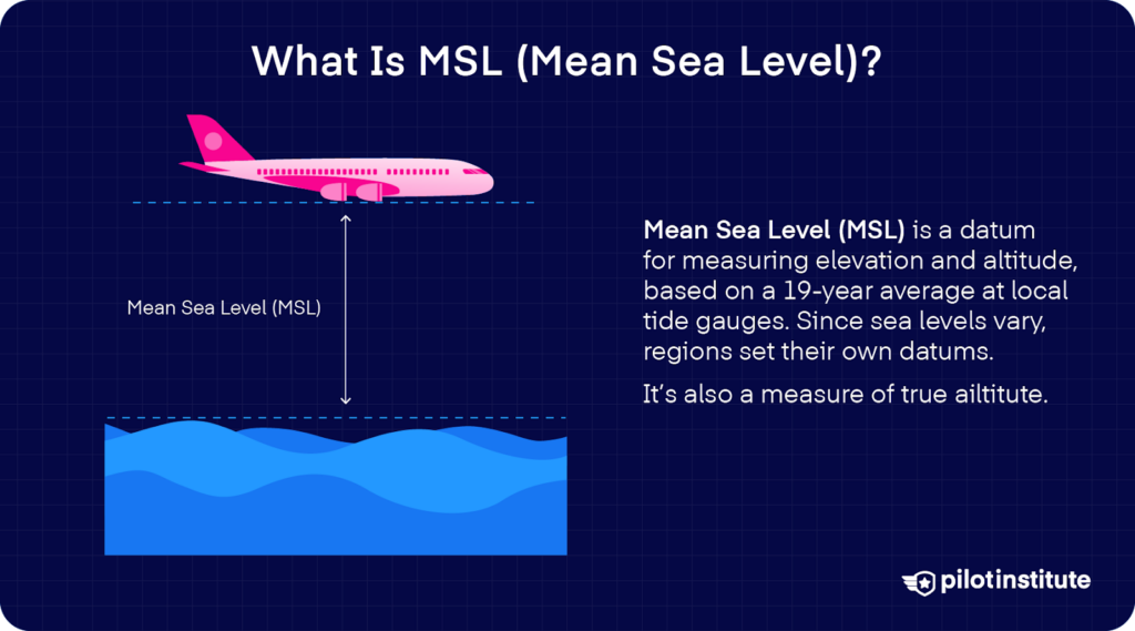
MSL, or Mean Sea Level, refers to your altitude above average sea level, that is, an average level for the surface of one or more of Earth’s bodies of water from which heights such as elevation may be measured.
Consider it as a standard baseline across the globe, irrespective of the actual terrain beneath.
What Is AGL (Above Ground Level)?
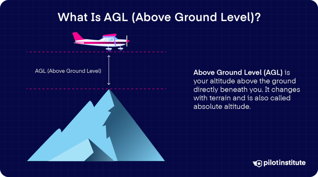
On the other hand, AGL, or Above Ground Level, is your altitude above the actual ground directly beneath your aircraft.
As the ground rises and falls beneath you, your AGL altitude changes accordingly.
AGL is also known as “absolute altitude.”
When to Use MSL
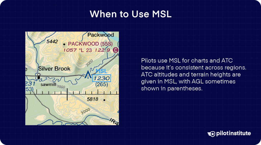
MSL is your go-to reference when reading aeronautical charts (maps) or communicating with Air Traffic Control (ATC).
Why not AGL?
Because MSL establishes a consistent reference point across different regions.
For instance, when ATC gives you an altitude to maintain, they’re referring to MSL.
If you used AGL over a mountain range, for example, your would need to constantly climb or descend to maintain an assigned (AGL) altitude – not practical.
Similarly, sectional charts list the heights of terrain in Mean Sea Level (MSL) so that you can ensure the altitude you are maintaining (in MSL) is above the height of the terrain (also given in MSL).
You’ll also find the height Above Ground Level (AGL) in parentheses next to the MSL altitude for some points on a sectional chart.
When to Use AGL
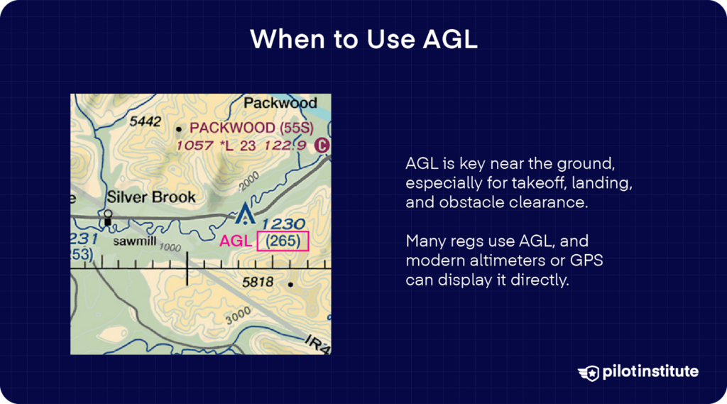
As for Above Ground Level (AGL), it becomes your key reference point when you’re flying closer to the ground.
When you’re low-level (say, during takeoff or landing), you want to ensure you’re clear of any potential obstacles. That’s where AGL altitude becomes useful.
Many regulations, like the minimum safe altitudes, are expressed in AGL.
In modern aircraft, some altimeters even give you a readout of your AGL altitude, using radar or GPS technology to work out the height of the terrain below.
Are METARs and TAFs AGL or MSL?
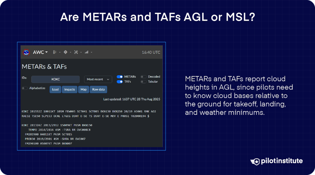
METARs and TAFs report the height of clouds in AGL, not MSL.
The preference for AGL in METARs and TAFs primarily stems from the fact that pilots need a clear understanding of their altitude in relation to the ground during crucial phases of flight, such as takeoff and landing. Here, an AGL measurement of cloud heights is far more valuable than MSL.
In simpler terms, AGL tells pilots about the distance from the cloud base to the ground level, enabling them to comply with weather minimums.
Is MSL an Altitude or a Reference Point?
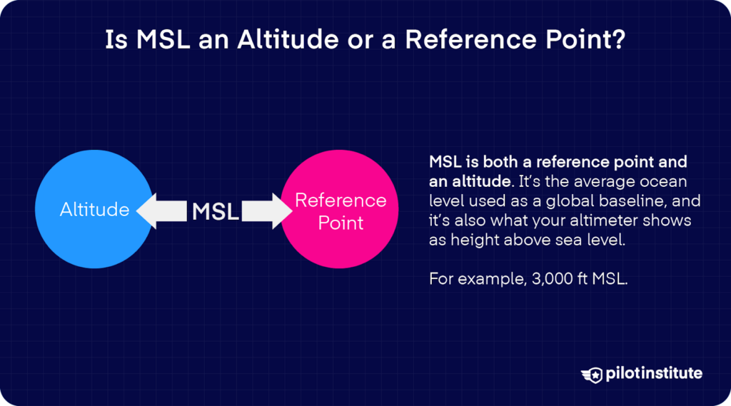
Well, it’s actually both.
This is a bit of a trick question, as Mean Sea Level (MSL) can be both an altitude and a reference point, depending on how we’re using the term.
In one sense, MSL is a reference point. It’s the average level of the world’s oceans, a datum we use as our zero point for measuring altitudes. When we talk about MSL in this way, we’re using it as a common baseline that allows us to have consistent, standardized measurements across the entire globe.
However, MSL can also be an altitude.
When your altimeter displays your aircraft’s altitude, it’s showing you the height above Mean Sea Level. In this sense, MSL becomes the unit of measure for your altitude.
In other words, if you’re flying at 3,000ft above Mean Sea Level, you’re flying at what you would call “3,000ft MSL”.
Where to Find MSL or AGL on Your Instruments
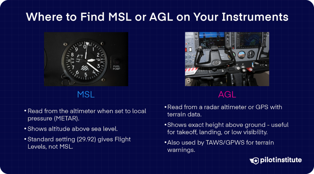
So, where do we find (and how do we read) MSL or AGL information in the cockpit?
MSL Instruments
Well, the primary source of MSL readings on your aircraft is the altimeter. When you set your altimeter based on METAR information, for example, you’ll read MSL from the altimeter.
If you use a different altimeter setting, your altimeter won’t display your altitude above Mean Sea Level.
For example, if you use the standard altimeter setting of 29.92, your altimeter no longer displays MSL, but rather an altitude based on a standard reference (29.92). These are known as “Flight Levels,” not “altitude.”
AGL Instruments
Readings for AGL, on the other hand, are typically found on a different instrument known as the radar altimeter, or radio altimeter.
Unlike the traditional altimeter, a radar altimeter calculates the altitude directly above the ground by bouncing radio waves off the ground and timing how long they take to return. This gives you your exact height above the terrain below, which can be extremely useful in situations like low-visibility landings.
Your aircraft’s Terrain Awareness and Warning System (TAWS) or Ground Proximity Warning System (GPWS) also uses AGL measurements. These systems provide alerts if the aircraft is in immediate danger of flying into the ground.
Not all aircraft have radar altimeters or TAWS/GPWS, however. Small, general aviation aircraft may only have a traditional altimeter, so you’ll need to use other means (like visually identifying landmarks and comparing them to a chart) to estimate your height above the ground.
There is one more system that provides AGL data and is relatively inexpensive – GPS.
In essence, a GPS provides altitude data relative to a mathematical model of the Earth (the WGS-84 ellipsoid).
But this model is flat, so to receive AGL information, a crucial additional layer of data is necessary – terrain elevation data. By combining this terrain data, modern GPS receivers or Electronic Flight Bag (EFB) applications can estimate the aircraft’s height above the ground (AGL).
So, while the GPS doesn’t directly read the aircraft’s height above the ground (AGL), it does provide reliably accurate AGL information.
Conclusion
At first glance, the difference between MSL and AGL might seem like a small detail, but in aviation, those details are everything.
MSL gives you a universal reference point. It’s what ATC uses, what charts are based on, and what keeps every pilot on the same page no matter where they fly.
AGL is what keeps you aware of the ground beneath your wings. It’s the number that matters most when you’re low, taking off, landing, or keeping clear of obstacles.
The best pilots know how to read and switch between both without hesitation. Your altimeter, radar altimeter, GPS, and even weather reports all give you pieces of the altitude puzzle.
At the end of the day, altitude is a language every pilot must speak fluently.