
-
Key Takeaways
-
What Is a Thermal Imaging Drone?
-
How Does Thermal Imaging Work on a Drone?
- Radiometric vs. Non-Radiometric Thermal Cameras
- What the Specs Mean
-
What Is Drone Thermography?
- Qualitative v. Quantitative Thermography
- What to Watch Out for as a New Thermal Drone Operator
-
What Are Thermal Drones Used For?
- Search and Rescue
- Firefighting and Wildfire Response
- Power Line and Tower Inspection
- Solar Farm Inspection
- Roof and Building Envelope Inspection
- Surveillance and Security
-
Which Thermal Drones and Cameras Are Available Now?
- Entry-Level Professional
- Mid-Level Professional
- Enterprise
- Highest Thermal Detail
- Payloads for Higher Detail and Custom Builds
- Choosing a Drone for Government Work
- Quick Comparison of Top Thermal Drones
-
How Do You Get Started in Drone Thermography?
-
Frequently Asked Questions
- Can a Thermal Drone See through Walls or Roofs?
- Is Thermal Imaging the Same as Night Vision?
- How Much Does a Thermal Drone Cost?
- What Thermal Resolution Do You Need for Professional Inspection Work?
- Do You Need a License to Fly a Thermal Drone?
- What Part 107 Rules Apply to Thermal Drone Flights?
- Can You Fly a Thermal Drone at Night?
-
Conclusion
A solar farm with 4,000 panels shows three of them are dead. From the ground, every panel looks identical. With drone thermal imaging, you’re not looking for a needle in a haystack. The dead ones glow thanks to thermal abnormalities.
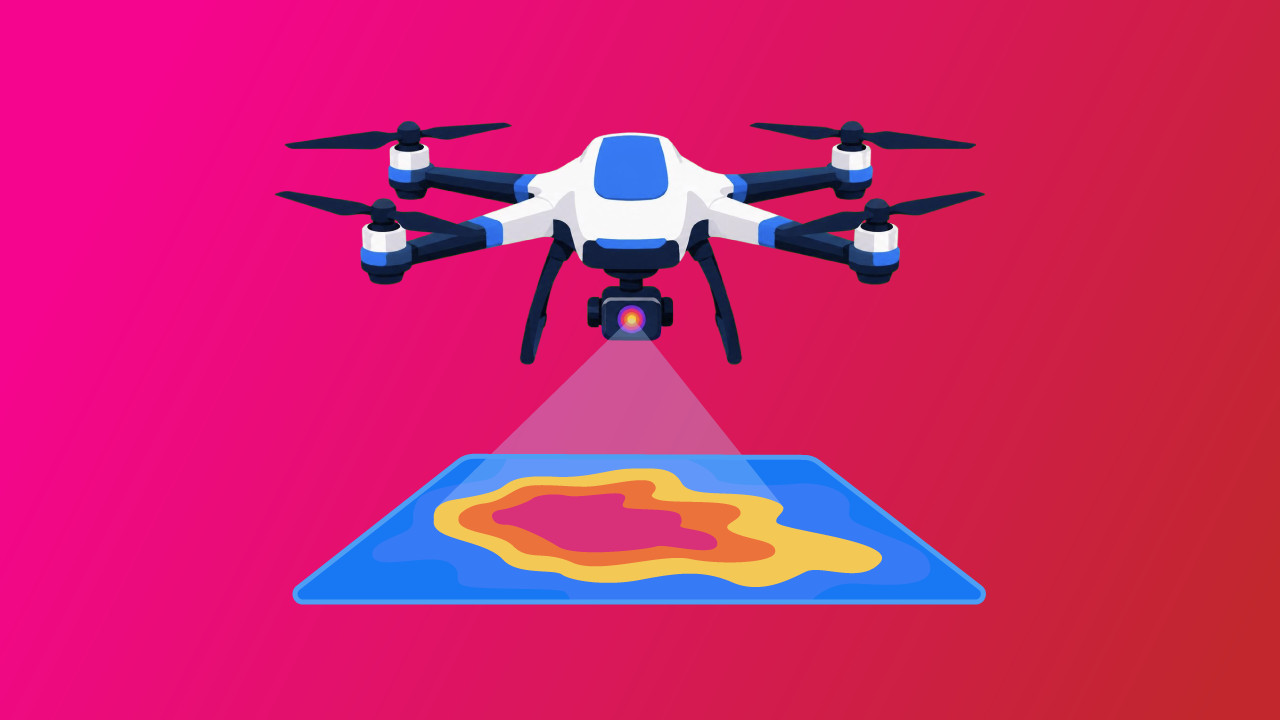
Drone thermal imaging uses infrared cameras to detect heat differences we cannot see with our eyes alone. Temperature patterns turn into a visual map of potential problems.
In this guide, we’ll cover how thermal drones work, key specifications to look for, and how to get started with professional thermal work.
Key Takeaways
- Drone thermal imaging measures infrared radiation to detect issues like electrical faults or find subjects via their heat signatures.
- Most professional thermal drones today use 640 x 512 thermal resolution and radiometric camera sensors.
- Evaluating your data is harder (and more important) than capturing it.
- Aerial thermal imaging plays a major role in search and rescue operations, firefighting, professional inspections, and surveillance and security.
What Is a Thermal Imaging Drone?
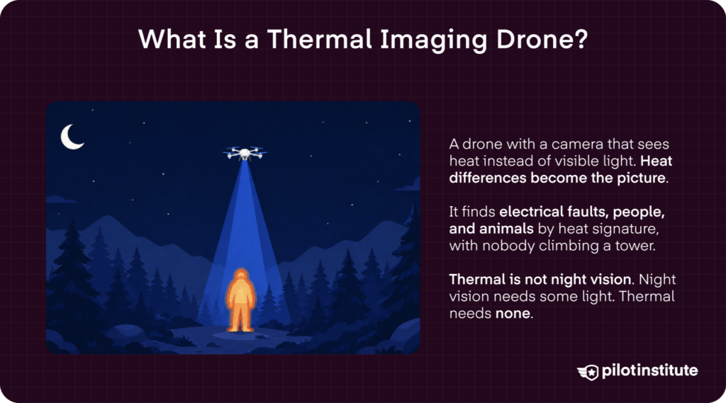
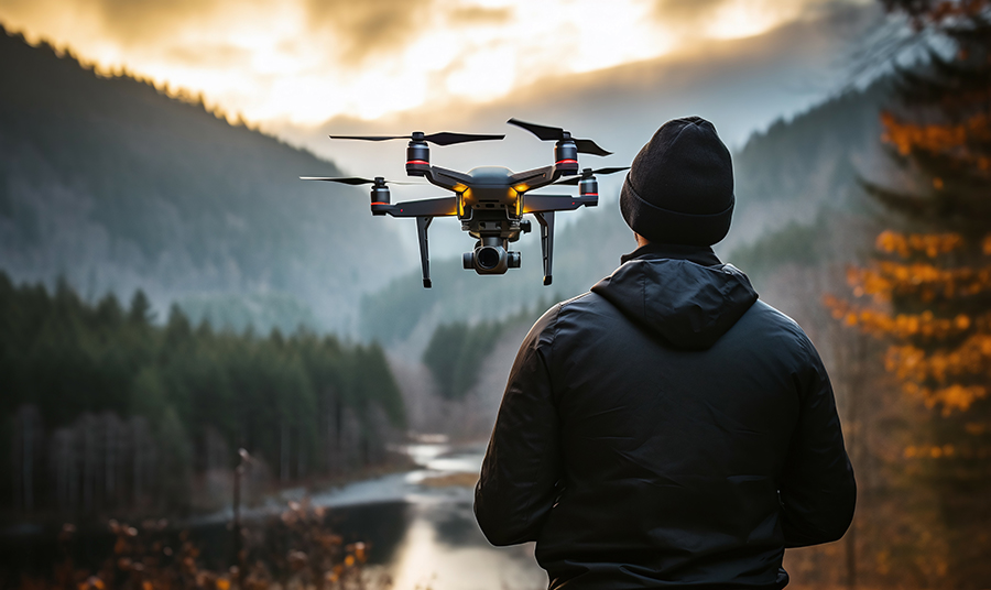
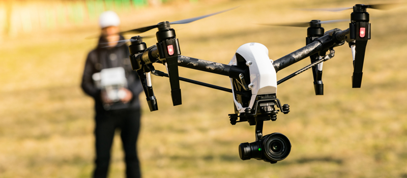
A thermal imaging drone is an aircraft equipped with a camera that detects infrared radiation instead of visible light. It converts heat differences into a visible image.
Thermal drones help identify problems like electrical faults and locate people or animals by their heat signatures, all without physically accessing difficult or dangerous areas.
Thermal imaging is not the same as night vision. It doesn’t need light at all. Night vision amplifies the small amount of visible light that is present.
How Does Thermal Imaging Work on a Drone?
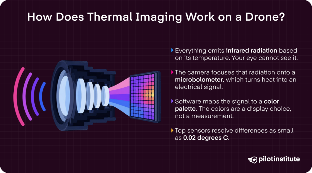
Thermal imaging reveals infrared radiation that may otherwise be invisible to the naked eye. Infrared radiation is a type of electromagnetic wave that lies just beyond the red end of the visible light on the electromagnetic spectrum. It is emitted by objects based on their temperature.
A thermal camera focuses infrared radiation onto a sensor called a microbolometer, which converts heat into an electrical signal that software maps to a color palette. Depending on the camera’s color palette, hotter areas may glow vibrant orange, red, and yellow, while cooler spots may appear in blue or purple tones.
High-end thermal imager cameras have incredibly sensitive sensors, some capable of detecting temperature differences as small as 0.02 degrees C.
Radiometric vs. Non-Radiometric Thermal Cameras
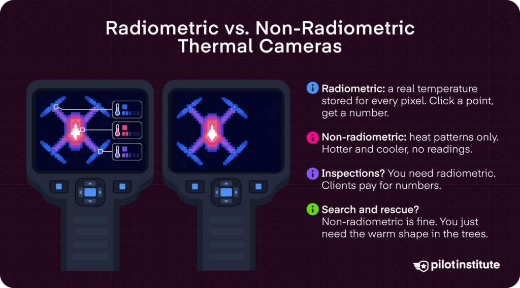
A radiometric camera stores a measurable temperature for every pixel. This allows operators to analyze specific points in the image, obtaining more precise temperature readings.
Meanwhile, non-radiometric cameras only show which areas are hotter than others. They can reveal heat patterns, but cannot provide more precise temperature readings.
Inspection and reporting drone operations typically need the more precise readings of a radiometric camera. Search and rescue often does not, as they are only concerned with locating a person or heat signature rather than determining an exact temperature.
What the Specs Mean
- Thermal Resolution: Higher resolution means more detail. A 640 x 512 sensor provides more detail than a 320 x 256 one, making it easier to distinguish smaller heat sources and identify objects at greater distances.
- Thermal Sensitivity (NETD): Noise Equivalent Temperature Difference, measured in millikelvin (mK), indicates how small a temperature the camera can detect. A lower NETD offers greater sensitivity, allowing the camera to distinguish more subtle variations in heat.
- Refresh Rate: Refresh rate, measured in hertz (Hz), determines how many frames the thermal camera captures per second. Think about Hz rates advertised in modern gaming monitors or fancy TVs. The higher the Hz, the smoother the image. This is especially helpful when capturing moving subjects and for drones flying through the air.
- Spot Size/IFOV: Spot size (IFOV) is the area a single pixel covers. It sets your distance-to-size ratio, meaning how far you can be from a target and still measure it accurately.
What Is Drone Thermography?
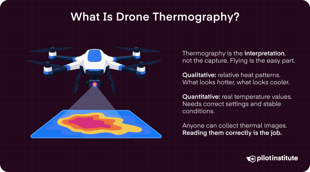
Drone thermography is the practice of interpreting thermal data, not the actual act of capturing it. Flying a drone is the easy part here. After capturing data from a scene, drone thermography then analyzes temperature differences across surfaces.
Qualitative v. Quantitative Thermography
Qualitative thermography shows relative heat patterns. It highlights what appears hotter or colder. Meanwhile, quantitative thermography provides more specific temperature measurements. Quantitative readings require specific camera settings and reliable field conditions.
What to Watch Out for as a New Thermal Drone Operator
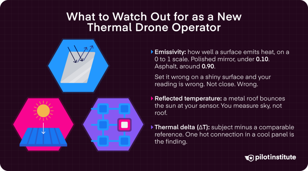
First, emissivity measures how efficiently an object’s surface emits heat as infrared radiation. Values range from 0 to 1, though real surfaces fall between about 0.1 and 0.99. A polished mirror sits below 0.10, while an asphalt parking lot is around 0.90.
Using the wrong emissivity setting on a surface can result in inaccurate temperature readings, especially on low-emissivity materials.
Surfaces can also reflect temperature from their surroundings. For example, a shiny metal roof can reflect heat from the sun.
This can cause a thermal camera to register radiation that does not accurately represent the roof’s temperature. So, it is important to account for any reflected temperature, especially when dealing with shiny or reflective surfaces.
Finally, thermal delta (ΔT) represents the temperature difference between a subject area and a comparable reference area.
Take the example of an electrical panel where one connection is significantly hotter than the others. That thermal difference could indicate a potential electrical fault. But the size of the difference must be accurately interpreted in light of the environmental and inspection conditions.

Label Your Drone the Right Way
Register with the FAA directly and get free stickers from us.
- FAA-ready marking.
- Looks professional.
- No card required.
- Quick request form.
What Are Thermal Drones Used For?
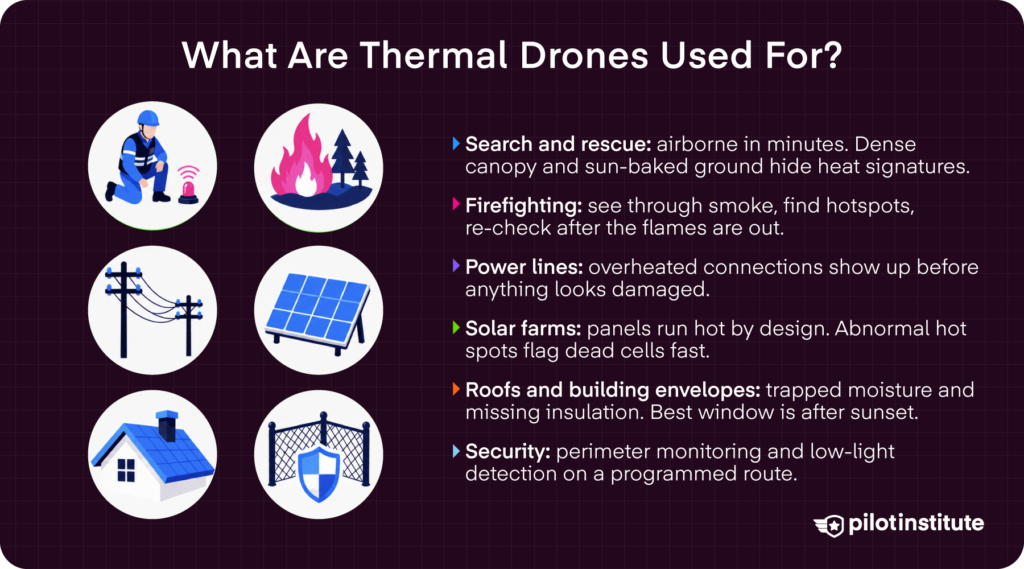
There are many thermal drone uses. The six main application areas include: Search and Rescue, Firefighting and Wildfire Response, Powerline and Tower Inspection, Solar Farm Inspection, Roof and Building Envelope Inspection, and Surveillance and Security.
Search and Rescue
Thermal drones offer a cost-effective solution compared to using helicopters in search and rescue operations. Drones can be deployed in mere minutes.
However, some scenarios limit a drone’s effectiveness here. Dense canopies and ground that has been sun-heated all day can make it difficult to distinguish a person’s heat signature from the surrounding environment.
Firefighting and Wildfire Response
Drones equipped with thermal imaging can provide situational awareness through dense smoke, identify hotspots, and help firefighters assess fire behavior without putting personnel in unnecessary danger.
After the flames have been extinguished, thermal drones can provide additional aerial surveys to find any lingering hotspots and ensure the area is safe.
Power Line and Tower Inspection
Thermal cameras can detect overheated connections, electrical faults, and abnormal heat patterns that may indicate damage so inspectors can address potential problems before the damage becomes visible or leads to equipment failure.
However, drones flying near powerlines can encounter electromagnetic interference, which can disrupt a drone’s compass, GPS, or other electronic systems. Make sure to plan flights with this in mind and have a contingency plan for if you experience such interference.
Solar Farm Inspection
Solar farms are a logistical challenge because they spread sensitive equipment across a very large footprint.
Panels also run hot, since they absorb far more solar energy than they convert to electricity, and the rest becomes heat. Abnormal heat signatures can indicate damage on a panel.
Thermal drones are in high demand to quickly scan large arrays for hotspots, defective cells, and other abnormalities without requiring inspectors to physically examine each panel.
Roof and Building Envelope Inspection
Thermal drones also help inspectors identify trapped moisture in flat roofs and missing or inadequate insulation in walls by analyzing temperature differences that are difficult to see with a standard camera.
Because of the large number of commercial and residential properties that require inspections, roof and building envelope inspection is a steady source of inspection work.
Timing is critical, however. Thermal surveys are most effective during the temperature swing after sunset, when materials release stored heat more slowly than dry materials.
Surveillance and Security
Police departments and security agencies rely on thermal drone imaging for surveillance, perimeter monitoring, and locating people or vehicles in low-light conditions.
These drones greatly enhance existing security systems and can be programmed to deploy at fixed schedules. They often automatically fly along a predetermined path with minimal pilot intervention.
Which Thermal Drones and Cameras Are Available Now?
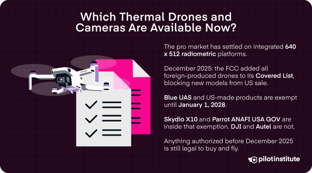
The professional market has consolidated around a handful of integrated platforms with 640 x 512 radiometric sensors. Today, standalone thermal payloads are mostly available for heavy-lift and custom builds.
One note before you shop. In December 2025, the FCC added all foreign-produced drones and drone components to its Covered List. That blocks new models from getting the equipment authorization they need to be sold in the US.
The FCC has since carved out exceptions. Drones and components on the DCMA Blue UAS Cleared List are exempt until January 1, 2028. So are products that qualify as “domestic end products” under the Buy American standard, meaning more than 65% of the product cost is US content. Anything granted a conditional approval by the Department of War or the Department of Homeland Security is also exempt, and as of July 2026 those approvals no longer expire.
That split matters when you shop. The Skydio X10 and the Parrot ANAFI USA GOV sit inside the Blue UAS exemption, so their makers can still bring new models to market. The DJI and Autel aircraft below do not, so their successor models may never reach US buyers. Weigh that if you expect to keep the platform for years.
Models authorized before December 2025 weren’t revoked, so you can still buy and fly every platform below. The FCC has set up a process that could restrict the continued sale of previously authorized equipment, though, so check the current status before you commit to a large purchase.
Entry-Level Professional
Entry-level platforms deliver radiometric imaging without enterprise cost or complexity.
The Autel EVO Lite 640T Enterprise pairs a 640 x 512 radiometric thermal camera with a compact airframe and 40 minutes of flight time, for less than $3,500.
Additionally, the DJI Mavic 3T has the same sensor in a smaller frame, but DJI discontinued the Mavic 3 Enterprise Series in favor of the Matrice 4 Series. Only dealer inventory is left, so buy the Matrice 4T if you need long-term support.
Mid-Level Professional
Mid-level platforms add ruggedness and performance while staying affordable.
The Autel EVO II Dual 640T Enterprise V3 pairs a 640 x 512 radiometric thermal camera with a 1/1.28 inch CMOS visual camera at around $4,500, the cheapest way into this tier.
Enterprise
Enterprise platforms trade portability and price for endurance, payload flexibility, and durability.
The DJI Matrice 4T has a 640 x 512 thermal camera that outputs up to 1280 x 1024 in super-resolution mode, a laser rangefinder good to 5,905 feet, a built-in RTK module, and 49 minutes of flight time.
The Matrice 4TD carries the same thermal camera but is built for the DJI Dock 3. It adds an IR-cut filter for black-and-white night vision and an optional Obstacle Sensing Module that detects 12 mm wires at up to 15 m/s. To fly it manually rather than from the dock, pair it with the DJI RC Plus 2 Enterprise controller.
The Autel EVO Max 4T V2 adds a zoom visual camera and a laser rangefinder to the same 640 x 512 radiometric thermal sensor.
Finally, the Skydio X10 pairs strong autonomy with two thermal sensor packages. The VT300-Z combines a 640 x 512 radiometric camera with narrow and telephoto visual cameras. The VT300-L swaps the telephoto for a 1” wide camera.
Highest Thermal Detail
These platforms allow professionals to identify smaller temperature variations and inspect targets in greater detail from further away.
These thermal cameras are additional sensor payloads that combine with top drone models to deliver more impressive thermal resolution and inspection capabilities than an integrated camera can provide.
For example, the DJI Zenmuse H30T on the Matrice 350 RTK is a powerhouse that combines a high-resolution thermal camera with wide-angle, zoom, and laser rangefinder capabilities for detailed inspections and demanding public safety applications.
Payloads for Higher Detail and Custom Builds
A few thermal cameras ship as separate payloads instead of integrated cameras. You mount them to a host aircraft, which costs more but buys you resolution and range that a built-in camera can’t match.
The DJI Zenmuse H30T is the one payload here that goes past 640 x 512. Its thermal camera runs at 1280 x 1024 and pairs with wide-angle, zoom, and laser rangefinder modules for detailed inspections and demanding public safety work. It mounts to the Matrice 400, the Matrice 350 RTK, and the Matrice 300 RTK. This tier costs more than most complete aircraft, so weigh it against the most expensive drones on the market before you commit budget.
The Teledyne FLIR Hadron 640R series sits at 640 x 512, same as the integrated cameras above. It’s built for integrators assembling custom platforms, not for buyers shopping finished aircraft.
Choosing a Drone for Government Work
Public agencies and federally funded programs face restrictions that private operators do not.
If you plan on bidding on government work, check whether the aircraft you plan to use appears on the Blue UAS Cleared List before you commit to the job. Blue UAS listing currently carries the FCC Covered List exemption as well, but that carve-out is set to expire on January 1, 2028, so confirm it is still in force at the time you buy.
The Skydio X10 makes the cut for the Blue UAS Cleared List. Another option built in the United States is the Parrot ANAFI USA GOV. Parrot is a French company, but the ANAFI USA is manufactured in Massachusetts, and it is Blue UAS cleared. Its thermal camera is 320 x 256, so it trades resolution for compliance.
Quick Comparison of Top Thermal Drones
| Model | Thermal Resolution | Radiometric | Approximate Price | Best-Fit Use |
| Autel EVO Lite 640T Enterprise | 640 x 512 | Yes | $3,359 | Budget entry point for rooftop, solar, and SAR work. |
| DJI Mavic 3T (discontinued) | 640 x 512 | Yes | $6,199 | Discontinued. Replaced by the Matrice 4T. |
| Autel EVO II Dual 640T Enterprise V3 | 640 x 512 | Yes | $4,499 (Enterprise Bundle) | Mid-tier inspection with a strong visual camera. |
| DJI Matrice 4T | 640 x 512 | Yes | $7,399 (Aircraft only) | All-round enterprise thermal. 1,800 m rangefinder. |
| DJI Matrice 4TD | 640 x 512 | Yes | $9,800 | Dock 3 deployment and 24/7 utility inspection. |
| Autel EVO Max 4T V2 | 640 x 512 | Yes | $5,999 | Rugged public safety work in GPS-denied areas. |
| Skydio X10 | 640 x 512 | Yes | $15,000 – $25,000 (Depending on package) | US-built. Blue UAS cleared. Drone as first responder. |
| DJI Zenmuse H30T | 1280 x 1024 | Yes | $11,999 (Sensor only) | Highest thermal detail. Payload only, needs a host aircraft. |
| DJI Matrice 350 RTK (host aircraft) | None integrated (payload platform) | Depends on payload | Aircraft only, confirm with dealer | Host aircraft for the Zenmuse H30T and other payloads. |
| Teledyne FLIR Hadron 640R | 640 x 512 | Yes | $3,992 – $4,330 | Custom builds and integrator payloads. |
| Parrot ANAFI USA GOV | 320 x 256 | No | Approx. $7,000 – $10,000 (confirm with dealer) | Federal and federally funded work. Blue UAS cleared. |
How Do You Get Started in Drone Thermography?
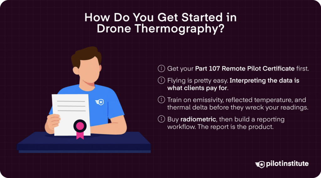
The first step is getting your Part 107 Remote Pilot Certificate to legally operate your drone commercially. We here at Pilot Institute offer in-depth Part 107 courses and test prep resources to make sure you pass with flying colors.
Thermal imaging is pretty easy to use, but interpreting that data is quite a different task. The training is what makes your reports worth paying for.
So, invest in some thermography training to understand how factors like emissivity, reflected temperature, and thermal delta can affect your drone’s readings. You can improve your skills through training and experience.
For inspection operations, the Infraspection Institute publishes a great resource you can reference: the Standard for Infrared Inspection of Building Envelopes. This standard guides how to conduct infrared inspections consistently.
Additionally, the ASNT SNT-TC-1A framework provides a common model for qualifying and certifying personnel performing nondestructive testing, including infrared thermography. There are progressively higher levels of certification and training that correspond to increasing responsibilities, from performing inspections to interpreting results, and even developing inspection techniques.
Next, invest in a radiometric platform, then establish a reporting workflow that allows you to document thermal findings, compare images, record temperature measurements, and deliver clear, professional reports to clients.
Frequently Asked Questions
Can a Thermal Drone See through Walls or Roofs?
No. Thermal cameras read surface temperature only. What operators actually detect is heat that is conducted through the surface.
Is Thermal Imaging the Same as Night Vision?
No. Thermal imaging detects infrared radiation emitted by objects based on their temperature. Night vision amplifies existing visible and near-infrared light to produce brighter images.
How Much Does a Thermal Drone Cost?
Entry-level integrated platforms start around $3,400. Mid-tier aircraft run roughly $4,500 to $6,000, and enterprise platforms start near $7,400. Payload-plus-aircraft builds go well above that, and standalone thermal payloads are priced separately from the drone that carries them.
What Thermal Resolution Do You Need for Professional Inspection Work?
For most professional thermal inspection work, 640 x 512 resolution is the sweet spot. With this resolution, you can more easily identify small thermal abnormalities, particularly when inspecting electrical components. 1280 x 1024 is best suited for specialized, high-detail inspections.
Do You Need a License to Fly a Thermal Drone?
While flying a thermal drone does not require a separate FAA license, you will need a Part 107 Remote Pilot Certificate to fly commercial operations. You will need to register your drone and follow all Part 107 regulations.
What Part 107 Rules Apply to Thermal Drone Flights?
Working with a thermal camera does not change anything about Part 107. All Part 107 rules that apply to drones with visual cameras still apply here.
Can You Fly a Thermal Drone at Night?
Yes. Under 14 CFR §107.29, you can fly your thermal drone at night, as long as it has anti-collision lighting that is visible for at least 3 statute miles.
For thermal inspection work, night flights are often useful because the temperature contrast between the materials can become more pronounced after the sun sets.
Conclusion
Those three dead solar panels could have cost thousands in lost energy production or caused a small fault to cause further damage.
Thermal drones turn invisible problems into visible ones. They help operators identify abnormalities and quickly take action before a small problem becomes a costly failure.
Just remember, the camera finds the anomaly, but it is the operator who explains what it means. That’s what you truly get paid for!