
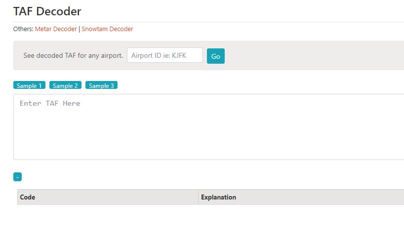
-
What is a TAF in Aviation?
-
How Do You Decode a TAF Report?
-
TAF - A Full Decode Guide
- Type of Report (TAF)
- ICAO Station identifier (KBOS)
- Issue Time and Date (201730Z)
- Validity Period (201818)
- Wind Speed (10005KT)
- Visibility (3SM)
- Significant Weather (HZ)
- Cloud Height (FEW030)
- Significant Change and Time Expected (FM2030 20020G40KT 2SM +SHRA OVC010)
- Temporary Changes to the Trend with Time of Expected Change (TEMPO 2122 +TSRA OVC15CB)
- The probability that Changes will Happen (FM0203 PROB40 5SM -RA)
- Expected Change (FM0306 NSW SKC)
-
TAF Abbreviations
-
TAF Practice Examples
-
How to Read a TAF - FAQ
- What Does 9999 Mean in a TAF?
- What Do TX and TN Mean in a TAF?
- What is the Difference Between a METAR and a TAF
- Are TAFs Always Accurate?
-
Final Thoughts
Before you go flying, you must check the weather. Looking at a weather forecast is an ideal place to start. An aviation TAF can appear to be complicated at first, but after we show you how to read a TAF, it will become much simpler. Today we’ll tell you all you need to know and even provide some examples so you can get to grips with the aviation weather forecast. Let’s jump right in!
What is a TAF in Aviation?
TAF stands for ‘Terminal Area Forecast’. It is given in a standard code format worldwide and allows pilots to see, at a glance, what the weather will be doing in the future. It contains details of the weather at any chosen airport. Generally, a TAF will consist of the following information: –
- An airport identifier code
- Date and time of issue
- Date and time of the validity of the forecast
- The overall trend of the anticipated weather
- A Probability of weather phenomena
- Predicated wind strength and speed
- Predicted visibility
- Predicted cloud base
- Anticipated precipitation
- Any other important information
If you think about the weather on any given day, you can be sure that no two days are exactly the same. Many things can change, so TAFs can be long on days when the weather is unsettled.
So, as a result…
We need to examine several areas in more detail as we explain how to read a TAF.
Here’s what you need to know.
How Do You Decode a TAF Report?
A Terminal Area Forecast (TAF) is how pilots know what the weather will be doing several hours in advance. The various parts of the TAF are always laid out in a standardized format. Once you know what to look for, it will become second nature.
We will provide an example of a TAF, explain it in plain terms, and then break down each section so you’ll know how to read a TAF for any airport.
Let’s take a look.
We will use the Phoenix Sky Harbor International Airport TAF as an Example.
Here it is:-
TAF: KPHX 190747Z 1908/2012 10004KT P6SM SKC FM192000 VRB03KT P6SM SKC FM192300 26005KT P6SM SKC FM200600 10004KT P6SM SCT250
Looks like a string of meaningless numbers and letters, right?
Actually, there is a lot of useful information there. Want to know what this TAF says in plain terms?
The above would actually read something like the following: –
“The terminal area forecast for Phoenix Sky Harbor Airport was made on the 19th of the month at 0747 ZULU. It is valid from 8 am on the 19th until 12pm on the 20th of the month. The prevailing wind will be 100 degrees at 4 knots, with a visibility of 6 statute miles with clear skies. From 8 pm on the 19th, the wind will be variable at 3 knots and change at 2300 to 260 degrees at five knots. From 6 am on the 20th, the wind will change to 100 degrees at 6 knots, and scatted clouds will form at 25,000 feet.”
All that information from that single string of letters and numbers?
You bet! Cool right?
Obviously, the weather changes from day to day, and it would be impossible to write a description of every forecast. But you want to know how to read a TAF, right?
Relax.
The format of all TAFs is standardized. Once you know what each section means, you can read any aviation weather forecast worldwide!
Here’s a breakdown of each section of the TAF. This is the same regardless of the airport…
TAF – A Full Decode Guide
Let’s look at an example of a TAF. We can then break it down, section by section.
TAF KBOS 201730Z 201818 10005KT 3SM HZ FEW030 FM2030 20020G40KT 2SM +SHRA OVC010 TEMPO 2122 +TSRA OVC15CB
FM0203 PROB40 5SM -RA
FM0306 NSW SKC
Type of Report (TAF)
Terminal area forecasts always start with the ‘TAF’ identifier. This is to avoid confusion with the similarly formatted METAR (which is an actual report. You can read more about METARs and how to decode them, here.)
ICAO Station identifier (KBOS)
The next part of the METAR is specific to each individual airport. The four-letter code specifies which airport the forecast refers to.
Top tip!
Make sure you check this. If you have a page full of TAF’s it is easy to get confused.
Issue Time and Date (201730Z)
Each aviation forecast is specific to a particular day and time. The first two figures refer to the date. The remaining figures are the times in UTC.
TAFs are issued four times per day. At midnight, 0600, 1200, and 1800 UTC. They are usually valid for 24 hours. However, they may also be updated as conditions vary and new data becomes apparent.
Certain airports also produce 30-hour TAFs.
Validity Period (201818)
TAFs can have different validity periods. The first two numbers tell you the date on which the forecast starts. The second pair of figures tell you the time the forecast starts. The final two digits will let you know when the forecast finishes.
Wind Speed (10005KT)
The next item on a TAF will be the wind direction and speed. It is important to note that the wind direction, given on a TAF, is measured in degrees true, not magnetic.
If you are unsure of the difference between the two, we suggest checking out this article.
Visibility (3SM)
Visibility on a TAF is normally given in statute miles (you guessed it, that’s what “SM” stands for”).
What do we look for if the visibility is really bad?
In this case, the visibility will be noted as a 4-figure number, given in meters.
Significant Weather (HZ)
On clear days, this section may not be present. It indicates any weather outside the “sky clear” definition. Various types of precipitation and weather phenomena may be mentioned in the TAF. This could include: –
- Fog
- Haze
- Mist
- Low cloud
- Thunderstorms
- Dust
- Rain or Drizzle
- Snow
- And many others…
There may also be a plus (+) or minus (-) sign before the significant weather. This indicates intensity, plus being ‘heavy’ and minus being ‘light’.
You’ll find a full list of weather phenomena and how it is indicated in our handy table below.
Cloud Height (FEW030)
Cloud height is given using a descriptor of how extensive the cloud is and its height.
How extensive? Wait, what?
It is actually really easy to understand cloud cover. Meteorologists will divide the sky above the airport into eighths, called “oktas”. They then observe how much cloud they expect in all combined’ eighths’.
The following applies: –
- 0 oktas: Sky Clear
- 1 – 2 oktas: Few clouds
- 3 – 4 oktas: Scattered clouds
- 5 – 7 oktas: Broken clouds
- 8 oktas: Overcast
The three digits at the end express clouds in terms of hundreds of feet. To convert to meaningful data, simply add two zeroes to the end of this figure. In our above example, the decode would be 1 – 2 oktas of the sky covered at 3000 feet.
Significant Change and Time Expected (FM2030 20020G40KT 2SM +SHRA OVC010)
When the weather is expected to deviate from the ‘trend’ of the forecast, it is annotated accordingly.
Essentially…
It is a forecast within a forecast.
The data that will be presented is given in exactly the same way as we have just described above. The main thing to note is the very start of the line.
“FM2030”
“FM” stands for “from, ” which will be followed by a time in UTC.
This is the time that the predicted weather is forecast to change. Reading FM data from a TAF is easy. It always starts on a new line and will also run chronologically, with phenomena occurring the soonest, first. Things that will happen later appear later on the TAF.
Temporary Changes to the Trend with Time of Expected Change (TEMPO 2122 +TSRA OVC15CB)
Occasionally, you’ll find a TAF with the word “TEMPO”.
Care to take a guess at what this means?
If you said temporary changes, you’d be correct.
Tempo data is weather occurrences that may be brief in duration and are expected to last generally less than one hour. The first two digits following TEMPO are when the expected weather begins, and the last two digits tell you what time it stops.
In the above example, for a period of one hour starting at 2100 and finishing at 2200, there will be heavy thunderstorms and rain.
The probability that Changes will Happen (FM0203 PROB40 5SM -RA)
Have you ever known the weatherman to be entirely correct?
Probably not.
Sometimes the forecast is correct, and sometimes it is a little off the mark.
TAF weather forecasters sometimes suggest that some weather might occur, but it is not guaranteed. To do this, they use the term “PROB”. This is short for “probability”. The two numbers following “PROB” are the percentage chance that weather phenomena might occur.
You’ll usually see either “PROB30” or “PROB40”.
- PROB30 means that there is a 30% likelihood of the forecast being correct
- PROB40 means there is a 40% likelihood of the forecast being correct.
Wait, why is there no PROB50 in a TAF?
Well, a couple of reasons.
First, saying something has a 50% chance of happening doesn’t give you any information. It might happen, or it might not. That’s no use to us as pilots.
Second, a 50% chance of something happening is not really that unlikely. Even an increase of 1% means that it is more likely to happen than not. So, weather forecasters assume that it is likely to happen, so PROB50 becomes the actual forecast.
In our above example, the TAF says that from 2 am, there is a fairly good chance that the visibility will change to 5 statute miles in light rain.
Expected Change (FM0306 NSW SKC)
More change?
You bet!
A new line in our TAF indicates that from 0300am to 0600am, the weather will clear up, with no significant weather and clear skies.
Nice!
TAF Abbreviations
There are numerous ways in which weather is indicated in a TAF. They can be long, and to save time and ease of reading, they are normally abbreviated into a few letters.
Each letter pairing is designed to be unambiguous and unique.
Here are most of the phenomena and abbreviations you will find on a TAF in a handy guide: –
| Intensity | Description | Precipitation | Obscuring Phenomena |
| MI Shallow | DZ Drizzle | BR Mist | |
| BC Patches | RA Rain | FG Fog | |
| (-) Light | DR Drifting | SN Snow | FU Smoke |
| (no prefix) Moderate | BL Blowing | SG Snow Grains | VA Volcanic Ash |
| (+) heavy | SH Showers | IC Ice Crystals | DU Dust |
| TS Thunderstorms | PL Ice Pellets | SA Sand | |
| FZ Freezing | GR Hailstone | HZ Haze | |
| PR Partial | GS Small Hail | PY Spray | |
| VC in the vicinity | UP Unknown Precipitation | SKC Sky Clear | |
| NSW No significant Weather |
TAF Practice Examples
OK, so now you know how to read a TAF, why not work through a few examples?
Below you’ll find 3 different Terminal Area Forecasts for US airports. See if you can get a general idea about what is going on at each: –
- TAF PNHL 210530Z 210606 24025KT 2SM DU +VA TEMPO0809 FEW020 +RADZ FM1200 NSW SKC
- TAF KSWF 211158Z 211212 18029G35KT 6SM FEW050 -DZ PROB40 1416 2SM +RAGR
- TAF KBWI 221532Z 221818 11029KT 8SM SKC PROB30 TEMPO 1820 OVC030
How to Read a TAF – FAQ
Reading a TAF isn’t difficult. However, we all have questions sometimes. Here are the things we most commonly get asked.
What Does 9999 Mean in a TAF?
In regions where meters are used for visibility, 9999, or “all the nines,” generally means visibility is greater than 9000 meters. This is an equivalent value of 7 statute miles or greater in the US. In both cases, visibility is excellent and above what is required for a VFR flight.
Visibility being 9999 is part of the ideal combination described as “CAVOK,” which is short for “ceiling and visibility OK”. This means a forward sight distance greater than 10km and no cloud below 5000 feet.
What Do TX and TN Mean in a TAF?
TX and TN indicate the maximum and minimum temperature (in degrees Celsius) during a given period. TX will be followed by a number. This is the maximum temperature expected, with the date and anticipated hour following.
TN is the minimum temperature. It is given in precisely the same format as TX. With a temperature followed by a date and time.
Here are a quick couple of examples: –
TX321812Z – This means that the maximum temperature will be 32 degrees on the 18th day of the month at 1200UTC
TN080106Z – This means that the minimum temperature will be 8 degrees Celsius on the 01st day of the month at 0600UTC
What is the Difference Between a METAR and a TAF
While METARS and TAFS look similar in format, they are very different. A TAF is a prediction about what is going to happen over a given period in the future. A METAR is an actual report of present conditions at a given airfield.
METARS are generally far more accurate than TAFS as they use real-time data and observations. They are also updated much more frequently than TAFS.
Are TAFs Always Accurate?
As with any weather forecast, TAFs are not always 100% accurate. So, you must exercise caution. It is vital that when you are decoding a TAF, you pay careful attention to the prevailing trend and general outlook. Gambling on marginal conditions or hoping that a PROB40 won’t come true can lead to trouble.
Try to gain a good overview of the overall weather synopsis for the day and use the TAF to plan your route effectively.
Final Thoughts
Learning how to read a TAF is a skill that you will often use in aviation. So, it pays to spend a little time getting familiar with the terms and format used. Hopefully, our guide has given you a solid foundation to build on your knowledge. While you are here, why not check out some other great flying lessons, all of which can be completed online!