-
What is drone mapping?
-
How drone mapping works – Photogrammetry and LiDAR
- Photogrammetry
- LiDAR
-
GCPs, RTK, and PPK
- GCP
- RTK
- PPK
-
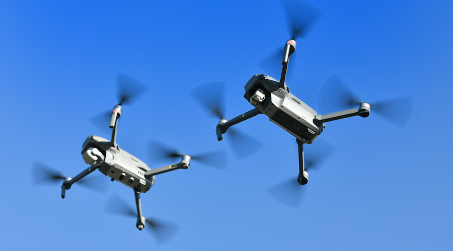
Fixed-wing vs. multi-copter
- Multi-copter
- Fixed-wing
-
Software needs
-
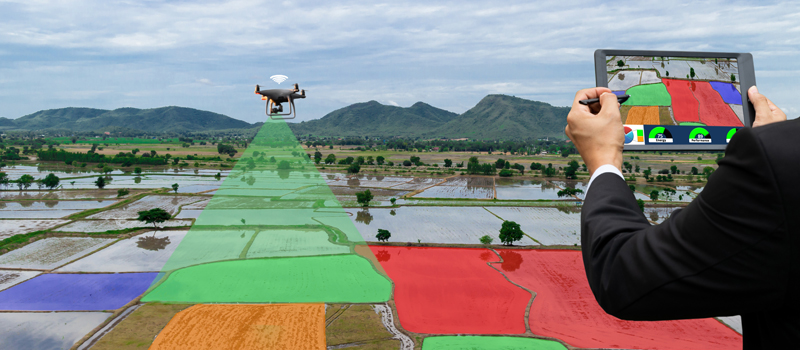
Applications of drone mapping
- Construction
- Research
- Land surveying
- Mining
-
Benefits of drone mapping
- Faster data collection
- Automated workflow
- Cheaper
- Safer
-
Training courses for drone mapping
-
Final thoughts
As an industry, mapping is still considered an up-and-coming field for drone pilots. The fact that it can be massively useful for lots of applications means that there are bound to be more opportunities for those who are well-versed in drone mapping. It also has a fairly steep barrier to entry, which means that the market isn’t likely to be saturated soon.
What exactly is drone mapping and what does one need to learn to get into this industry? Let’s look at the basics of drone mapping, how it works, and the hardware and software you’re going to need if you intend to build a career in this niche field.
What is drone mapping?
Drone mapping is simply an alternative method of aerial mapping. Before drones were more common, mapping of large areas was done using manned aircraft, typically helicopters. Drone mapping is a way to do this job cheaper, safer, and with simpler logistics.
Mapping is self-explanatory. The objective is to create a 2D or 3D map of the survey area using data collected by the drone. An essential component of mapping is that data needs to be “geospatial”. This means that each data point must correspond to a specific location in the real world based on actual coordinates. This makes mapping data useful for making real-world measurements and for planning activities such as slope stabilization, road construction, or expeditions into remote areas.
Speaking on more general terms, drone mapping is an example of remote sensing technology. Remote sensing refers to any data collection method that requires no physical contact between the person or measuring device and the object being measured. Satellite imagery and seafloor surveys are some of the more common applications of remote sensing.
How drone mapping works – Photogrammetry and LiDAR
For us to understand how drone mapping works, we will need to look into the two technologies used in this field, namely photogrammetry and LiDAR.
Photogrammetry
Photogrammetry as a concept is easier to understand. It involves taking multiple, overlapping photos of the same subject which can then be processed to create a 3D model. Think of it as the way that our brain perceives depth because we see the world through two eyes. You don’t even need to have a drone to practice photogrammetry – there are photogrammetry apps that you can practice using just your camera phone.
Drone mapping using photogrammetry is simply a scaled-up version of the same concept. Using a drone, multiple photos of a survey area are taken from changing vantage points. These photos could number in the hundreds or thousands. This is ideally done automatically by programming the drone using special mapping software.
The upside of photogrammetry is that it does not require any fancy devices outside of the usual camera drone. With the quality of camera drones that have been released in recent years, photogrammetry has become the go-to method for most drone pilots. In terms of capital involved, it is much easier to start a commercial business based on photogrammetry-based drone mapping.
The limitation of photogrammetry is that it relies heavily on visibility. It can only record data on features that are visible from the drone’s cruising altitude. It is entirely ineffective in darkness and may struggle in cloudy or foggy environments. Photogrammetry also isn’t recommended for capturing topography data in areas where there is thick vegetation.
LiDAR
The alternative to photogrammetry is LiDAR, or “Light Detection and Ranging”. This type of survey relies on a special LiDAR sensor that emits continuous and rapid pulses of non-visible light towards the survey area. This light is reflected off the surface of solid features and detected again by the LiDAR sensor. The dimensions and locations of features on the ground are then determined using the time-of-flight concept.
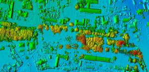
The biggest advantage of LiDAR is that it does not depend on visibility to make measurements. This makes it a little more versatile in surveying areas where visibility can be an issue, such as those with nearby large structures. LiDAR signals can also penetrate through the canopy, making it the ideal mapping technology for heavily forested areas.
The downside of LiDAR is that is not as easily accessible as photogrammetry. Surveying with LiDAR means buying a special LiDAR sensor and mounting it on a drone that can accommodate interchangeable payloads. This is much more expensive than buying a high-quality camera drone.
A few years ago, LiDAR was considered to be superior to photogrammetry when it came to accuracy. We have better cameras now, so the gap in accuracy between the two is no longer as relevant. The drone pilot can also influence the accuracy of a survey through the use of GCPs (Ground Control Points), or via using a drone with RTK or PPK capabilities.
GCPs, RTK, and PPK
If you’ve never studied mapping before, then that header might as well be a series of random letters. Each of these is a method for improving the geospatial accuracy of data collected during mapping. Technically called ground-level correction, these methods reference the current location of the drone with another location on the ground that is at a fixed location.
Ground-level correction is necessary for high-level mapping applications because the accuracy of GPS location is typically limited at 2 to 5 meters, even at maximum satellite coverage and using the most sophisticated GPS technology. By correcting using any of the three methods, the geospatial accuracy of the data can be increased up to a centimeter-level.
Still, the question remains – what are GCPs, RTK, and PPK, and how are they different?
GCP
GCPs stands for “Ground Control Points”. This is the most traditional method of ground-level collection. It needs no fancy technology but just good old-fashioned legwork.
GCPs are, quite literally, fixed points on the ground that are captured by the drone during aerial mapping. These GCPs are established by the surveyors on the ground and recorded via GPS location. Mapping professionals often refer to GCPs as the way to establish the “ground truth” of an aerial survey. A minimum of five GCPs is usually recommended but increasing up to ten can also be beneficial.
As mentioned, the advantage of establishing GCPs is that it incurs no additional cost to a survey in terms of more advanced technology. However, surveys will take more time on account of the surveyors having to physically access the target locations for the GCPs. This might not be feasible in survey areas that are heavily forested or have dangerous terrain.
RTK
RTK stands for “Real Time Kinematic”. It is found in drones as an additional module designed specifically for more accurate mapping. An onboard RTK module has to be paired with a base station on the ground. As the drone flies over the survey area, its GPS reading is continuously corrected based on its relative distance from the base station.
An RTK workflow applies geospatial corrections in real-time. This means that the RTK module and base station need to be constantly communicating for every data point that is collected during the survey. This usually works great in large open areas without any obstructions. However, urban areas with building and other sources of signal interference may be challenging for an RTK-based survey.
PPK
PPK stands for “Post-Processed Kinematic”. It’s very similar to RTK in that it also relies on an onboard PPK module and a base station at a fixed location on the ground. There is hardly any difference between the two in terms of technology.
Instead, the difference is that of workflow. Instead of doing real-time geospatial correction, the PPK module and base station collect data in a manner that is synchronized but independent. This means that the locational data collected by the PPK module will merely be corrected during post-processing.
A PPK-enabled mapping drone is a lot more versatile because it does not rely on the two modules maintaining good communication throughout the survey. This makes PPK surveys favorable in urban areas or any areas with a dense distribution of obstructions. For this reason, PPK has been the ground correction method of choice for most mapping professionals in the last few years.
Fixed-wing vs. multi-copter
A major consideration when getting into drone mapping is the type of drone that you’re going to use. Should you go for the usual multi-copter drone or get one with a fixed wing? Each option has merits and is appropriate for aerial mapping.
Multi-copter
Multicopter drones are likely the default choice for many considering how common they are. Even drones from the DJI Mavic line have cameras that are good enough for rudimentary mapping jobs. The portability, ease of use, and accessibility of multicopter drones are some of its major strengths. The maneuverability of multicopter drones can also come in handy when surveying small areas where the drone needs to make tight turns.
However, a multicopter drone is severely limited by its battery capacity. Most models, even the newer ones, can only stay airborne for a little more than 30 minutes. Aerial mapping is a particularly power-intensive activity because of the amount of data that the drone needs to collect.
Fixed-wing
Fixed-wing drones are perfect for covering large areas. Not only do they have much higher maximum ground speeds, but most fixed-wing drones can fly for over an hour on a single battery cycle. They perform exceptionally well for mapping corridors and other linear areas.
Most beginners might be intimidated by the premise of flying a fixed-wing drone. It’s certainly not as easy. Even the act of taking off and landing a fixed-wing drone requires a bit of planning, as you will need a short runway of sorts. They are also generally more expensive, particularly the models that can handle professional work.
A third option would be to use VTOL (Vertical Take-off and Landing) drones. These so-called “hybrid” drones have fixed wings but also have propellers that provide lift. This unique design gives them the longevity of fixed-wing drones along with the ability to take-off and land vertically. Although there’s huge potential in this technology, VTOL drones haven’t really gone past being a novel idea.
Software needs
The software you use for drone mapping is almost equally as important as your drone and other mapping equipment. Ideally, the software you choose should provide end-to-end solutions. This means that it can be used for planning the surveys, data management, data processing, and publishing of the processed data. It’s also a lot more convenient to do all these steps within a single software ecosystem.
There are several different options for drone mapping software but the Pix4D is certainly one of the most popular and widely used. The biggest advantage of Pix4D is that it has been in the industry for so long and has had the time to develop an entire suite of mapping software solutions. With specialized modules for just about every step of the aerial mapping process, Pix4D has quickly become the software of choice for enterprise-level applications.
The downside of Pix4D is that it’s not very accessible to beginners. Not only is the platform expensive, but it doesn’t exactly excel in the ease-of-use department. If you’re looking for a more beginner-friendly alternative, then DroneDeploy is a worthy consideration. Although it lacks some of the more advanced features, DroneDeploy has a platform that is a lot more intuitive and easier to learn. They also offer a free 14-day trial.
Aside from the two mentioned above, DroneMapper and PrecisionHawk also provide good software platforms that have been widely used and tested by the drone mapping industry. Between these four options, you should be able to pick one that fits your budget and use case.
Applications of drone mapping
With what we know so far about the hardware and software needed for drone mapping, you can probably tell that getting into this industry is going to take substantial capital. The question then becomes – is it worth it? What are the business opportunities for someone getting into drone mapping? Let’s look at some of the industries that have already recognized how drone mapping can be valuable to them.
Construction
A construction firm can probably offer the most lucrative opportunity for a drone mapping professional. Aside from there being an endless stream of construction jobs, a detailed 3D map also provides a lot of value to a construction job and will likely fetch a premium price.
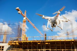
Whether it’s for a building, roads, communications towers, or power lines, the model generated by aerial mapping can be during planning for a construction job. A 3D model that can be used to make length, distance, and volume measurements can be instrumental in making project timelines and cost estimates.
Drone mapping technology can even be useful during or after a construction job. It is now common to generate 3D models of a building as it is constructed as a means to monitor and document progress. 3D models also provide excellent marketing materials should a project need to be presented to investors or stakeholders.
Research
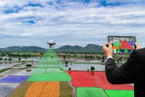
In the last few years, more and more researchers and scientists in the environmental sciences and geology fields have recognized the value of drone mapping. Through the use of drones, these scientists can gather data in hazardous areas such as those that are heavily forested or have dangerous terrain.
Modern survey equipment is accurate enough to help geologists identify geologic features such as rivers, domes, faults, and fault scarps. They can also help with survey planning should there be a need for field personnel to physically access said areas. For environmental monitoring, regular drone surveys can be done to monitor vegetation growth or the movement of wildlife.
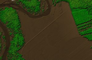
Land surveying
Land surveying is a practice done in real estate that is used to define the boundaries of a parcel of land. This used to be done using ground-based land surveys. This is fine for small land parcels but can take a lot of work for land that stretches across several acres.
The advantage of a drone survey in this application is that it generates a digital model that can be navigated and measured an infinite number of times. Once a survey is done, there should be no need to go back to the field as all the data is easily accessible.
Mining
The mining industry has become one of the top customers of drone mapping professionals in the last decade. 3D models of a mining area are invaluable during planning. It helps companies plan the construction of access roads and how much material they will need to excavate. They can also identify possible geologic hazards that need to be addressed.
Drone surveys are also used in mining for inventory management. Drones can make volumetric measurements of stockpiles and aggregates more accurately than other ground-based methods. They can also be used for safety and progress monitoring over the course of a mining operation.
Benefits of drone mapping
Drones have proven to be a disruptive force in the mapping industry. Nowadays, just about all aerial images are captured either via drone or satellite. Gone are the days when this kind of work has to be done by a manned aircraft. What unique value proposition do drones offer?
Faster data collection
Compared to any ground-based method, a remote sensing process like drone mapping is always a much faster alternative. The amount of data that a drone can collect in just an hour of flight will probably take several days or weeks for people on the ground.
Even compared to a manned aircraft, it can be argued that a drone is still a faster and leaner data collection tool. It does not require a lot of time for clearance or refueling and can be deployed right outside the survey area.
Automated workflow
Data accuracy and precision are some of the most important elements of a mapping survey. When a million-dollar project is on the line, there is simply no room for human error. Drone surveys are perfectly suitable for this need as they can be completely automated.
There are several benefits to automation. It allows surveys to be completed faster and without errors due to operator intervention. It also means that data is collected at the exact intervals as needed by the program for processing.
A programmed flight path can be saved and retrieved, allowing surveys to be repeated as needed. This can be instrumental for surveys done to monitor changes in terrain or vegetation.
Cheaper
Nowadays, you can get a good camera drone for less than $2000. If you’re trying to build a LiDAR setup, you might have to spend somewhere between $5000 to $10,000. Although not cheap, this is nowhere near as expensive as hiring a helicopter (and a pilot) to do an aerial survey.
Safer
Safety should be one of the primary motivating factors for opting into drone aerial surveys. Compared to ground-based surveys, drone surveys do not expose personnel to the hazards of being out in the field. This is especially important in remote areas where physical access is difficult and often dangerous.
In urban areas, unmanned flight has a huge safety advantage over manned flight. Since drones are much smaller than helicopters, they can more easily and safely negotiate around obstacles such as buildings, trees, and power lines. Even if a drone crashes, the damage it can cause is minuscule compared to that of a manned aircraft.
Compared to manned aircraft or ground-based surveys, a drone survey has benefits across the board and almost no drawbacks. As drone technology gets even better, more old-fashioned practices will be pushed more and more into the background. For this reason, mapping certainly holds a lot of opportunities for aspiring professional drone pilots.
Training courses for drone mapping
Knowing the basic flight skills isn’t enough to thrive in the drone mapping industry. There are a couple of other skills that you will need to master.
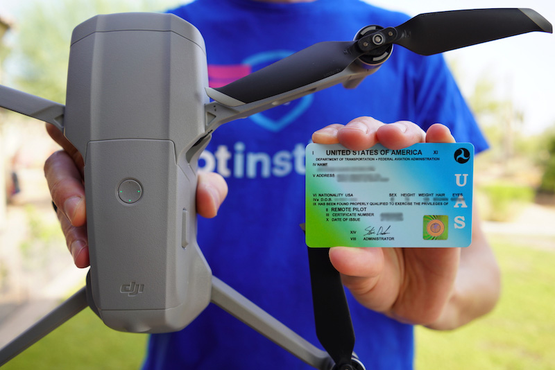
If you’re a beginner drone pilot, then our Commercial Drone Pilot Bundle will be a good place to start. This will cover just about everything you need to get started as a commercial drone pilot including how to pass the Part 107 test and what it takes to start a potentially successful drone business.
For more specialized skills, you can sign up for this introductory UAV 3D mapping course in Udemy. It covers the basics of drone mapping technology and provides a sample process workflow for processing survey data using Pix4D and AgiSoft.
Knowing how to manipulate and present spatial data is what separates drone mapping professionals from drone pilots. If you know how to use standard GIS software like ArcGIS, then you can offer even more versatile services to your clients. This ArcGIS Spatial Analysis course in Udemy will take your map data processing to the pro level.
Final thoughts
The drone mapping industry may be worth considering for those who are looking to get into professional drone work. There may be a lot of potential opportunities out there for those who have the right skills and equipment.
The barrier to drone mapping can be quite steep but this is easily one of the most lucrative industries for drone pilots. Hopefully, the tips we have provided here are enough just to get you started. If this is the path you choose, you certainly still have a long road ahead of you.