The past few years have seen drone pilots become elevated to the status of legitimate airmen. Along with the privileges come several responsibilities, such as complying with FAA regulations and maintaining situational awareness. This includes knowing which airspace you’re in, or whether you run the risk of operating in a no-fly zone.
The knowledge of airspace classification is one thing but knowing which airspace you’re in is another. There are old-fashioned ways for those who want to stick to the old methods, but there are also other ways that leverage more modern technology.
Check sectional charts
The primary source for airspace information will always be sectional charts. For reference, airspace information needs to be both accurate and dynamic. This is because some flight restrictions, such as TFRs (Temporary Flight Restrictions) are fleeting in nature and can pop up at a moment’s notice.
For this reason, printed sectional charts are no longer in fashion. They are still worth checking but are best paired with a secondary reference to which the FAA can add data as it comes.
A website worth checking is Skyvector. The site provides an interactive map that highlights the locations of airports, air traffic control (ATC) facilities, and weather stations. You can also drill down on the data shown in the main map to highlight METARs, TAFs, and TFRs. Skyvector even has a special section for DROTAMs, or NOTAMs pertaining to drone flight.
A highlight of this site is the sectional charts which can be accessed through a separate tab. Unfortunately, the sectional charts aren’t as dynamic as their interactive map. These are basically electronic copies of the printed sectional charts which you can zoom into to take a detailed look. They’re still useful for when you don’t have printed sectional charts on hand, but they aren’t all the convenient and can still be a pain to navigate.
Use a drone planning app
More preferred by most drone pilots because of their convenience, drone flight apps have made it possible to check real-time airspace and flight data even while out on the field. With such an app, you no longer need to leaf through pages of sectional charts to look for the particular one you need. All you need to do is search for where you plan to fly, and the app should navigate to the relevant sectional chart.
As with Skyvector, the advantage of a drone flight planning app is that it can receive updated info for new flight restrictions. This makes drone flight apps useful not just for checking the location of controlled airspace, but also for scanning for NOTAMs or TRFs.
There are a lot of good flight planning apps out there, most of which are available both for Android and iOS devices. Noteworthy examples include UAVForecast and Hover. Either one of these apps should provide you with just about all the information you need to plan your drone operations. Aside from airspace data, the apps also double as a weather forecast tool that provides detailed meteorological information. If you’re interested in the and wind speed and visibility for the next couple of days, these are all conveniently provided in the same apps.
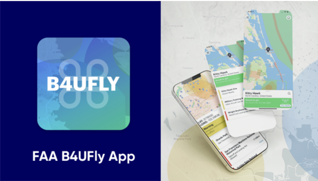
With intuitive interfaces and comprehensive information, it’s no surprise that these two apps are some of the most widely used by drone pilots, recreational and commercial alike. The B4UFLY app is also worth mentioning, if only because it’s the officially FAA endorsed drone flight planning app.
Where to check time-sensitive flight restrictions
At this point, it’s worth noting that these drone flight planning apps should not be treated as the primary source of time-sensitive information on airspace restrictions. Of note are TFRs (Temporary Flight Restrictions) which can be declared for a variety of reasons. Some of these reasons, such as VIP movement, can come up at a moment’s notice.
To make sure that you’re reading up-to-date information on TFRs, it’s a good idea to go straight to the source. The FAA maintains a list of active TFRs which can be filtered by state or arranged chronologically. Keep in mind that these TFRs apply to both manned and unmanned aircraft, so not all of them may be relevant to you.
Checking TFRs this way isn’t as convenient as checking it on a mobile app. The little bit of extra effort is worth it, though, just to make sure that you don’t unwittingly fly into a no-fly zone delineated by a TFR.
The types of airspace you should watch out for
With all this talk of airspace classes, some may ask – is it really so important? Well, it absolutely is if you don’t want to risk getting penalized with a fine or jail time and having your drone license revoked. When your review sectional charts before you fly your drone, these are the airspace classes you should be trying to avoid:
Controlled airspace
Areas of controlled airspace are easy to identify because they typically surround airports. If there’s an airport within five to ten miles of where you plan to fly, then there’s a very good chance that you’re going to end up in controlled airspace.
By default, drone flight is prohibited in controlled airspace as these areas are expected to have heavy traffic of manned aircraft. A close encounter between a drone and a manned aircraft is something that the FAA is trying to avoid (although they haven’t been completely successful yet, despite the restrictions).
The shape and extent of controlled airspace surrounding an airport depend on how much traffic that airport regularly receives. A more active airport will generally have larger controlled airspace along its proximity.
There’s good news for both recreational and commercial drone pilots, though. It’s now possible to request for airspace authorization from the FAA and receive a response almost instantly. This is through the LAANC, a system developed by the FAA along with other stakeholders in the drone community. LAANC is accessible through about a dozen drone flight planning apps.
Special use airspace
Special use airspace is a bit more difficult to define, as it covers a wider range of location-specific drone flight restrictions. There are types of special airspace, such as restricted areas and TFRs, where drone flight is strictly prohibited. There are also others, such as military operation areas and alert areas, where drone pilots are advised to operate at their own risk.
A lot of special use airspace is used by the military for their training exercises, flight shows, and artillery tests. The FAA has minimal control over these areas, so you aren’t likely to receive any authorization to fly in them.
Unauthorized drone flight in TFRs and prohibited areas is a serious offense that can result in both civil and criminal charges. Violation of a security-related TFR is punishable by at least six months of jail time. If the incident caused a death, the drone pilot can be charged a fine of up to $250,000.
Final thoughts
A quick check of the airspace class you’ll be flying in should be part of the prep work of any drone pilots, whether in commercial or recreational flights. More than the possible penalties which could result from a violation of airspace restrictions, the potential of causing an airspace-related accident should be enough to convince any drone pilot to take pause and gain some situational awareness.