Both recreational and Part 107-licensed drone pilots are now required to secure authorization to operate in controlled airspace through the LAANC system.
The sheer volume of drones owned and operated in the US has made them an element of national airspace that is worth considering. Nowadays, drone flight is regulated by the FAA, whether done professionally or recreationally. Among the regulations is the restriction on drone flight in controlled airspace, or in the airspace immediately surrounding airports.
The situation’s not all bad, though. The FAA has official procedures for securing authorization to fly in controlled airspace. What are the steps you need to take?
A primer on controlled airspace
A knowledge of airspace classes and the corresponding flight rules is an essential part of the certification standards for airmen. This topic constitutes a large part of the knowledge test required for aspiring Part 107-licensed drone pilots. However, the FAA also encourages learning about airspace classifications even for drone pilots who are flying purely recreationally.
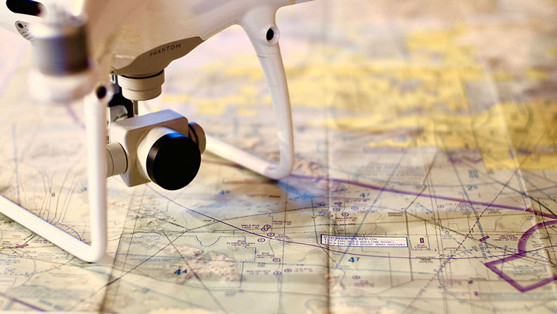
Even if you never get to learn about how to read sectional charts, you should at least know about controlled airspace. This refers to the three-dimensional space where air traffic control (ATC) services are provided. Controlled airspace typically exists in the airspace immediately
surrounding airports and similar air facilities where there is an unusually high volume of air traffic.
There are five classes of controlled airspace, coded A to E. Drone pilots do not need to be concerned about Class A airspace because this airspace starts from 18,000 feet up to 60,000 feet – altitudes that drones typically do not reach. This airspace is mostly used by commercial airlines for long flights between different cities or countries.
The other four classes of controlled airspace – Classes B, C, D, and E – are mainly differentiated by the level of activity of their included airports. For instance, Class B airspace occurs at the country’s busiest airports such as those in the major air travel hubs like New York and Los Angeles. As such, Class B usually has the widest extent – a radius of around 10 nautical miles measured from the location of the airport.
In stark contrast is Class D airspace which is assigned to the areas surrounding the smallest airports with functioning control tower. In most cases, the extent of Class D airspace is only within a 5-mile diameter with the airport as the center.
Lastly, Class E airspace serves to “fill in” all other areas of controlled airspace that have not been covered by other classes. This may be quite a vague definition, but the extend and location of Class E airspace should be easy to understand with a sectional chart.
Rules on flying in controlled airspace
By default, drone flight in controlled airspace Classes B, C, and D is prohibited. This is a means to avoid close encounters between drones and manned aircraft. Despite this rule being in place, sightings of drones near airports continue to be reported with alarming frequency.
We say that drone flight in controlled airspace is prohibited “by default” because it’s actually possible to do if you can get authorization from the relevant ATC facility. Even then, you will be required to abide by the maximum distance and altitude in which you can fly your drone.
You normally will not need ATC authorization to fly a drone in Class E airspace. However, there are rare exceptions where Class E airspace appears to be located near an airport. In such a case, you will still need to secure authorization from the relevant ATC. However, this is a pretty rare case that the FAA is already trying to avoid.
Before Part 107 and LAANC, recreational drone pilots simply made a call to the nearby ATC facility to seek approval to fly in the controller airspace under their jurisdiction. In those simpler times, verbal permission was enough to serve as clearance from the ATC.
The Part 107 rules somehow made airspace authorization more systematic by integrating it into their waiver system via the DroneZone website. Under this system, drone flight in airspace was treated just like any other Part 107 flight restriction for which you can request a waiver. The problem with this approach was that it required a lot of documentation and usually only provided results in several weeks’ time.
What is LAANC?
In 2017, the FAA launched the Low Altitude Authorization and Notification Capability (LAANC) which superseded all previous methods to secure airspace authorization. LAANC was developed by the FAA along with several private drone operators and developers of drone flight apps.
LAANC is a system that allows drone pilots to make requests for airspace authorization via an app. These requests are then received by the FAA who get in touch with the relevant ATC facilities. This provides a centralized system for the FAA to receive and screen all airspace requests, instead of individual ATC facilities having to spend precious time and resources fielding calls from drone pilots.
On the side of the drone pilots, the benefit of LAANC is that it allows for a near-instant response to their requests. Based on the performance of LAANC in the last couple of years, it’s possible to receive airspace authorization within several seconds of filing a request. This has given drone pilots more flexibility to operate in controlled airspace, all within the legal boundaries as set by the FAA.
Right now, the LAANC function is being offered by a growing number of drone flight apps, including high-profile ones such as Airmap and KittyHawk. Over 600 airports in the US are covered by LAANC, with the bigger ones prioritized by the FAA for implementation. The FAA continues to add more airports to this list. If you need to fly in controlled airspace near an unlisted airport, then you will need to secure authorization via the old method through the FAA DroneZone website.
How to request for airspace authorization via LAANC
The specific steps in requesting airspace authorization through LAANC may have slight variations based on the drone flight app you are using. This procedure applies to the Airmap app, but the essence of each step should remain similar to those of other apps.
- Upon booting the app, a map displaying your current location should appear. To provide a location for your planned flight mission, simply input a specific address or use the search function.
- After choosing a location, the app will display a summary of the flight restrictions that apply to your planned flight mission. This should include information on any altitude ceilings in place for drone flight, or if you will be flying in controlled airspace. For the latter case, you will have to proceed with requesting LAANC authorization.
- You will then have to choose if you will be flying under Part 107 rules for commercial drone flight or as a recreational drone pilot.
- In the next screen, you will have to define the extent of the area for which you are applying for authorization. There are three tools in the app to do this: a box tool, a circle tool, or a free-hand tool that allows you to freeform a custom boundary. In any case, the area you define needs to be enclosed.
- Once you have a defined area, you need to provide details about the pilot flying the drone and your planned mission. These include the date and time of the mission, the duration of the flight, and your planned maximum altitude. You also need to indicate the name of the pilot, the pilot’s contact details, the make and model of the drone that will be used, and the drone’s registration number. If you need to fly right now, then you can also indicate that you would like to request authorization for a drone flight mission intermediately.
- You will be presented with a series of yes or no questions related to doing a pre-flight safety inspection of your drone and its safety features. You will also be shown a weather forecast for the time and date of your planned flight mission. This includes details on wind speed, precipitation, visibility, and temperature. Just do a quick review of the weather forecast.
- Press the SUBMIT button.
Your request will be sent directly to the FAA and be reviewed. You should receive a response in no more than a few minutes. The response will be in the form of a text message that confirms the authorization and details on the conditions of the approval. You may also download a PDF copy of the approval document through the app.
Airmap also has a feature that lets the LAANC system know if you have completed your planned flight mission. It is a good idea the press the END FLIGHT button once your mission in controlled airspace is finished so that safety monitoring measures can be stopped.
Can recreational pilots also use LAANC?
Yes! Recreational drone pilots were finally integrated into the LAANC system in the second half of 2019, allowing them to fly in controlled airspace subject to the approval of the FAA. Not all the drone flight apps offer the provision for recreational drone flight, but there should be more in the coming months aside from Airmap, KittyHawk, and UASidekick.
The procedure for securing airspace authorization via LAANC as a recreational drone pilot is quite similar to the original procedure for Part 107-licensed pilots. Just make sure that you pick the option for recreational drone pilots when prompted. In Airmap, the option is labeled as “FAA Recreational Flyers – 44809.” You will still need to provide your personal and contact details, as well as the make and model of your drone.
Keep in mind that the rules for recreational drone flight have been redefined by the FAA Reauthorization Act of 2018. This means that recreational drone pilots are now under the authority of the FAA and need to follow a list of rules, most of which overlap with the Part 107 rules for commercial drone pilots.
These rules include flying within visual line-of-sight, maintaining a maximum altitude of 400 feet in uncontrolled airspace, avoiding flying over people or public events, and not flying when under the influence of drugs or alcohol. Equally as important is the condition to fly purely for recreation – earning anything from drone flight could land you in trouble if you don’t have a Part 107 license.
Final thoughts
The restriction against flying in controlled airspace has long been a controversial matter in the drone community because of the sheer number of airports and ATC facilities in the US. The old methods surely didn’t make it easy for drone pilots, both recreational and professional, to seek authorization to fly in controlled airspace.
Now, we have the LAANC system that allows for almost real-time approval of airspace authorization requests. Better yet, even recreational drone pilots have been integrated into the LAANC system, making it a more inclusive tool for all types of drone flight.

