-
Key Takeaways
-
Understanding the Difference: National Parks vs. National Forests
- What Is a National Park?
- What Is a National Forest?
-
Drone Use in National Parks: The General Ban
- Reasons Behind the Ban
- Drone News Update
- Noise Pollution & Wildlife Concerns
- Penalties for Violating the Ban
-
Exceptions in National Parks: Is There a Way to Fly?
- How to Apply for a Permit
- Examples of Approved Drone Use
-
Flying Drones in National Forests: What's Allowed
- General Rules for National Forests
- Restrictions in Wilderness Areas
- Other Local Restrictions
-
Responsible Drone Operation in National Forests
- Respecting Wildlife and the Environment
- Avoiding Temporary Flight Restrictions (TFRs)
- Following FAA Guidelines
-
Alternative Locations for Drone Flying
- State Parks and Local Parks
- Bureau of Land Management (BLM) Lands
- Using Apps and Online Resources
-
Consequences of Ignoring Drone Regulations
- Legal Ramifications
- Impact on Wildlife and Natural Resources
-
Frequently Asked Questions
-
Conclusion
Want that dream footage of some of America’s most majestic landscapes? Hold on before launching your drone for aerial footage. National Parks and other lands have some strict regulations that can catch you off guard.
Empower yourself with knowledge of where you can—and can’t—fly to avoid legal trouble. Proper knowledge protects our natural treasures and ensures a positive experience for all visitors.
This guide will help you navigate the complex rules governing drone use in National Parks and Forests.
Key Takeaways
- Restrictions – Drones are banned in National Parks but generally allowed in National Forests with restrictions.
- Timing Counts – National Forests prohibit drones in Wilderness Areas and during certain events.
- Violations – Fines up to $5,000 and possible jail time.
- Know Before You Fly – Check local laws, TFRs, and permits before flying.
Understanding the Difference: National Parks vs. National Forests
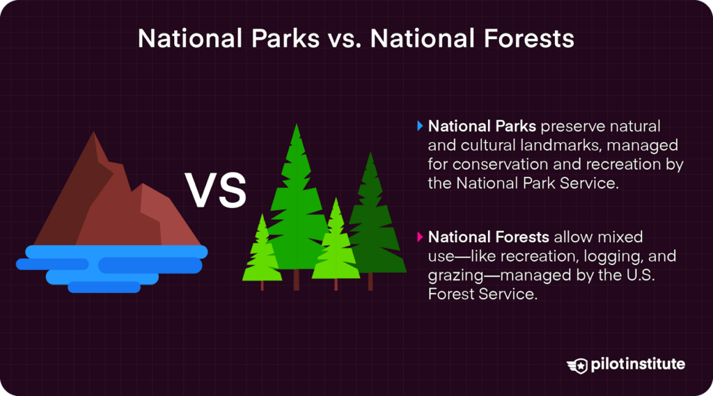
What Is a National Park?
National Parks protect some of our country’s most pristine landscapes and natural resources.
National parks are managed by the National Park Service (NPS) under the Department of the Interior. Their primary purpose is to preserve unique natural, cultural, and historical resources. National Parks focus heavily on conservation, recreation, and education.
Parks like Yellowstone, Yosemite, and the Grand Canyon have been preserved for future generations to enjoy, thanks to the stewardship of the NPS.
What Is a National Forest?
National Forests are public lands that balance conservation, recreation, and resource management.
Managed by the U.S. Forest Service under the Department of Agriculture, National Forests focuses on multiple-use management: recreation, timber harvesting, grazing, wildlife habitat, and water resource preservation.
While commercial activities such as logging, grazing, and mining are allowed, they are balanced with active conservation efforts and recreational opportunities for the public.
Some examples include the Angeles National Forest and Tongass National Forest.
Drone Use in National Parks: The General Ban
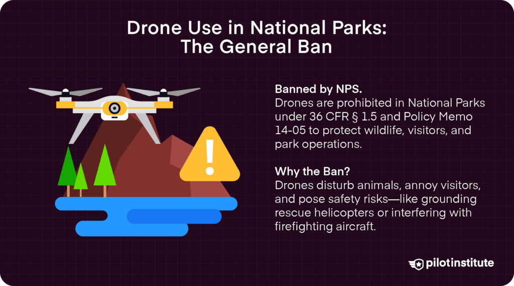
Most unmanned aircraft operations are banned from National Parks to protect park resources and visitor experiences.
Thanks to 36 CFR § 1.5, park superintendents have the authority to “impose public use limits” within their jurisdiction. This allows superintendents to impose restrictions on use or activity, such as flying drones.
In 2014, the NPS issued Policy Memorandum 14-05, which invoked this authority to ban drones in National Parks. This prohibits launching, landing, or operating unmanned aircraft, including drones, on NPS lands and waters within the boundaries of National Parks. The ban applies to both recreational and commercial use.
However, park superintendents can grant special use permits (SUPs) for activities such as scientific data collection and search and rescue.
In addition to the guidelines outlined in Policy Memorandum 14-05, existing 36 CFR sections also prohibit UAS flight to prevent harassment of wildlife (36 C.F.R. § 2.2), creation of a nuisance or “risk of public alarm” (36 C.F.R. § 2.34), and prohibit portable motors or engines in undeveloped areas without a permit (36 C.F.R. § 2.12(a)(3)). These regulations can restrict drone usage in other public lands outside of National Parks as well.
Reasons Behind the Ban
Safety concerns for both humans and wildlife motivated the ban.
Drones can interfere with emergency or other critical park operations. For example, in the summer of 2017, a drone forced an NPS helicopter to land to avoid a collision.
While not in a National Park, another recent example highlights the larger impacts of these safety concerns.
In the January 2025 wildfires in Los Angeles, a drone crashed into a Super Scooper airplane that had been sent from Canada to assist in containing the Palisades Fire.
The incident put the pilots’ lives in danger and grounded the aircraft for several days—stopping critical operations during a time when it was needed most.
Noise Pollution & Wildlife Concerns
The drone ban aims to improve the visitor experience for the millions of visitors who visit National Parks each year. Turns out, most people don’t like drones buzzing by their heads when trying to enjoy the beauty of our Natural Parks.
A 2021 study published in the International Journal of Environmental Research and Public Health found that:
“—drone noise is substantially more annoying than road traffic or aircraft noise due to its special acoustic characteristics such as pure tones and high-frequency broadband noise.”
The study correlated the sound of drones with higher levels of annoyance and stress in humans compared to other common traffic noises. One can only imagine the impact that sound has on animal populations!
Speaking of wildlife, drones can confuse, scare, and negatively impact species within park boundaries.
Studies have shown that noise pollution from drones can disrupt animal behaviors, frightening birds to the point that they may even abandon their nests, for example.
Even more concerning, some unethical pilots have engaged in antagonizing wildlife—just to get a good shot. Just this February, witnesses reported a UAS harassing bighorn sheep at Zion National Park, where the drone operator was reportedly separating juvenile sheep from the rest of the herd.
Misuse of drones can also threaten natural resources and NPS property. In 2014, a drone crashed into the Grand Prismatic Spring in Yellowstone National Park. One pilot even attempted to land right on the iconic Mount Rushmore monument!
Penalties for Violating the Ban
If you are caught violating these policies, you face fines of up to $5,000 and/or up to six months in jail.
Remember that tourist who crashed a drone into Yellowstone’s Grand Prismatic Spring? He was ordered by a judge to pay $3,200 for the crash–$1,000 in fines and $2,200 in restitution to the Park.
Additionally, equipment may be confiscated by park authorities. This includes not only the UAS itself but also memory cards that may have recorded park property during the illegal flight.
Individuals may also face park bans.
Exceptions in National Parks: Is There a Way to Fly?
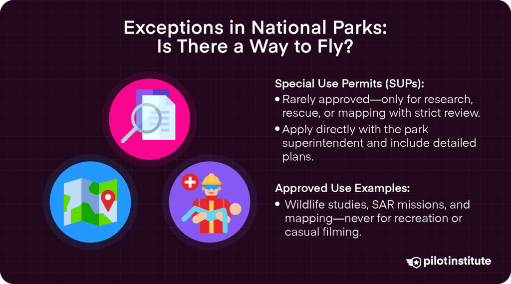
SUPs are rare permits issued under strict criteria that give drone operators special permission to fly in National Parks. These are typically only granted for purposes like scientific research, search and rescue, aerial mapping, or special events.
Acquiring an SUP to fly in National Parks is notoriously difficult. Approval requires a demonstration of necessity, highly detailed plans for operations, and minimal impact.
Even with a permit, operations are closely regulated.
How to Apply for a Permit
Contact the park superintendent’s office directly to file for SUPs. Park superintendents oversee the approval of SUPs for launching, landing, and operating drones within their jurisdiction.
Submit a detailed proposal outlining the purpose, location, duration, and equipment to be used. It is always a bonus to include information on how the activity supports park management or conservation goals.
Acquire any special permissions needed by the FAA before applying for SUPs. This includes beyond visual line of sight (BVLOS) drone operation waivers.
Allow ample time for the review and approval process, as park superintendents take this process very seriously.
The NPS also states that park superintendents can sometimes designate a special area within the park for flying recreationally. It may be worth a shot to call and ask what your options are!
Examples of Approved Drone Use
While rare, there are examples of approved drone use in National Parks. These are often research projects, such as studying wildlife migration patterns or search and rescue missions during emergencies.
One success story was seen in 2017 when the NPS granted special permission for drone use in the geospatial mapping of the unique desert environment at Great Sand Dunes National Park in Colorado.
Some National Parks, like the Grand Canyon, employ drones in search and rescue operations. The NPS at the Grand Canyon has its own drone fleet to use in critical operations. So far, it has been quite successful, helping find lost and injured hikers in the rough terrain of the canyon.
Parks may choose to utilize drones for promotional materials—under controlled conditions, of course. Yet, it is important to note that recreational filming is generally not approved.
Flying Drones in National Forests: What’s Allowed
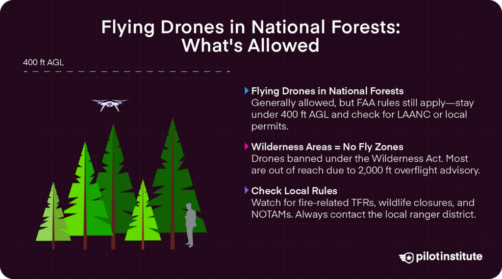
General Rules for National Forests
Unlike National Parks, drone flying in National Forests is generally permitted. The FAA’s airspace regulations still apply over public lands, like National Forests. As such, pilots should always comply with FAA regulations, such as flying below 400 feet AGL, for example.
Operators may also need special permits or LAANCs, which offer pilots special airspace authorizations in areas that are typically restricted. It is important to check the unique requirements at your chosen location beforehand.
Restrictions in Wilderness Areas
Drones are prohibited in Congressionally designated Wilderness Areas. Section 4(c) of the Wilderness Act of 1964 banned motorized equipment in these areas, including taking off, landing, and operating drones.
FAA regulations related to flying above Wilderness areas are stated in Chapter 7, Section 5 of AIM:
“Pilots are requested to maintain a minimum altitude of 2,000 feet above the surface of the following: … Wilderness and Primitive areas administered by the U.S. Forest Service.”
Given that the FAA limits drone flight to 400 feet above ground level (AGL), this puts most Wilderness areas out of reach for drone pilots.
Wilderness Connect has a great layered map of Wilderness areas to help you navigate where you can and can’t fly. The U.S. Forestry Service also has downloadable Wilderness maps to keep you informed when you’re out of service range.
Other Local Restrictions
Some National Forests may have specific closures or notices related to wildlife migration or fire danger. Contact local ranger districts for more area-specific rules.
In the event of wildfires, Temporary Flight Restrictions (TFRs) may trigger even more restrictions. Always check Notices to Air Missions (NOTAMs) before flying.
Responsible Drone Operation in National Forests
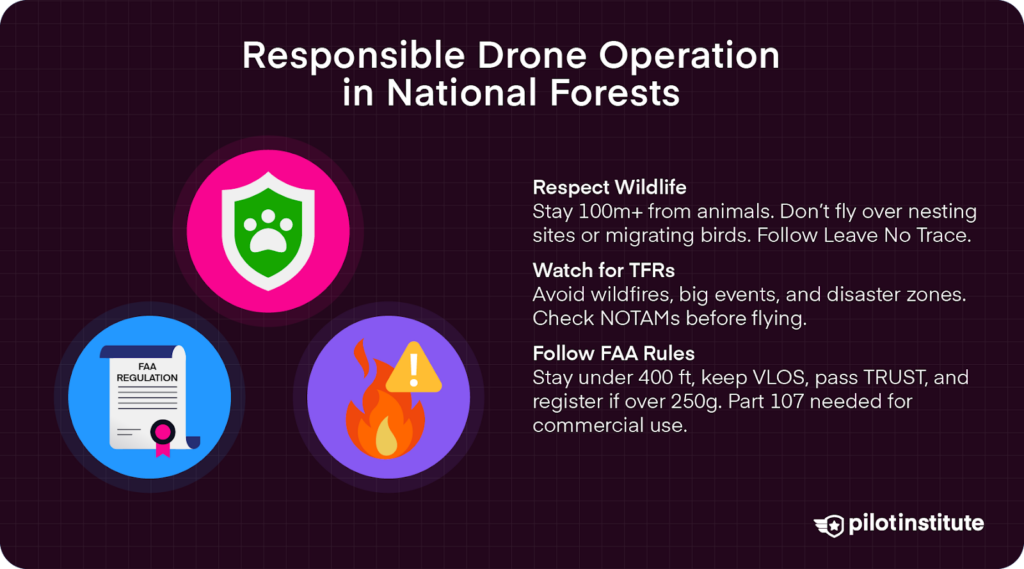
Respecting Wildlife and the Environment
The FAA admits that “UAS, if misused, can have devastating impacts on protected wildlife” (AIM, Chapter 11, Section 8). Flying over wildlife can cause undue stress and physical harm.
Maintain a safe distance from wildlife to avoid causing stress or harm. Avoid flying directly over animals, and be mindful of sensitive areas like nesting sites and breeding grounds.
In its Recreational Drone Tips, the US Forest Service recommends that drones be launched at least 100 meters (328 feet) away from wildlife and that drones should not fly directly over wildlife.
You can also research or consult with local authorities to determine appropriate distances for wildlife in the area.
March through April and August through November have the highest risk of bird strikes, as many migrating bird species are on the move during this time. So, when flying in these months, be aware of potential risks to bird species in the area.
Follow Leave No Trace principles to minimize impact on sensitive ecosystems. This means leaving no trash behind or impacting sensitive ecosystems with operations.
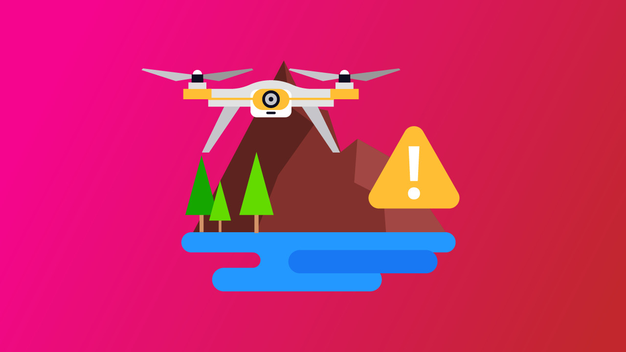
Avoiding Temporary Flight Restrictions (TFRs)
Temporary Flight Restrictions (TFRs) are interim airspace restrictions that prohibit air traffic within a designated area for a specified time. These are communicated to pilots via Notices To Airmen (NOTAMs).
Typically, TFRs restrict flight around sensitive locations, including the airspace above large events, such as air shows and sporting events.
Areas hit by natural disasters, such as wildfires, are also often marked off-limits because of ongoing first-responder activity. Even presidential movements or political rallies may be assigned TFRs.
Only drone pilots with authorization from the controlling agency listed in the TFR can fly, which typically includes support for disaster relief and recovery assistance.
Violating TFRs can result in fines, even certification suspension and revocation. As such, it is important to always check the FAA’s TFR listings before each flight. This is especially true in remote areas, where there may be wildfires in the dry, summer months.
Following FAA Guidelines
No matter where you fly, it is always crucial to follow FAA guidelines. As a general list:
- Keep the drone within visual line of sight (VLOS) at all times.
- Fly below 400 feet above ground level (AGL), which is designated by the FAA as the “upper limit of recreational UAS operations in Class G airspace” (AIM, Chapter 11, Section 4).
- Do not fly over people or moving vehicles.
- Pass the TRUST (The Recreational UAS Safety Test) for recreational flying.
- Register your drone if it weighs more than 250 grams (0.55 pounds).
- Complete Part 107 Certification for any commercial drone operations.
Alternative Locations for Drone Flying
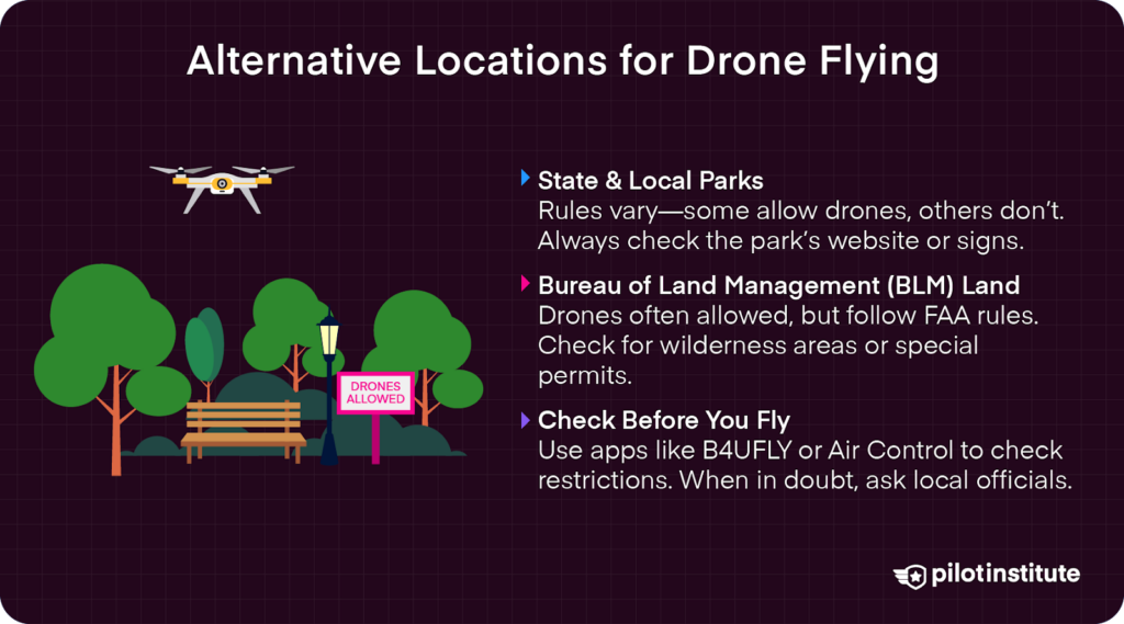
State Parks and Local Parks
While drones are generally allowed in state parks, rules vary widely by state and locality. Some parks have designated areas for drone flying; others prohibit it entirely.
If a park does prohibit drone operations, it will often have posted notices. Before you fly, research park policies on their official websites or contact park officials personally.
Moreover, some parks may fall within other agency jurisdictions, requiring additional permissions. For example, a state park may be located in a designated wilderness preserve or within a municipal jurisdiction that applied additional drone regulations.
Obtain any required permits or permissions before flying to ensure a seamless operation.
Bureau of Land Management (BLM) Lands
BLM land is managed by the U.S. Department of the Interior. There are over 245 million acres of public lands that can be used for recreation, such as dispersed camping. Many BLM-managed lands allow drone use.
The remote beauty of these lands is ideal for capturing diverse landscapes—with fewer crowds. BLM National Data has a great layered map of BLM lands nationwide.
While far less restrictive than National Parks and National Forests, flying in BLM land still requires adherence to FAA rules and may be subjected to additional regulations depending on the location. Always check for any additional permits or LAANCs that you may need.
Remember, most Wilderness areas are off-limits for flying. Given that these are sometimes part of larger BLM land holdings, it is also important to check if there are any wilderness or preserve restrictions.
Using Apps and Online Resources
There are some amazing tools right at your fingertips to help check airspace restrictions. The FAA’s B4UFLY app is a great resource that is recommended in AIM Chapter 11, Section 8: “UAS operators may check for conservation area airspace restrictions on the B4UFLY mobile app.”
There are other apps, like DroneDeploy, that offer additional airspace information. The app Air Control, formerly Aloft, is also useful in applying for LAANC authorizations on the go.
Whenever in doubt, consult local regulations through municipal websites or park offices.
Joining drone community forums is another great resource, as pilots can share their experiences and advice. Pilot Institute offers an impressive drone community that helps elevate pilots with knowledge about drone operating procedures and how to navigate the tricky world of restricted air spaces.
Consequences of Ignoring Drone Regulations
Legal Ramifications
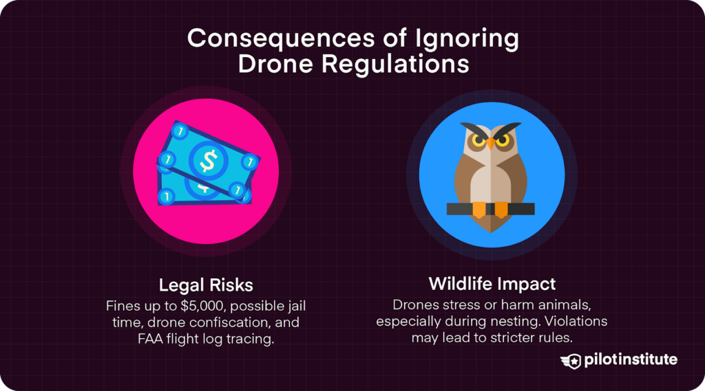
Ignoring drone bans in National Parks and Wilderness areas can result in fines up to $5,000. Additionally, state and local penalties may apply, adding to federal fines.
Drones can be confiscated, including any media recorded on media storage devices like SD cards.
There is even the threat of jail time. Having a criminal record can impact future opportunities.
Remember, even if you aren’t caught red-handed, drones are traceable via serial numbers and flight logs. The FAA can request flight logs at any time, and you risk being penalized if there are coordinates in designated no-fly zones.
Impact on Wildlife and Natural Resources
Drones have the potential to seriously impact wildlife. They can cause stress, injury, or death to animals who fear or feel threatened by drones.
Certain species may react aggressively to drones in flight. Eagles and other raptors, for example, may attack a drone they perceive as a threat in their territory. This can cause unnecessary injury to protected wildlife.
Disturbances that occur during breeding seasons can have long-term effects on populations. In 2021, a drone flew over the protected area of the Bolsa Chica Ecological Reserve. At the time, the reserve was filled with nesting terns. In a panic, many of the birds fled—abandoning over 1,500 eggs in the process.
Regulations that protect certain species and habitats may also restrict drone activity. Eagles, for example, are federally protected from pursuit or harassment—which includes getting too close with one’s drone.
Negative interactions can lead to stricter regulations for all pilots. This is, after all, why drones were banned from National Parks in the first place.
Frequently Asked Questions
So, this has been a lot of information! Let’s break down some common questions to remind us of the main points here.
- Can you fly a drone in National Parks?
No, drones are prohibited in National Parks unless you can obtain an elusive Special Use Permit (SUP) from the park superintendent.
- What happens if you get caught with a drone in a national park?
Ignoring restrictions could result in a hefty fine of up to $5,000, a possible ban from the park, risk of your equipment and media being confiscated, and even lead to jail time.
- Can I fly my drone in Yellowstone National Park?
Unfortunately, no. While that would result in some epic drone footage, flying a drone in Yellowstone National Park is prohibited.
Conclusion
Drone flying is prohibited in National Parks, unfortunately. However, it is often allowed in National Forests—with restrictions. Always research and comply with FAA regulations and local laws.
Respect for wildlife and the environment is paramount. Pilots should never pursue or harass wildlife, which includes flying in sensitive, prohibited areas, such as nesting habitats or wildlife preserves.
Ignoring regulations can lead to severe legal consequences, such as hefty fines and even jail time!
It is all of our duties to fly responsibly and ethically. By staying informed about regulations and updates, we can ensure our flying operations do not interfere with delicate ecological systems and the well-being of wildlife.
Your responsible actions today contribute to successful conservation efforts and stronger ecosystems far into the future.