-
Key Takeaways
-
1. Know Your Audience, Aircraft, and Risk Tolerance
- Aircraft Limits Matter
- Personal Minimums Worksheet
-
2. Weather Fundamentals Every Drone Pilot Must Understand
- Wind & Gusts
- Visibility & Cloud Clearance
- Precipitation & Humidity
- Temperature & Density Altitude
- Geomagnetic Kp Index & GPS Satellites
-
3. Forecast Sources: Layered Approach For Reliability
- FAA-Recognized Data
- Drone-Specific Apps (Free & Paid)
- Reading NOTAMs & TFRs
-
4. Building A Pre-Flight Weather Briefing Workflow
- Step-By-Step Checklist
- Example Briefing Walk-Through
-
5. In-Flight Monitoring & Dynamic Decision-Making
- Using Telemetry Overlays
- Mid-Mission Weather Triggers
- Emergency Contingency Planning
-
6. Special Operating Environments
- Mountain & Canyon Flights
- Coastal & Marine Layers
- Urban Heat Islands & Downwash
- Night & Operations Over People (OOP)
-
7. Common Drone Pilot Mistakes (And How To Avoid Them)
-
8. Case Studies & Lessons Learned
- Military Drone Crash In Wind Gust
- NOAA & Meteodrone Project
-
Conclusion
One second, it is smooth sailing. Then, a sudden wind gust bursts out of nowhere, shifting your drone’s stability and causing it to veer violently off track. All of this chaos in just 200 feet AGL.
The weather constantly shapes every flight with forces you cannot always see or predict. Wind gusts, unexpected turbulence, and shifting microclimates can turn a routine mission into a hazardous situation in mere seconds.
Understanding these forces empowers pilots and assures safer flying. Let’s look at the risks and how to avoid them with a battle-tested playbook utilizing a pre-flight brief, in-flight monitoring, and post-flight documentation.
Key Takeaways
- Learn your aircraft’s limits.
- Get familiar with key weather factors that can impact flight operations.
- Navigate strategies to mitigate risks associated with wind gusts and turbulent air conditions.
- Resource: FAA, NOAA, and other weather data for improved safety.
- Understand how different terrain affects air turbulence and drone flight performance.
1. Know Your Audience, Aircraft, and Risk Tolerance
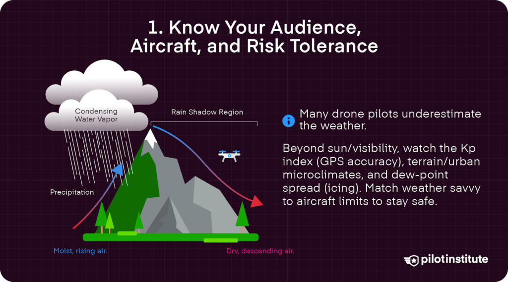
While most drone operators may have some idea of how different weather components affect flight safety, many may underestimate certain conditions or be unaware of certain factors altogether. Unfortunately, knowledge gaps are all too common.
For example, a hobbyist may obsess over sunlight for visibility, but may overlook how KP index levels (the standardized geomagnetic range) may impact GPS accuracy.
Meanwhile, a Part 107 pilot may be comfortable reading METARS (Meteorological Aerodrome Reports), yet still skip an understanding of potentially shifting microclimates around rugged terrain or urban heat zones.
Even a seasoned BVLOS team with advanced planning tools may overlook dew-point spread, raising icing risks.
Operational safety is directly linked to pilot proficiency, which includes in-depth knowledge of weather factors on UAS performance. As such, it is essential to match knowledge and risk awareness with aircraft limits to maximize mission potential.
Aircraft Limits Matter
Speaking of aircraft limits, understanding the max conditions your UAS is capable of is essential to safe and successful flying.
It is critical to understand your drone’s maximum wind resistance, operating temperature, and satellite (GNSS) requirements. Take a look at some specs for common drone models.
| Model | Max Wind | Operating Temp | GNSS Types |
| DJI Mini 4 Pro | 23.9 mph (38.5 km/h) | 14° to 104° F (-10° to 40° C) | 10 – 15 satellites for a strong connection |
| DJI Mavic 4 Pro | 26.8 mph (43.2 km/h) | 14° to 104° F (-10° to 40° C) | At least 8 satellites for RTH |
| DJI Matrice 350 | 26.8 mph (43.2 km/h) | -4° to 122° F (-20° to 50° C) | Minimum of 4 satellites |
| WingtraOne VTOL | 27 mph (43.45 km/h) | 14° to 104° F (-10° to 40° C) | Recommended 7 – 10 satellites |
It is important to note that the maximum wind resistance published by drone manufacturers tends to represent steady-wind conditions. Yet, that is not the way the world works, and experienced pilots would add around a 30% buffer to account for wind gusts.
Personal Minimums Worksheet
There are some useful personal evaluation tools and checklists to ensure that pilots are flying within their range of operational capacity.
IMSAFE focuses on pilot readiness, standing for Illness, Medication, Stress, Alcohol, Fatigue, and Emotion.
PAVE focuses more holistically on the pilot and environment. It stands for Pilot, Aircraft, enVironment, and External pressures.
Pilot factors are similar to the IMSAFE components. Yet, the PAVE tool also allows drone pilots to evaluate aircraft factors, such as battery temperatures, or environmental factors, like weather.
Proactive steps, like setting personal maximum gust speeds or minimum satellite count, can also prevent issues before they take place. Pilots can even set a minimum battery reserve to ensure that their drones engage the RTH function at a safe distance.
2. Weather Fundamentals Every Drone Pilot Must Understand
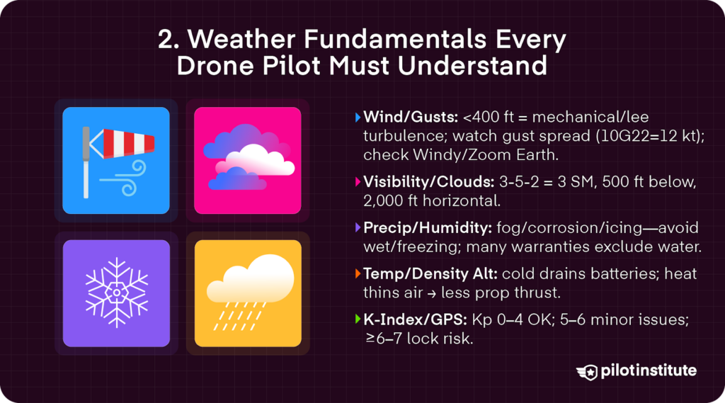
Wind & Gusts
Wind is one of the most underestimated hazards for drones, especially below 400 feet AGL.
Mechanical turbulence refers to the chaotic, uneven airflow that is created when steady wind is disrupted by obstacles, such as buildings or trees.
The rotor/lee effect (localized circulations of turbulent air that form on the downwind side of mountains)
Both are typically greater below 400 feet, where there are more physical obstacles, such as buildings or mountains, that disrupt airflow and affect flight performance.
In the AC 107-2A B.4.1, the FAA advises how “wind speed and direction are important as they affect takeoff, landing, and cruise of flight operations.”
Wind gusts can also cause performance issues. Pilots must be able to distinguish between steady winds and gusts, as well as between sustained and peak wind speeds.
For example, a forecast of 10 knots gusting 22 knots has a 12-knot gust spread, which can easily double the drone’s power draw as it is forced to constantly correct itself during strong gusts.
Checking wind forecasts with detailed gust information, from Zoom Earth or Windy, can mean the difference between a successful flight operation and a potential crash.
Visibility & Cloud Clearance
Visibility is another major component to look for before taking off. Poor conditions can drastically reduce situational awareness and impose risks to flight safety.
Flight under Part 107 requires a minimum of 3 statutory miles of visibility. In AC 107-2A 5.10, the FAA also sets requirements for “minimum distance from clouds being no less than 500 feet below a cloud and no less than 2,000 feet horizontally from the cloud.”
These minimum distances can be remembered easily with the mnemonic “3-5-2 rule.”
Precipitation & Humidity
Moisture can degrade performance, shorten drone lifespan, and even cause in-flight failures.
Precipitation and humidity also pose risks to drone flight safety. Both can cause sensor fogging, electronic speed controller (ESC) corrosion, and even icing when the wet-bulb temperature is at or below 0 °C.
It is important to note that many drone manufacturers exclude water damage from warranty coverage or claims. DJI’s warranty, for example, does not cover water damage.
In order not to be left in the cold, pilots should shy away from flying in overly wet or freezing conditions.
Temperature & Density Altitude
Temperature extremes also affect drone performance. In very cold conditions, batteries will discharge at a faster rate, meaning shorter flight times.
For conditions below 10° C (50° F), it is also recommended to wear gloves or hand warmers for field work. As the cold can impact dexterity, it is important to keep warm and keep a tight grip on the controls.
On the other end of the spectrum, heat can significantly impact density altitude. Hot air is thinner, which can reduce propeller efficiency, just like the reduced thrust seen in crewed aircraft on hot days.
Geomagnetic Kp Index & GPS Satellites
As briefly mentioned before, Kp represents the geomagnetic Kp-index. This measures solar storms and geomagnetic activity that can disrupt GPS reliability and compass accuracy.
For drone flights, Kp-index levels between 0 and 4 are considered safe. When Kp-index levels reach 5 or 6, pilots may experience minor GPS issues.
A Kp level of 6 to 7 increases the risk for GPS and may result in the loss of satellite lock.
3. Forecast Sources: Layered Approach For Reliability
FAA-Recognized Data
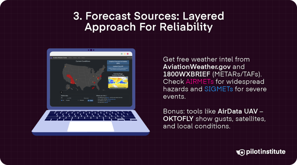
Luckily, the FAA offers a wealth of weather data free of charge. Pilots can pull METAR/TAF data free from AviationWeather.gov or the 1800WXBRIEF text brief.
AIRMETs and SIGMETs are also useful for drone operations. These are weather advisories issued by the National Weather Service and the FAA.
AIRMETs (Airmen’s Meteorological Information) offer information on weather conditions and phenomena that can impact drone performance and flight safety.
Meanwhile, SIGMETs (Significant Meteorological Information) focus more on severe and extreme weather condition warnings.
There are also several other free or easy-to-access tools. For example, AirData UAV offers a useful free tool called OKTOFLY, which measures not only satellite data but also wind gusts and other weather conditions.
Drone-Specific Apps (Free & Paid)
| App | Cost Tier | Unique Strength | Limitation |
| AirData “OK to Fly” | Free / Pro | 15-day satellite + wind-altitude profile | Requires account sync |
| Dronecast | Free | Custom go/no-go thresholds per model | 48-hr forecasts |
| UAV Forecast (limited) | Free | Simple red/green UI | 3-hr window now for free tier |
| Meteomatics Meteodrones feed | Enterprise | Live boundary-layer data | Limited rollout |
Reading NOTAMs & TFRs
Checking Notices to Airmen (NOTAMs) and Temporary Flight Restrictions (TFRs) is also essential for safe flying.
NOTAMs are official advisories issued by the FAA that alert pilots to temporary changes in airspace or hazards in the area. TFRs typically prohibit or significantly limit flight operations in a specific area, largely due to sensitive activity such as wildfires or security concerns.
Both are time sensitive, offering pilots up-to-date information for safe flight operations.
An example of a wildfire TFR might include changes to visual flight rules (VFR), reading “3015/-SFC,” meaning a restriction extending from the surface upwards to prohibit drone and manned aircraft from interfering with emergency efforts.
4. Building A Pre-Flight Weather Briefing Workflow
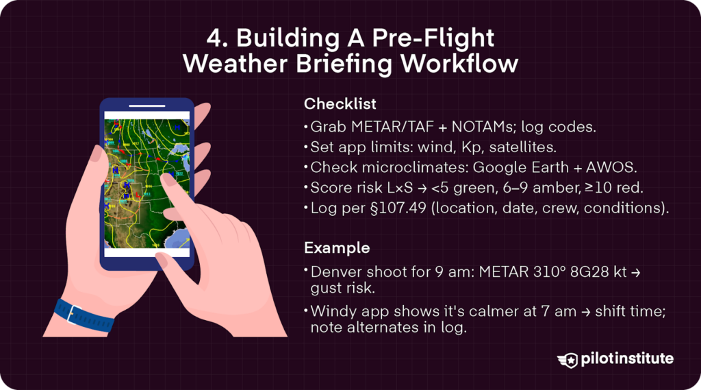
Step-By-Step Checklist
A thorough checklist helps ensure safe and compliant drone operations.
Start by pulling up official weather data and NOTAMs, copying METAR and TAF codes into your log.
Then, in your drone’s app, set custom limits for wind, Kp index, and satellite availability.
Analyze microclimates using Google Earth elevation profiles and local surface weather (AWOS) data.
Next, score your risk matrix using the L x S formula, which stands for likelihood by severity. Identify hazards and evaluate likelihood and severity. Scores below 5 are in the green for safe flight, 6-9 are amber and require heightened caution, and 10 or more is in the red.
Finally, file everything in your digital log to meet §107.49 requirements for location, date, personnel, and conditions.
Example Briefing Walk-Through
Let’s take a look at a case scenario, a real estate shoot in the Denver foothills scheduled for 9 am.
First, review METAR data to check for red-flag wind gusts that could compromise flight stability.
A reading could look like “KBJC 1353Z3108G28KT,” which represents a warning issued by the Rocky Mountain Metropolitan Airport in Broomfield, Colorado, on the 13th day of the month.
3108G28KT signifies that the wind is coming from 310 degrees to the northwest, with a windspeed of 8 knots, but gusting 28 knots.
Next, check Windy’s altitude slider to find a calmer layer. In this case, the wind is much calmer at 7 am.
Pilots can suggest a time shift for smoother operations with fewer risks.
All data should be documented, along with any potential alternative dates.
5. In-Flight Monitoring & Dynamic Decision-Making
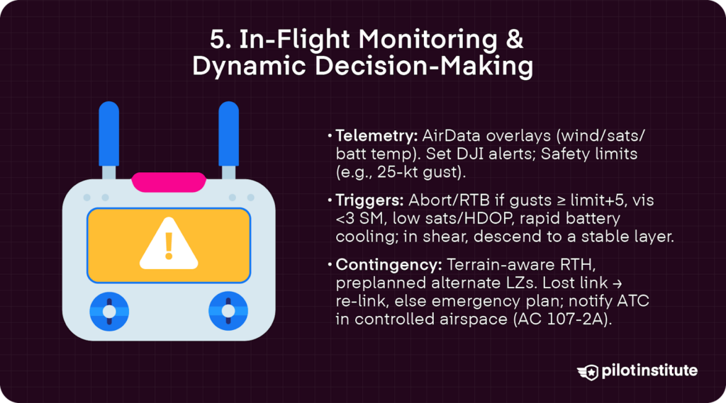
Using Telemetry Overlays
Pilots can benefit from using telemetry overlays. AirData, for example, provides live overlays that can be streamed with drone apps, offering detailed data on wind, satellite counts, and battery temperatures.
On a smart controller, like those offered with many DJI models, pilots can set custom alerts for wind gusts or Kp-index readings using the DJI Fly or DJI Go 4 app.
In settings, navigate to the safety tab. There, you can set the maximum altitude, distance, wind resistance, and more. Setting a 25 knot gust limit, for example, can set off an audio alert when maximum gusts hit unexpectedly.
Mid-Mission Weather Triggers
Certain weather triggers require immediate attention or a hard abort to maintain safety.
These include wind gusts exceeding a drone’s maximum wind resistance by 5 knots or more, visibility dropping below the set minimum of 3 statute miles, too few available satellites, or rapidly cooling battery temperatures.
In the event of a wind shear, climbing is not always the best option. In many cases, quickly descending below a wind shear or turbulent air layers offers better stability.
Emergency Contingency Planning
Emergency contingency planning is also crucial for maintaining smooth operations, particularly in complex terrain.
Pre-programmed RTH altitudes need to take into account potential downdraft zones, such as in mountainous areas. This could cause the drone to encounter sudden turbulence when ascending.
Pilots should map out alternative landing sites ahead of time, ensuring a safe option if original take-off locations become problematic.
In cases of a lost link, AC 107-2A recommends attempting to re-establish the connection and closely observing the behavior of the drone.
If that fails, emergency procedures should be implemented. This should include contacting any ATC or other authorities in controlled airspace.
6. Special Operating Environments
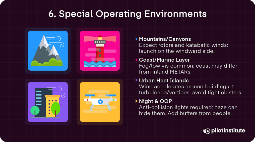
Mountain & Canyon Flights
Rough terrain in canyons or mountains can significantly impact flight environments and performance. Rotor and katabatic winds can create significant turbulence.
Rotor winds form on the leeward sides of mountains or ridges. They produce circular, turbulent airflow.
Katabatic winds are created when dense, cold air rushes downhill.
When operating in mountainous terrain, pilots can minimize unexpected downdraft surprises by launching the drone on the windward side of a ridge.
Coastal & Marine Layers
Marine layers are dense, cool, and moist air layers that form over the ocean, eventually moving inland. They tend to bring fog and reduced visibility that can impact visibility requirements.
When working in such environments, pilots can add visibility checkers, such as a handheld laser rangefinder.
It is important to note that while inland METAR may offer Visual Meteorological Conditions (VMC), the situation may be quite different just a few miles away at the coast.
Urban Heat Islands & Downwash
Even urban environments have their own unique weather hazards.
Mechanical turbulence results when wind accelerates around tall buildings, creating localized turbulence that can impact flight performance and increase risk.
Drones can become trapped in vortexes between skyscrapers, forcing emergency procedures or a hard abort.
When operating in urban landscapes, pilots should plan flight paths away from tight building clusters and maintain altitude flexibility.
Night & Operations Over People (OOP)
Night operations and operations above people incur additional risks.
Low visibility and risk of not being seen are real in nighttime environments, which is why the FAA requires all drones operating at night to have anti-collision lights. Yet, haze or fog can hide those lights, increasing the potential for midair collisions with manned aircraft.
Poor weather conditions also increase the risk to bystanders, requiring increased safety measures when flying over people.
Though not a requirement mandated by the FAA, a good idea is to launch at least 150 meters (around 492 feet) from people in order to stabilize flight operations.
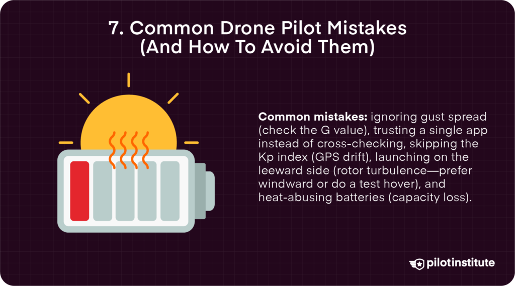
7. Common Drone Pilot Mistakes (And How To Avoid Them)
Common pilot mistakes can occur when environmental factors are overlooked.
Underestimating gust spread, for example, can lead to unstable flight. It is important to always check the G value of wind reports to get a better understanding of gust spreads.
Relying too heavily on a single app can also produce inaccurate data that can have disastrous consequences on flight operations. Cross-check multiple sources to empower yourself with the most accurate data.
Additionally, ignoring the Kp-index before mapping out flight plans can trigger a “toilet-bowl” GPS drift, or the gradual deviation of a drone’s reported position from its true location.
Taking off from the leeward side of a mountain exposes a drone to rotor turbulence. If possible, plan take-offs on the windward side of a ridge. When there is no option, take a few minutes to conduct a test hover to assess the risk of turbulence.
Finally, pay attention to proper battery storage. Leaving batteries in extreme temperatures, such as a hot trunk, can permanently reduce capacity.
8. Case Studies & Lessons Learned
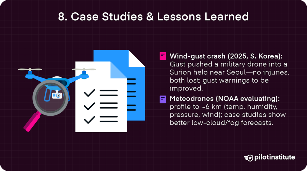
Military Drone Crash In Wind Gust
One tragic example of the dangers of wind gusts occurred in South Korea in March 2025. A sudden gust of wind pushed a military drone into a helicopter just outside of Seoul.
Fortunately, no one was injured, but both the drone and the Surion helicopter were destroyed.
The South Korean Army has since vowed to install more efficient warning systems for wind gusts.
NOAA & Meteodrone Project
Additionally, the NOAA recently partnered with Meteomatics to evaluate weather conditions. It demonstrated that integrating 6 km vertical atmospheric profiles can significantly improve fog forecasts.
Capturing detailed temperature, humidity, and wind data from different altitude points significantly improved forecasting and helped pilots to plan safer flights in low-visibility conditions.
Conclusion
The weather is unpredictable. It is our responsibility as drone pilots to plan, monitor, and review, not just once but constantly.
It is essential to also familiarize yourself with key weather factors and phenomena that can reduce drone performance and increase flight risks, such as mechanical turbulence, rotor wind, and issues flying in cold weather environments.
Proper planning requires a thorough evaluation of environmental conditions. Use tools like risk checklists, weather apps, and telemetry overlays to determine when it is simply too unsafe to fly.
Just remember, commercial airline pilots never fly without a thorough weather briefing; why should you?