-
How drone-based 3D modeling is used for public safety
-
What software does SkyeBrowse offer?
-
What are the advantages of using SkyeBrowse?
- Fast data collection
- Detailed 3D models
- A Freemium model
- Can be integrated with thermal imaging
- Compatible with Leica/FARO/Trimble/ESRI
-
Which drones can be used with SkyeBrowse?
-
Final thoughts
Public safety is only one of many ways that drone technology is being harnessed for the benefit of society nowadays. Drones provide elevated levels of speed of response and situational awareness in many critical situations without exposing responders to undue hazards.
When paired with 3D modeling technology, drones provide a faster and more detailed procedure for response or documentation of accidents, crime scenes, and other time-critical scenarios. In this specific field of public safety drone use, high-quality software like SkyeBrowse can make a huge difference in ensuring accurate and timely information is provided for on-the-field tactical intelligence.
How drone-based 3D modeling is used for public safety
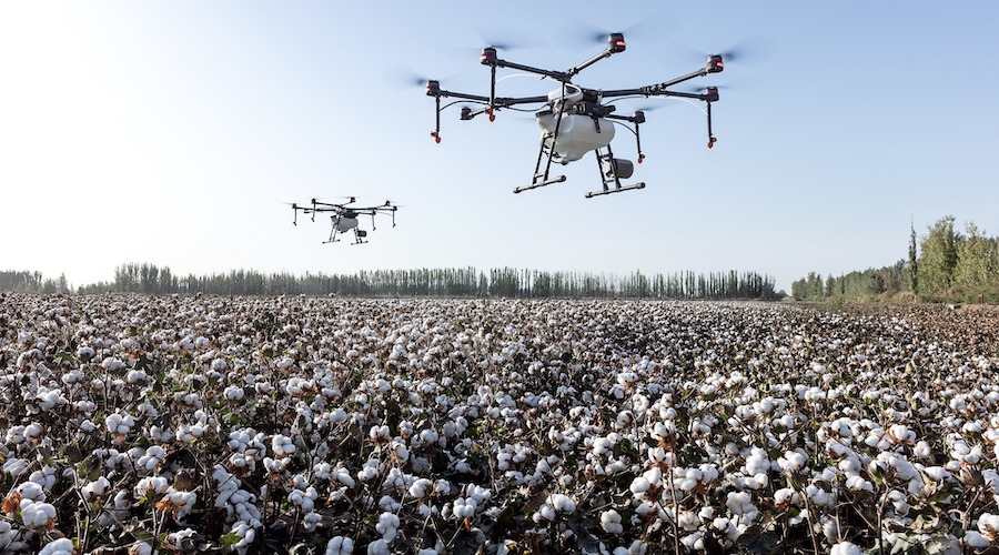
At the most basic level, the mobility and ease of deployment of drones make them valuable tools for responding to any dangerous or time-critical situation. Drones can fly to any location much faster than on-the-ground teams. With the high-definition cameras of modern drones, simply having a drone on-site is already a huge advantage in providing tactical intelligence.
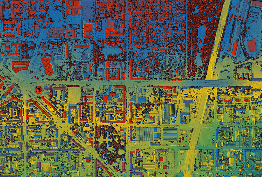
Combining drones with 3D mapping technology makes them even more powerful. With photogrammetry, drones can just take a series of aerial photos that can be processed to create an accurate 3D model of a building, interior space, parking lot, or street corner.
Drones with 3D modeling capabilities can aid in both gathering tactical intelligence and in the documentation of accidents or crime scenes. Drones can do this in a manner that is safer, faster, and arguably to a higher level of detail than people on the ground. Being able to revisit a scene in 3D is also essential for investigation, whether for a crime or an accident.
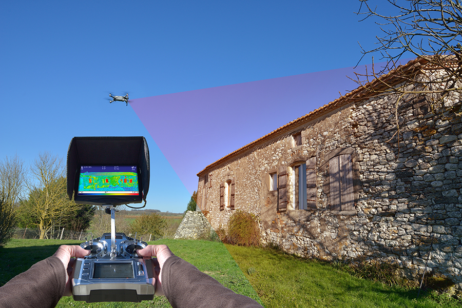
The utility of drones can be further enhanced with thermal imaging. Tactical reconnaissance using thermal cameras can be used in areas and at times of poor visibility. It can also be useful when responding to fires or other related accidents. Thermal imaging can be combined with 3D mapping to create a comprehensive 3D model that highlights thermal anomalies.
What software does SkyeBrowse offer?
SkyeBrowse is a startup that specializes in drone mapping software for use in public safety applications. The company offers three software platforms – the main SkyeBrowse software, TacBrowse, and Midnight Sun.
SkyeBrowse is the company’s flagship software, available on both iOS and Android platforms. It is a software platform that can create detailed 3D models using a technique called videogrammetry. This is similar to photogrammetry, except that it uses recorded video for 3D model generation. This allows for faster data collection – a crucial element in the field of public safety.
When capturing aerial videos, the SkyeBrowse mobile app effectively flies itself along pre-determined flight paths. These paths are generated by the flight planning app based on the flight area that the user has defined.
SkyeBrowse has a “Freemium” version that has the 1-tap 3D modeling function, as well as cloud storage and model sharing functions. The premium subscription has additional tools for annotation, measurements, thermal mapping, and diagrams. The scene of an accident can be fully documented in less than 3 minutes using a drone and the SkyeBrowse software.
The SkyeBrowse software can also be upgraded to the Hyper version which provides higher-resolution models and faster processing speeds. The increased level of SkyeBrowse Hyper makes it the optimal tool for forensic investigation or accident reconstruction. The shorter processing time can also be a huge advantage in tactical scenarios.
SkyeBrowse has provided previews of TacBrowse, an add-on that allows for real-time tracking of on-the-ground personnel on the 3D models generated by SkyeBrowse. It works by activating an app on the mobile units of field personnel. Using this app, the SkyeBrowse 3D model tracks their real-time position. This provides an unprecedented level of situational awareness for the incident commander, aiding in tactical strategies and maintaining the safety of people on the ground.
The website of SkyeBrowse indicates that TacBrowse will also be available for both Android and iOS platforms and that it is coming soon. Qualified agencies may apply for early access.
Finally, Midnight Sun is the AI-powered platform that also complements the SkyeBrowse software. With the use of AI, Midnight Sun can automatically identify people, vehicles, and other points of interest in a scenario or 3D model. When used in combination with TacBrowse, Midnight Sun can identify friendly personnel on the map and contrast them with the coordinates of unknown personnel.
Midnight Sun streamlines the decision-making process and provides tactical intelligence almost instantly through the power of AI. The software has not been released yet, but early access can be provided to qualified agencies.
What are the advantages of using SkyeBrowse?
SkyeBrowse provides a multi-faceted software platform that leverages technologies including drones, 3D mapping, GPS tracking, and AI to make public safety operations safer and more efficient. This combination creates a unique product that offers all these benefits:
Fast data collection
With the use of videogrammetry and drone flight, a detailed 3D model can be generated in SkyeBrowse in as little as two minutes. This speed in data collection and model generation is highly essential in situations where hazards can escalate in just a few seconds.
Detailed 3D models
With the Hyper upgrade, models generated by SkyeBrowse can be accurate to the centimeter. These models can then be analyzed and measured in countless ways. Slices in the models can be selected to create elevation profiles that can be useful for field operations. Operators can also go to POV mode to look for good vantage points.
The level of detail of SkyeBrowse models is further improved with the addition of the TactBrowse and Midnight Sun modules. With real-time location feedback and AI-aided identification and tracking, the situational awareness that SkyeBrowse can provide is at a truly impressive level.
A Freemium model
The subscription for SkyeBrowse is quite steep, so it’s very good news that it is also offered in a Freemium version. Even with this free-to-use model, SkyeBrowse can be used to create quick and accurate 3D models using drone videogrammetry. This is a great way for agencies and professionals to try out what SkyeBrowse has to offer without committing to a huge expense.
Can be integrated with thermal imaging
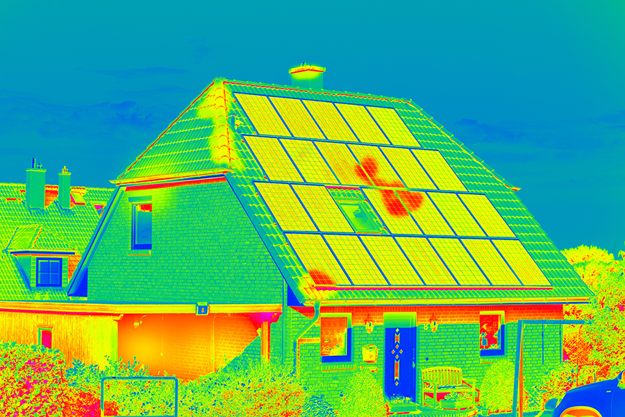
SkyeBrowse works brilliantly with drones that have thermal imaging capabilities, further enhancing the level of detail of generated 3D models. Thermal imaging is useful for identifying thermal anomalies or providing some visibility in low-light conditions.
Compatible with Leica/FARO/Trimble/ESRI
3D models generated with SkyeBrowse are perfectly compatible with popular points cloud tools like Leica Map360, Trimble, Cloud Compare, ESRI, and FARO Zone 3D. This is important for operational flexibility, especially for agencies that are already using any of these mapping platforms. SkyeBrowse models can be directly imported into these platforms without any need for file conversion. This feature is not available in the Freemium version of SkyeBrowse.
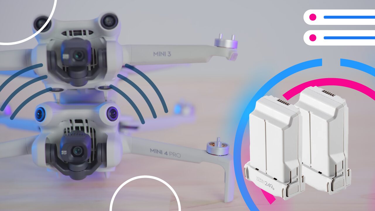
Which drones can be used with SkyeBrowse?
SkyeBrowse works with a wide range of drones from DJI and Autel, mostly enterprise-range models and a few prosumer models. The compatibility list is as follows:
- DJI Mavic Pro
- DJI Mavic 2 Series
- DJI Mavic Mini
- DJI Mini 2
- DJI Mini SE
- DJI Mini 3 Pro
- DJI Phantom 4 Series
- DJI M210
- DJI M300 H20T / H20N
- DJI Air 2/ Air 2S
- DJI FPV
- DJI M30 / M30T
- AUTEL EVO I
- AUTEL EVO II SERIES
SkyeBrowse is actively working to expand this list, so it will likely be updated in the coming months.
Final thoughts
Time of response, the accuracy of data, and flexibility of operations – are some of the most important elements in any operation that involves public safety. With the surging popularity of drones, it only makes sense for emergency response and other public safety agencies to use and leverage this technology in a manner that is both practical and intelligent.
SkyeBrowse provides one of the most efficient platforms for drone-based public safety response. It aims to provide situational awareness and tactical intelligence for field teams quickly and with minimal need for training. This is a preview of what emergency response will look like in the future and is one of the finest applications of drone technology.