-
Data as currency
- Drone News Update
-
The unique value of drones
-
Examples of data collection using drones
- Magnetometry for geothermal exploration
- Urban stormwater management
- Water quality monitoring
-
Challenges of drone-based data collection
- Restrictive legislation
- Data privacy
- Drone pilot education
-
Final thoughts
Now that more people than ever own and operate drones, they have become valuable both as devices for leisure and for commercial use. Beyond just taking aerial photos and videos, drones can be outfitted with sensors and other data-gathering technology. With their unique mobility, drones can fulfill a highly specialized role in the era when data is becoming more and more valuable.
In this data-driven world, what role can we expect drones to take? Does this bode well for professional drone pilots? Which industries stand to benefit from drones as devices for data collection?
Data as currency
Whether we like it or not, we already provide data that corporations deem to be commercially valuable. Data on the places we go to, the websites we visit, and the topics we talk about are collected through our devices and social media channels. This data is then used as tools for targeted marketing. Who has not been enticed by a well-timed and uniquely appropriate advertisement that has shown up on their phones?
Outside the area of marketing, large-scale data collection is also practiced by other industries. Manufacturing facilities use arrays of sensors to gather real-time data about their operations, allowing for automation and minimal downtime. A large dataset also provides insight into manufacturing operations that can e used to enhance efficiency and enact improvements.
With more powerful data processing capabilities, the field of big data has emerged. As the name implies, big data involves collecting and processing large amounts of data for advanced analytics. This is used nowadays to optimize traffic flow, forecast weather, help with pharmaceutical research, and predict consumer behavior. In some cases, big data deals with a scale of data that is larger than the human mind can perceive.
Due to the real-world value that data provides, it is now considered by many as a form of currency, even going so far as to describe it as the “new oil”. The last few years have shown that this comparison is not mere hyperbole. For any corporation to thrive (or even survive) in a data-driven world, they need to leverage the value of data.
The unique value of drones
With our knowledge of the value of data, we can now better appreciate the potential of drones for data collection. Drones are unique because of their unparalleled mobility. They can fly just about anywhere, even in tight spaces and close to critical infrastructure. Unlike helicopters and other manned aircraft, drones can be deployed in just a matter of minutes. They are also a lot less expensive, both in terms of acquisition and operating costs.
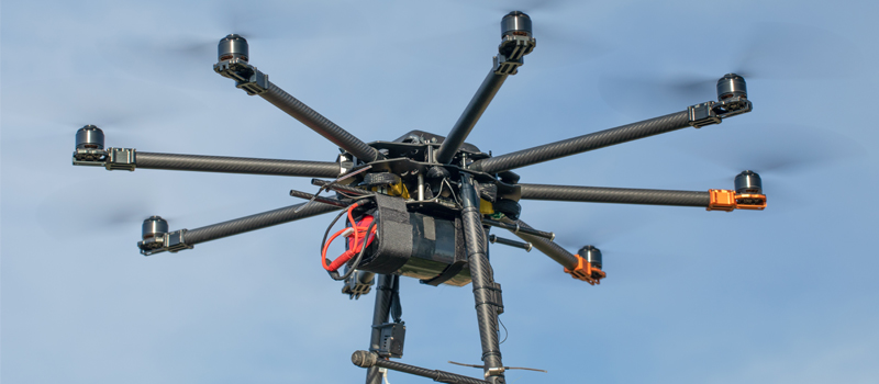
Drones have come a long way since the years when they were mostly used for aerial photography. While camera drones still have a place in a data-driven society, drones can now be augmented with more sophisticated equipment such as thermal cameras, LiDAR sensors, electromagnetic energy (EME) sensors, and multispectral sensors.
With the appropriate sensor, a drone can collect huge amounts of data much faster than any ground-based method. By automating data collection flight missions, operators can better assure more consistent and accurate data. Drones also greatly reduce the risk of data collection operations by keeping people away from potentially dangerous environments, such as near large industrial equipment and high-voltage power lines.
Even in applications that are not aimed towards data gathering, the data processing capability of drones still proves valuable. Drones that are designed to fly autonomously will typically have an array of infrared and time-of-flight sensors that help them identify obstacles in their vicinity. This data is then processed so that the drone can come up with a flight path that will clear the obstacles.
Examples of data collection using drones
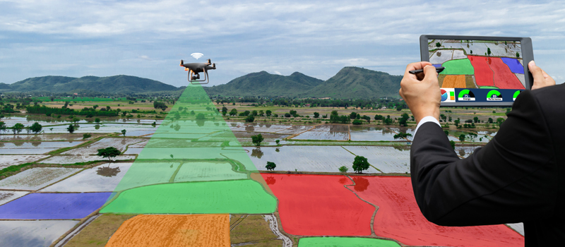
By now, most drone enthusiasts are well aware of common commercial applications of drones in mapping, inspection, and farm management. To truly highlight the potential of drones, let’s look at some of the more unconventional uses of drones in data gathering.
Magnetometry for geothermal exploration
A team of scientists at the University of Reno in Nevada have used a drone as a tool for exploring a site for its geothermal potential. In this case, the site is considered “blind”, which means there is nothing on the surface that indicates that it may be a good candidate for geothermal development.
The technique uses a magnetometer mounted on the drone as it flies above the surface area. The data collected by the drone will then be processed to provide valuable information about the heat or permeability of the site.
Typically, this survey is done by having people on the ground hauling equipment on long hikes. A drone survey is up to ten times faster and reduces the exposure of personnel to dangerous conditions.
Urban stormwater management
The use of drones in urban planning is already a well-studied field. However, there are still smaller sub-fields that are worth exploring, such as data collection for stormwater management. In the face of climate change, stormwater management has become crucial for human and ecological health. Of particular concern is whether cities manage stormwater properly and implement sufficient pollution reduction mechanisms.
There are several facets to a drone-based strategy for stormwater management. On one hand, runoff water quality can be monitored via multispectral and hyperspectral imagery. A more indirect approach is to use visual and 3D imagery to measure changes in assets such as sediment piles in construction sites.
The ultimate vision is to use the data collected by drones to develop a smart and interconnected system for managing urban stormwater. Once critical points in the urban network are identified, more permanent data gathering stations can be assigned for real-time monitoring of stormwater quality and flow. This data can also be used for the rapid response of emergency services.
Water quality monitoring
A presentation made by a team of scientists in the Virginia Institute of Marine Science highlighted the value of drones in data collection for water quality monitoring of Chesapeake Bay. The main challenge here is the sheer volume and variety of data that the team needs for accurate monitoring.
Before drones, the team relied mainly on satellite-based remote monitoring. However, the resolution of data collected by a satellite station is much too coarse to be usable and can be compromised by the presence of clouds and fog.
By using drones, water quality monitoring can be done using high-resolution data that can be collected more frequently. The team can also quickly deploy drones to gather data in response to environmental changes without having to worry about the challenges of cloud cover and poor visibility.
Through multispectral analysis, a drone survey can collect a huge amount of diverse data via remote sensing. These include indicators of temperature, salinity, sediment load, dissolved oxygen, pH, and biological load. Some drones can even be customized to allow for in-situ sampling of water. Data collected by drones is then processed and analyzed by the scientists to come up with models for rapid response.
As these scenarios indicate, the value of drones lies in their ability to gather large amounts of data from similarly large areas. This means that there is a geographical or physical aspect to the data. This physical boundary is one that drones can very easily overcome.
Challenges of drone-based data collection
Industry insiders are very optimistic about the growth in the value of drones. As of the end of 2020, the commercial drone industry is estimated to be worth at least $100 billion. Most experts would also say that there is still potential for growth – but only if the drone industry can overcome its current challenges.
Restrictive legislation
In almost all countries, drones are already recognized as components that need to be considered in airspace safety. This means that laws have been passed regulating drone flight. There’s no problem with this concept except for the fact that the commercial drone industry is evolving at a rapid pace and that the laws seemingly cannot keep up.
Unfortunately, this means that some restrictions have hampered the growth of the commercial drone industry. Undoubtedly, some drone pilots are missing out on jobs because of airspace restrictions, having to fly within visual line of sight, and not being able to fly over people. The good news is that federal agencies have started to recognize the economic value of commercial drone services and have been mandated to support them.
Data privacy
Although commons have become a lot more common in the past few years, a lot of people are still uncomfortable with the prospect of having drones fly above them. This is unavoidable when capturing data in highly urban settings. This also means that visual data on people can be collected even when a drone survey is only concerned about data on infrastructure or terrain.
This emphasizes the importance of having robust data privacy policies for commercial drone operators. There must be a way to protect the data of private citizens and make sure that it does not get leaked or used without their permission.
Drone pilot education
As more people buy drones, drone pilot education becomes a bigger challenge. Back in the old days of model airplanes, RC pilots often congregated into flight clubs because the hobby wasn’t exactly beginner-friendly. These clubs provided an informal means of training, largely making the hobby free of safety incidents.
Nowadays, a beginner drone pilot can have a drone up and running in less than an hour. Drone technology is so advanced that anyone with a passing knowledge of electronics can learn how to fly drones with just a bit of practice.
This trend has been great for drone manufacturers but has been a headache for agencies concerned with airspace safety. As one can imagine, recreational drone flight is harder to regulate than commercial drone flight. In any case, widespread education on drone technology and regulations will be a prerequisite before drones can be accepted socially.
Final thoughts
We now live in an era when data reigns supreme. More than many other physical goods, data is collected at a huge scale and exchanged across several global corporations. As large-scale data becomes more valuable, so does the unique data-gathering capability of drones.
Drones hold a unique position in this type of society. If you need to collect data with a geospatial component, there is probably no technology that can rival the efficiency of a drone. This has created an entirely new industry centered on commercial drone services. The sophisticated drones we have nowadays are equipped to handle the type of “big data” that will drive many industries forward.