Best Places to Fly
Your Drone in San Francisco
Welcome to this wiki. The goal of this wiki is to crowd-source drone information. Having said that, information may be inaccurate, out-of-date, and should not be relied upon for legal advice.


San Francisco Drone Flying
Locations Map
1. Cesar E. Chavez Park
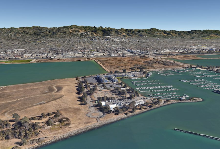

The 90-acre Cesar E. Chavez Park is another attractive spot for drone photographers and fun flyers. This gorgeous space encompasses the San Francisco Bay Area. You can easily see three of its bridges and the distant San Francisco skyline. Also, within the line of sight from the wide-open grassy park are Alcatraz and Angel Islands. There’s a lot to capture here. Be sure to turn up with a couple of spare batteries and plenty of storage if you plan to film
2. Empowerment Park
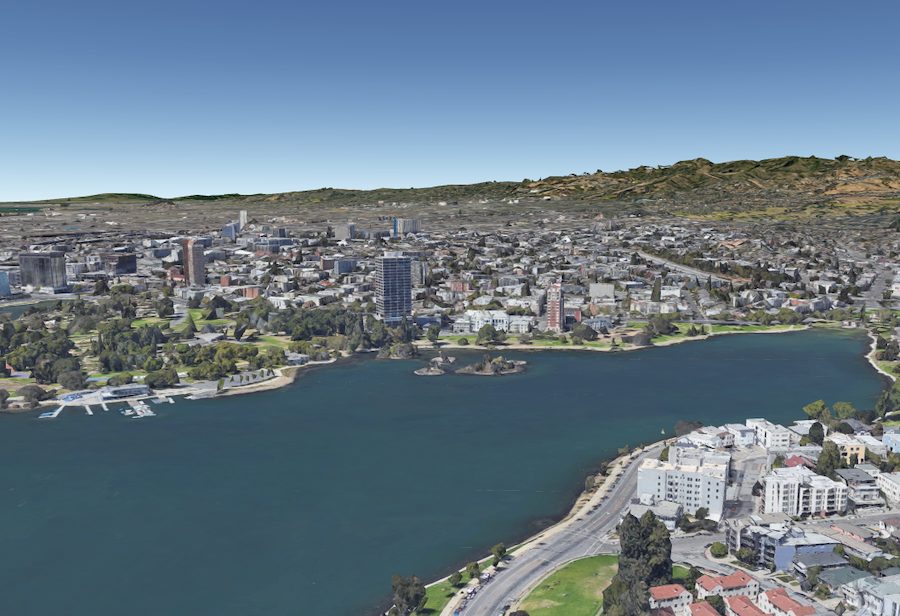
Empowerment Park is near San Francisco, located on the eastern side of the tidal lagoon, Lake Merrit, in Central Oakland. Empowerment Park is a National Historic Landmark that spans some 140 acres. It offers spectacular views of the lake and surrounding areas. Drone pilots who like to film at dusk can capture the amazing necklace lights that illuminate the lake. Videographers who enjoy nature—especially birds—can film a variety of species from the several islands.
Flying around Lake Merrit, be careful as the pathways and streets around the lake can get very busy with foot and vehicle traffic. There are also many seagulls and other birds in the area that can act aggressively towards craft.