-
1. General surveillance
-
2. Precision agriculture
-
3. Crop spraying
-
4. Land mapping
- Drone News Update
-
5. Livestock management
-
More future uses of drones in agriculture
- Aerial planting
- Flight beyond visual line-of-sight
- American Manufacturer Freefly Talks New Product & Drone Ban - Matt Isenbarger - PiXL Drone Show #82
- Better accessibility to farmers
- Adoption of modern practices
-
Final thoughts
Of the many ways in which drones are being used in today’s industries, agricultural use remains one of the rarer but more valuable ones. This is one of the more surprising results of the development of drone technology – that even such a traditional and old-fashioned industry as agriculture stands to benefit from a drone’s unique capabilities.
There’s no question that drones can cover hectares of farmland faster than any tractor or pickup truck can. However, what information can drones collect as they fly that can be useful for farm management? A lot of them, actually. Let’s look at the different ways in which drones have become useful in agriculture.
1. General surveillance
The mobility of a drone, paired with its ability to broadcast a livestream video feed from its onboard, has long made it a valuable tool in security and safety. This characteristic traces back to the first few times that a drone was ever used – for surveillance by the military.
Farms can be hundreds of hectares wide. Even with a fenced-in property, it’s virtually impossible to constantly have human eyes on the ground to catch intruders, wild animals, or livestock that have wandered off. This is where drones come in.
A drone can fly across several hundred hectares of land in a single battery cycle and in just a few minutes. This can be done as needed or be scheduled as part of regular farm management. As the drone flies across, the operator can monitor the real-time video feed for any unusual activity. Drones can even be outfitted with thermal cameras so that surveillance can be done under the darkness of night.
For larger farms that cannot be monitored by a single drone, professional drone companies have started offering surveillance by drone swarms. This involves the use of a small fleet of drones that automatically fly along pre-established routes. This eliminates the need for manual drone flight and extends the scope of a drone surveillance system. However, such an operation requires a waiver for a particular Part 107 drone flight restriction.
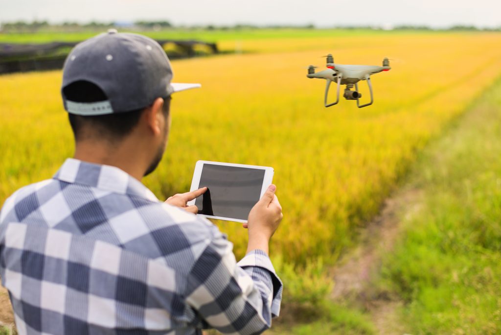
2. Precision agriculture
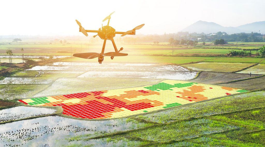
By far, the widest and most useful application of drones in an agricultural setting lies in a practice broadly called “precision agriculture.” This pertains to large-scale data collection which can be used as metrics of crop health.
Aside from the numbers that indicate crop health, each data point in precision agriculture has a spatial dimension, which means that each point corresponds to a particular spot on the farm. This makes targeted remediation possible – fertilizer, pest control, or irrigation can be allocated exactly where they are needed. This data-driven approach will result in a farm that is run more efficiently.
Drones can aid in precision agriculture by outfitting them with multispectral sensors. These sensors are a lot like cameras, except they are sensitive to energy outside of the spectrum of visible light. Multispectral sensors are special because they can detect and record energy at different frequencies. This data can then be manipulated, combined, and interpreted to infer very important indicators of crop health.
For instance, the chlorophyll pigment found in healthy plants leads to higher absorption of infrared light and lower absorption of near-infrared light. When combined, data from the two frequencies constitute the Normalized Difference Vegetation Index (NDVI), which is a measure of photosynthetic activity.
Precision agriculture isn’t a field that was only developed because of drones. However, drone technology created an opportunity to practice precision agriculture in a manner that is quick and inexpensive. The only downside is that most commercial drones aren’t ready for precision agriculture right out of the box – you’ll have to modify them with multispectral sensors typically by a third-party service.
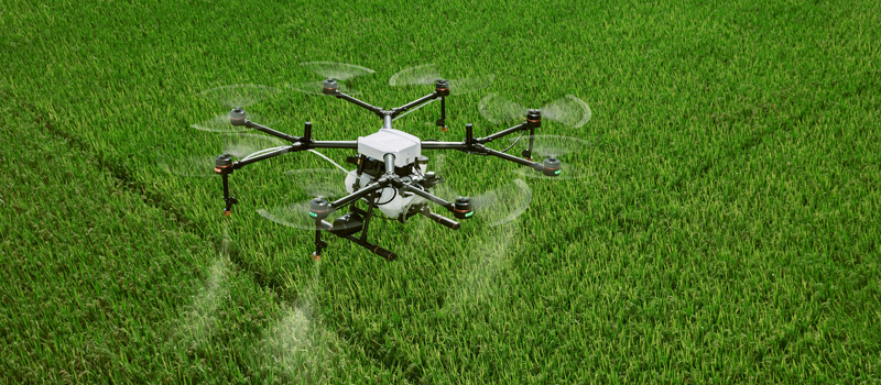
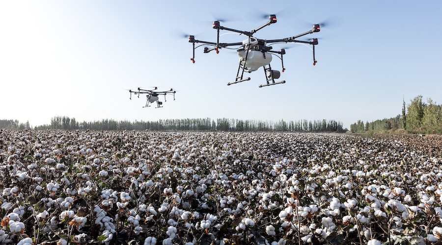
3. Crop spraying
Not many drones are known for their lifting power. In most cases, the propeller motors of a drone are only powerful enough to carry the drone’s own weight and withstand normal levels of wind resistance. However, exceptionally powerful drones can be useful in agriculture as a replacement for crop dusters.
The DJI Agras MG-1 is one of the few drones that are capable of this feat. With a 10-kilogram payload capacity, the Agras can spray treatment chemicals for crops across up to 10 acres on a single battery cycle.
China has been at the forefront of the use of drones for crop spraying. There have already been studies involving the automation of drones for crop spraying, making use of pre-planned GPS routes, and advanced obstacle avoidance systems. Some drones can even be programmed to vary the spray rate relative to the drone’s cruising altitude to ensure that the crops are sprayed equally.
Compared to crop dusters, drones are capable of more precise and targeted crop spraying. They can fly around small obstacles to access areas that would have been inaccessible to a manned aircraft. They are also much cheaper and easier to deploy.
Aside from current limitations on drone technology, the widespread use of drones for crop spraying has also run into a few legal issues. Aerial spraying has already been banned in some countries due to environmental concerns on the uncontrolled application of crop treatment chemicals. Some countries also prohibit flight of drones with heavy payloads as part of their anti-terrorism laws.
4. Land mapping
The use of drones for mapping has long been documented. Through the use of either photogrammetry or LiDAR, drones can be used to collect data over a region and reconstruct a 3D model of its terrain. This comes useful in a lot of industries including construction, mining, and urban planning.
In a farm setting, regular mapping by drones can be done to get a “lay of the land.” This can be useful for monitoring changes in topography, foliage, crop health, and crop density. Think of it as getting a highly detailed and full navigable snapshot of the farm.
The maps generated using aerial mapping techniques can be accurate to the centimeter level. This makes them useful for coming up with an infinite number of accurate measurements. Do you need to know the exact area of a patch of crops that need to be treated with fertilizer? How high are the trees in your orchard? All you need to do is to jump into that 3D map and take measurements.
Terrain information can also be very useful for planning irrigation systems. By identifying water sources, and determining how they cascade down the topography, farmers can better determine where active irrigation is needed and where passive, gravity-driven irrigation can be used as the more practical option.
5. Livestock management
Keeping track of livestock is one of the more labor-intensive jobs on a farm. They have to be counted, monitored, and regularly checked for signs of sickness, injury, or pregnancy. Through the use of drones, such tasks can be done in real-time without having to physically visit the barn or grazing fields. This frees up a lot of time for the farmer which can be used for more productive work.
Thermal cameras can prove to be a great enhancement for livestock monitoring. This allows for easy tagging of livestock, even at night. With regular monitoring, the presence of predators near your livestock can even be determined.
More future uses of drones in agriculture
Despite all the different ways in which drones can now be used in agriculture, there is still so much more potential for the technology. Here are just some of the ways in which drone use in agriculture can become more common in the future.
Aerial planting
One of the more unusual concepts being developed for drones is the concept of “aerial planting.” As the name implies, this involves the use of drones to plant seeds pods in the soil so that planting can be done remotely or automatically.
The most high-profile example of this technology was developed by UK-based BioCarbon Engineering. With an objective to battle deforestation, they created a system where drones can fire seed pods into the ground using hydraulic force while it hovers six feet above the ground. With their technology, up to 400,000 seed pods can be planted in a day by ten drones controlled by only two operators.
There were also elements of automation in the system. Using a 3D map (which the drones also scanned), the operators can program exactly where the seed pods will be planted. This removes the need for manual control while improving the accuracy of the location of planting sites.
Aerial planting can provide opportunities for less labor-intensive farm management. When planting season comes around, farms can be populated with seeds much faster than previously possible with farm tractors. Although still an immature technology, the potential of aerial planting is huge and quite exciting.
Flight beyond visual line-of-sight


Right now, all forms of drone flight are only permitted within visual line-of-sight. What this means is that the drone pilot needs to be able to see the drone’s location, attitude, and direction of flight without the use of vision enhancement aids. This expressly prohibits the use of flying only with FPV or using the real-time video feed of the drone’s camera.
This can be limiting for drone use in agriculture because visual line-of-sight can only be reliably established for less than two miles. For farms that span hundreds of hectares wide, it means that the drone pilot needs to change from one vantage point to another so that they do not violate the FAA’s laws.
In recent years, the FAA has somewhat loosened its stance on drone flight beyond visual line-of-sight. Although licensed drone pilots still need to apply for a waiver, the FAA has been more liberal about granting said waivers. A few measures are typically put in place – geofences to avoid drone flyaways, a reliable return-to-home feature, multiple visual observers, and a drone recovery system.
Better accessibility to farmers
All things considered, it’s not the immature technology that remains the biggest hurdle for drone use in agriculture – it’s the expenses. Despite their critical role in food security, farmers are still in a field with very small profit margins, fluctuating market conditions, and under heavy risk for climate change and adverse weather conditions. This makes farmers apprehensive about spending capital for drone technology, even if they can generate higher profits and savings in the long run.
The equipment needed for agricultural drone use remains uncommon and novel. Whether it’s multispectral sensors, thermal cameras, or heavy-lifting drones, all these equipment are a lot more expensive than your standard prosumer-grade drone. There’s also the matter of expertise – specialized drone use for agriculture is beyond the skill set of your average drone pilot.
Right now, drones used in agriculture are either purchased by the farmer or by a cooperative of farmers to keep the costs down. There are also third-party services that offer agriculture drone flight services, which allows farmers to skip the part that requires capital investment.
Adoption of modern practices
Somewhat related to the previous bullet is the seeming reluctance of many partners to adopt practices that are more modern or technologically inclined to what they are used to. This pertains to more than just drones – according to a study by the US Department of Agriculture, only 47% of farms use computers for business purposes. Thus, the challenge is two-fold. Not only do farmers need to be given access to modern technology, but they also need to be inclined to change their old practices.
Until such time, widespread drone use in agriculture will not be probable. The burden is then placed on the drone manufacturers to come up with a middle ground. This means that they need to make their technology more user-friendly, keeping in mind that their market may not be tech-savvy.
Final thoughts
In terms of social relevance, agricultural drone use may be one of the more valuable applications of drone technology. If drones can help keep farm management costs down and reduce crop damage, they can help improve food security while increasing profit margins for farmers. Right now, there have already been a lot of technologies developed for drone use in agriculture. The biggest challenge, however, is how to place this technology in the hands of farmers.