In aviation, altitude is far more complex than its dictionary definition.
Pilots use several types of altitude for varying purposes, which include reading aeronautical charts, communicating with ATC, and calculating aircraft performance.
In this short guide, you’ll learn about the different altitude types and their significance.
Key Takeaways
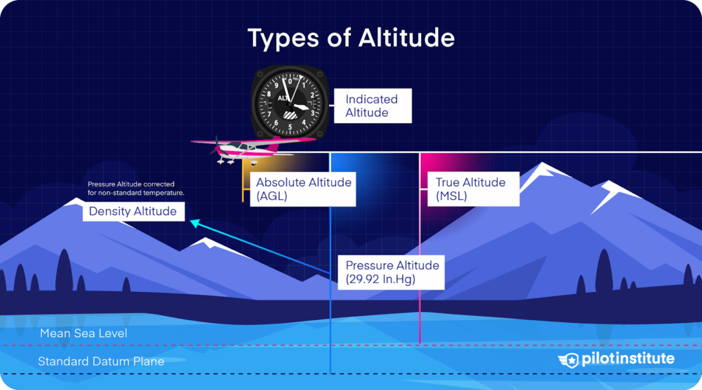
- Pilots use six altitude types: Indicated, True, Absolute, Pressure, Density, and Flight Levels.
- Indicated altitude shows the altimeter reading, while true altitude refers to height above MSL.
- Absolute altitude measures height above ground, which is critical during approaches and landings.
- Pressure and density altitudes impact performance, while flight levels separate at high altitudes.
Indicated Altitude
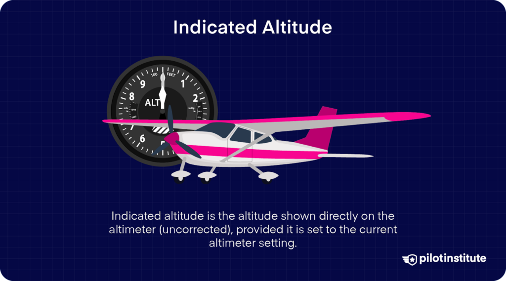
Indicated altitude is the reading on the altimeter when the altimeter setting is set to the local barometric pressure.
Altimeters display altitude in feet in the United States and most of the world, but a few countries such as Russia use meters.
Indicated altitude is mainly used for aircraft separation and standard operating procedures.
True Altitude
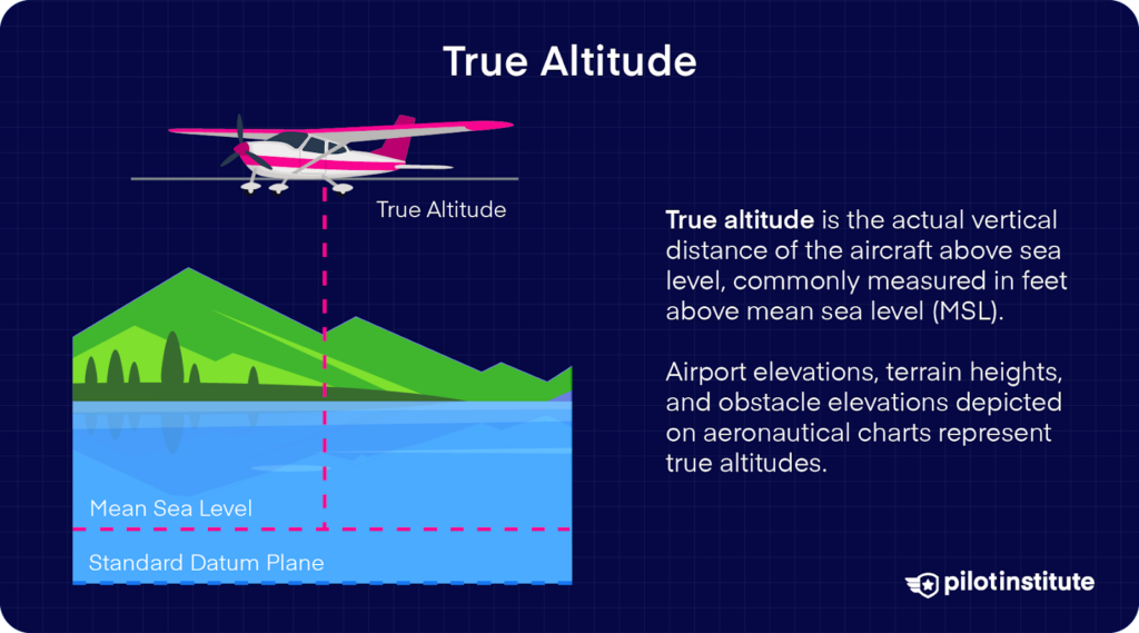
The vertical distance of the aircraft above mean sea level (MSL), which is the indicated altitude corrected for non-standard temperature and pressure.
Airport, terrain, and obstacle elevations on aeronautical charts are true altitudes.
True altitude equals the indicated altitude when conditions are standard, which is rarely the case.
Absolute Altitude
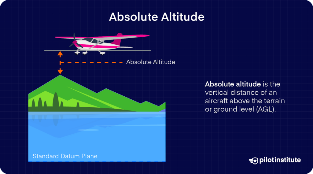
The vertical distance of the aircraft above ground level (AGL), which is true altitude minus terrain elevation.
Radio or radar altimeters measure absolute altitude, usually up to 2,500 feet AGL.
This type of altitude is crucial during approach and landing as it gives pilots an indication of how far the aircraft is from the ground.
Pressure Altitude
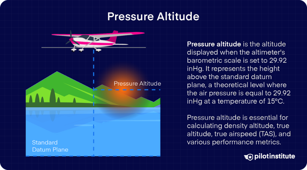
The vertical distance of the aircraft above the standard datum plane, which is a theoretical plane where air pressure (corrected to 15 °C) equals 29.92 inches of mercury.
Pressure altitude is equal to the indicated altitude when the altimeter setting is set to, you guessed it, 29.92” Hg.
It is used for performance calculations and flight level computation.
You can learn more about the differences between pressure and density altitude in our article Pressure Altitude Explained.
Density Altitude
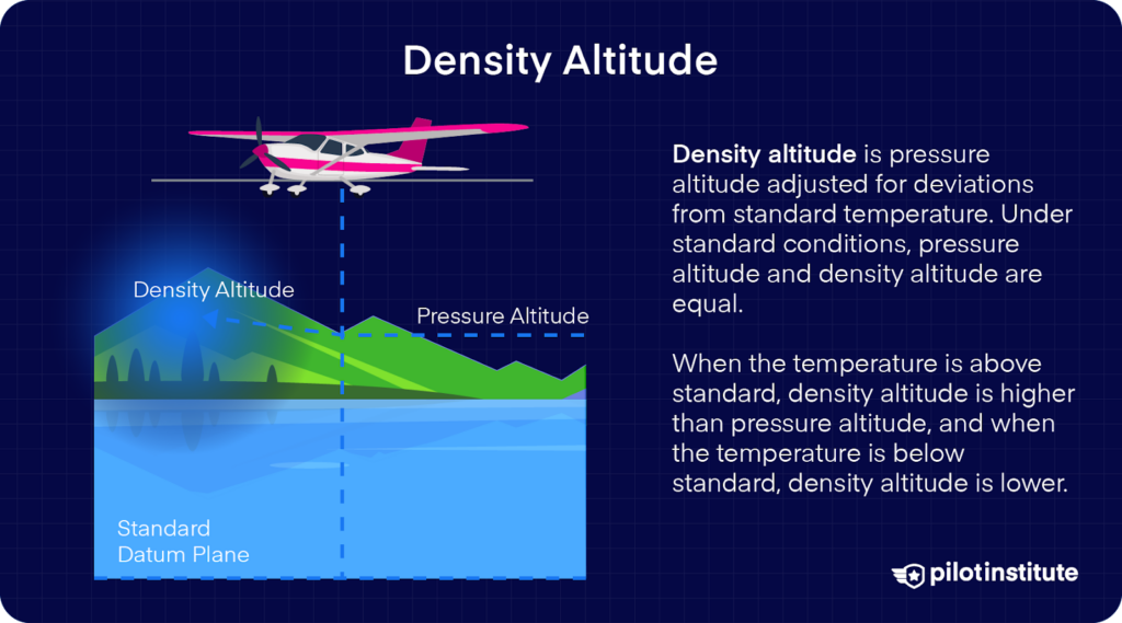
Pressure altitude corrected for variations from standard temperature, or simply put, it’s the air density expressed as an altitude.
Density altitude equals pressure altitude when atmospheric conditions are standard.
It’s one of the most important types of altitude as it’s directly related to the aircraft’s performance.
Flight Level
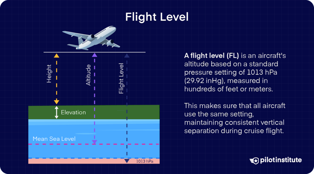
Pressure altitude is expressed in hundreds of feet, which is used in class A airspace above 18,000 feet in the United States.
Flight levels’ purpose is to ensure adequate vertical separation between aircraft at higher altitudes.
Pilots start using flight levels at and above the transition altitude, reverting to feet below the transition level.
Transition Altitude and Level
Transition altitude (TA) is the altitude above sea level at which pilots change the altimeter setting from the local to the standard setting and switch from using altitudes to flight levels.
Transition level (TL) is the lowest flight level above the transition altitude, at which a pilot must switch from the standard to the local altimeter setting and start referring to altitude in feet.
Conclusion
Altitude plays a key role in aircraft operation. To recap, here’s a quick summary of the types of altitude used in aviation:
- Indicated altitude: altimeter reading
- Absolute altitude: above ground level
- True altitude: above sea level
- Pressure altitude: above the standard datum plane
- Density altitude: air density expressed as an altitude
- Flight level: Pressure altitude in 100s of feet
Always pay attention to your transition altitude and level; it’s paramount to change your altimeter setting accordingly to avoid any safety hazards.