-
Key Takeaways
-
What Is an IFR Flight Plan?
-
Understanding IFR Requirements and Regulations
- The 1-2-3 Rule
- Alternate Airport Weather Minimums
- IFR Currency Requirements
-
Weather Considerations for IFR Planning
- Frontal Systems
- Seasonal Considerations
- Getting Updates
-
How to File an IFR Flight Plan
- 1. Gather Essential Information
- 2. Choose Your Filing Method
- Common Mistakes to Avoid:
-
The Best Flight Planning Tools and Resources
- Popular Flight Planning Tools
- Overview of Flight Planning Tools
- Pros
- Cons
- Pros
- Cons
- Pros
- Cons
-
In-flight Adjustments and Safety Tips
- Weather Changes
- ATC Changes
- Safety Tips
-
Conclusion
You might think that Instrument Flight Rules (IFR) are just about how to control and use your instruments in the aircraft, but you need more than skill–you need a rock-solid plan.
IFR flight planning is about preparing for every twist and turn along the route. You need to anticipate alternate airports and be prepared for those “what if” moments.
This article will teach you ways to deal with weather, routes, altitude choices, and using helpful tools when flying in poor visibility.
The goal? To help you fly confidently and to prepare for both the planned and unplanned aspects of IFR.
Key Takeaways
- Creating an IFR flight plan requires looking at weather patterns, fuel requirements, and alternate airports.
- Use the 1-2-3 rule to determine if you need to file for an alternate airport.
- Digital flight planning tools streamline the process but shouldn’t replace fundamental planning skills.
- Regular weather updates and maintaining situational awareness are important for safe IFR operations.
What Is an IFR Flight Plan?
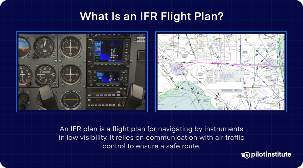
An IFR flight plan is similar to a roadmap through the clouds. The flight plan informs the Air Traffic Control (ATC) of your planned course, aircraft capability, and contingency plan. Consider it a deal with ATC – they provide separation from other aircraft, and you follow the assigned route and altitudes.
Unlike Visual Flight Rules (VFR), filing an IFR flight plan is mandatory for all IFR flights. Whether sunny, rainy, snowy, or stormy, you will fly in controlled airspace. ATC uses your submitted flight plan to coordinate traffic and maintain safe separation between aircraft.
Understanding IFR Requirements and Regulations
IFR provides a standardized system for instrument-based flight, which allows for better airspace management, minimizes the risk of mid-air collisions, and enables flights to operate even when weather conditions are not optimal.
File an IFR flight plan if you cannot use visual references to fly safely or require traffic separation. While VFR flights rely on seeing outside the aircraft, IFR procedures allow pilots to navigate precisely when they cannot see the ground, horizon, or surrounding terrain.
Note: To file an IFR flight plan, you must meet certain qualifications, have certified IFR aircraft equipment, and hold a valid instrument rating.
The 1-2-3 Rule
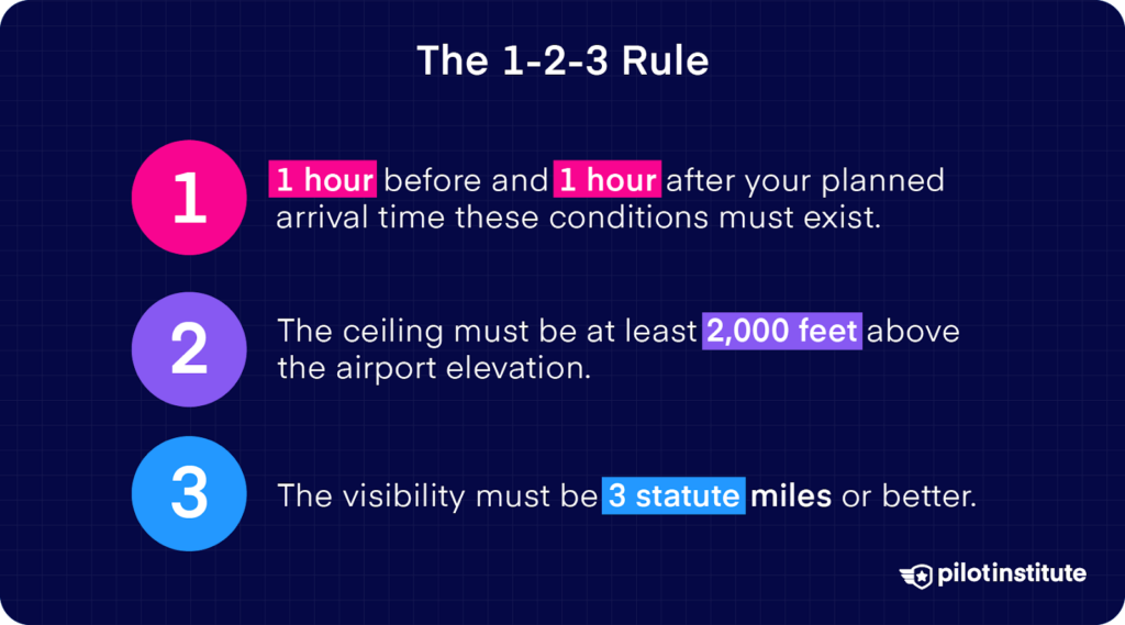
During flight planning, you should follow the 1-2-3 rule. So, why should you care about this rule? This rule provides guidance for determining if you need to file an alternate airport on an IFR flight plan.
For your planned destination, you need ALL of these conditions to exist:
- One hour before and one hour after your planned arrival time these conditions must exist.
- The ceiling must be at least 2,000 feet above the airport elevation.
- The visibility must be 3 statute miles or better.
If any ONE of these conditions is not met, you must file for an alternate airport. Your alternate airport must have a working instrument approach procedure available.
Note: While the 1-2-3 rule may indicate you don’t legally need an alternate, experienced pilots often file one anyway.
Alternate Airport Weather Minimums
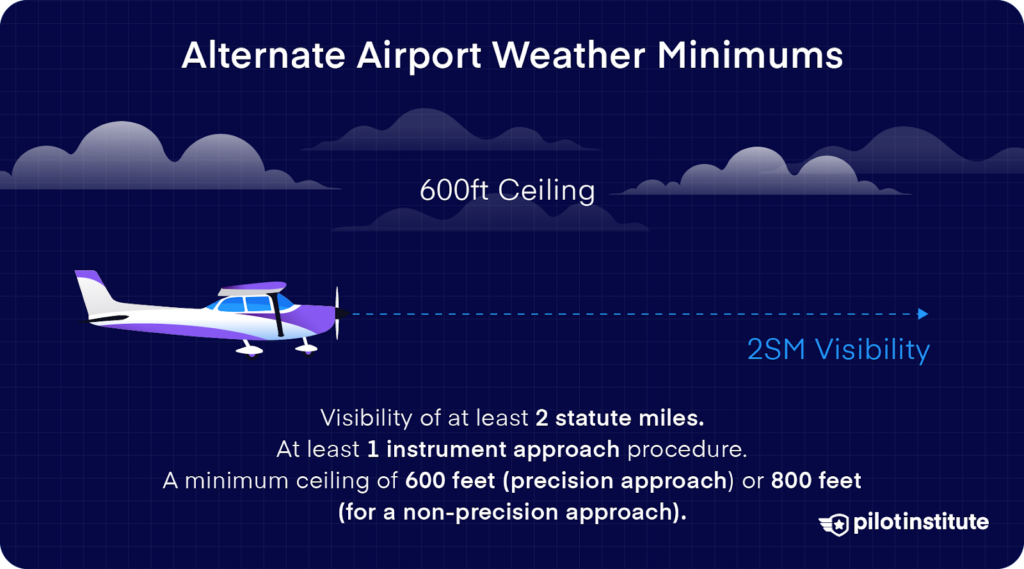
When selecting an alternate airport for an IFR flight, the weather minimums at your estimated time of arrival must have the following:
- Visibility of at least 2 statute miles.
- At least 1 instrument approach procedure.
- A minimum ceiling of 600 (precision approach) or 800 feet (for a non-precision approach).
IFR Currency Requirements
As a pilot, you must remain proficient in flying under Instrument Meteorological Conditions (IMC). The FAA requires specific currency requirements to maintain your instrument flying privileges.
Within the Past 6 Months, You Must Log:
- 6 instrument approaches.
- Holding procedures.
- Course intercepting and tracking using navigational systems.
If You’re Not Current:
- You cannot act as a pilot in command under IFR.
- You must complete an Instrument Proficiency Check (IPC) with a Certified Flight Instructor Instrument (CFII).
- The IPC must include tasks specified in the Instrument Rating Airman Certification Standards (ACS).
- Once completed, your IFR currency clock resets.
Weather Considerations for IFR Planning
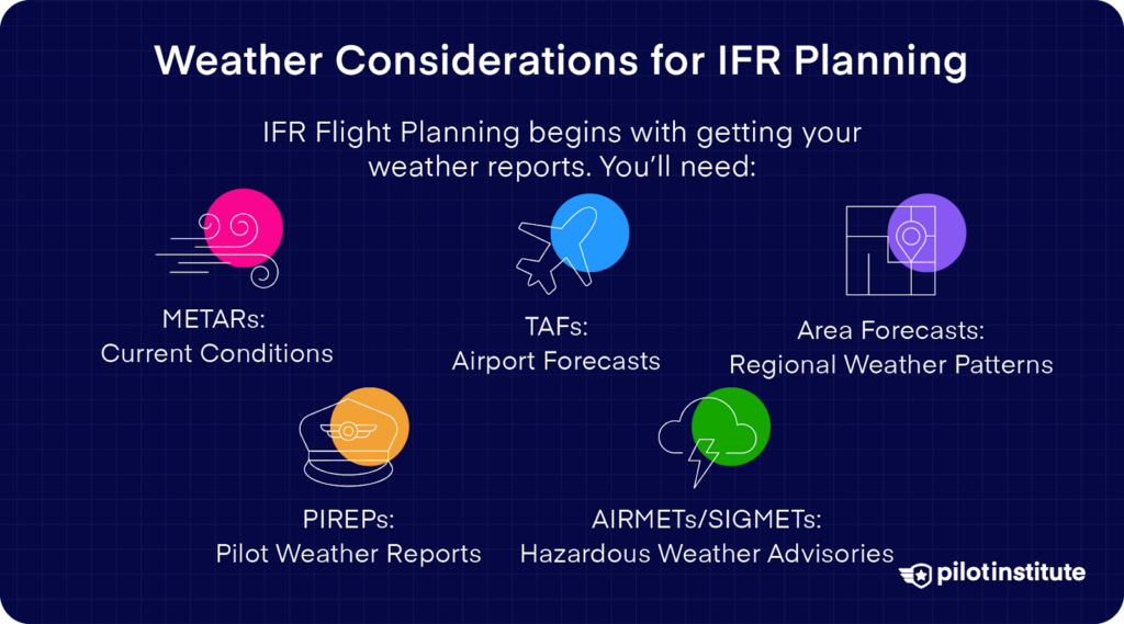
Weather is an important factor in IFR flight planning. After some practice, reading weather reports will become second nature to you. You should start with these weather resources:
- METARs: Current conditions.
- TAFs: Airport forecasts.
- Area Forecasts: Regional weather patterns.
- PIREPs: Pilot weather reports.
- AIRMETs/SIGMETs: Hazardous weather advisories.
It’s best to create an IFR flight plan that avoids bad weather and low visibility conditions. Understanding weather patterns will help you make better decisions and plan for alternate routes. You should pay special attention to:
Frontal Systems
- Cold fronts often cause sudden changes in weather conditions.
- Warm fronts present gradual but steady IFR conditions.
- Stationary fronts can trap moisture and create long periods of low visibility.
Seasonal Considerations
- Summer thunderstorms require pre-planning to avoid storms.
- Winter operations require checks to prevent icing.
- Unfavorable wind conditions arise in transition seasons, such as spring and fall.
Getting Updates
Never check the weather only once. Smart pilots get regular updates:
- During preflight planning.
- Before the engine starts.
- While en route.
- When approaching the destination.
- Any time conditions appear different than forecast.
How to File an IFR Flight Plan
Before taking off, the FAA requires that you file an IFR flight plan. The ATC accepts flight plans up to 22 hours before your set departure time. However, you should file your IFR flight plan at least 60 minutes before departure.
Filing an IFR flight plan is easy and involves the following two steps:
1. Gather Essential Information
- Aircraft identification.
- Type of flight.
- Aircraft type and special equipment.
- True airspeed.
- Departure point.
- Proposed departure time.
- Cruising altitude.
- Route of flight.
- Destination.
- Estimated time en route.
- Fuel on board.
- Number of passengers.
- Alternate airports.
- Pilot information and contact details.
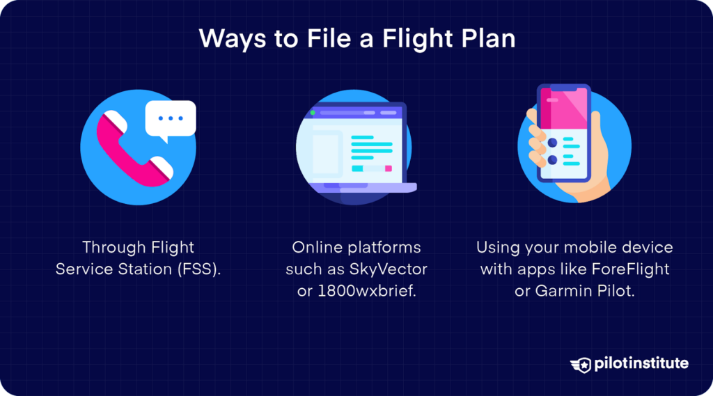
2. Choose Your Filing Method
- Through Flight Service Station (FSS).
- Online platforms such as SkyVector or 1800wxbrief.
- Use your mobile device with apps like ForeFlight or Garmin Pilot.
Common Mistakes to Avoid:
- Filing without checking Notice to Airmen (NOTAMs).
- Overlooking airspace restrictions.
- Forgetting to include alternate airports.
- Not calculating fuel requirements properly.
The Best Flight Planning Tools and Resources
As a modern IFR pilot, you have numerous tools at your disposal:
Popular Flight Planning Tools
- ForeFlight
- Garmin Pilot
- FltPlan.com
- WingX Pro
- Printed Charts
Overview of Flight Planning Tools
Flight planning tools can simplify the process of creating and filing IFR flight plans. These apps can also help with missed approach procedures. Here’s an overview of some popular tools and software for IFR flight planning:
ForeFlight
ForeFlight is the market leader for a reason. It offers IFR flight filing (web or mobile), real-time weather, and easy charting. However, the subscription price ($10 to $30 per month) runs higher than rivals.
Another downside is the learning curve for new users. ForeFlight also relies heavily on an internet connection to provide all its functionalities.
The software does a good job of providing important information and auto-fills data for the flight plan such as planned route, departure time, ICAO airport codes, and more.
Pros
-
Integrated weather.
-
Smart route planning.
-
Performance calculations.
-
Automatic weather brief.
-
Digital chart management.
Cons
-
Expensive.
-
Learning curve.
Garmin Pilot
Garmin Pilot allows you to file IFR flight plans online via the app. While the interface is less user-friendly than ForeFlight, it offers good radar imagery. You can load instrument procedures, including Standard Instrument Departures (SIDs) and Standard Terminal Arrival Routes (STARs), from the flight plan page.
The software works even when used offline but requires storage space on the device. Plus, Garmin hides some features behind higher subscription levels, with the standard plan starting at $109.99 annually.
Pros
-
Excellent radar imagery.
-
Automated flight logging.
-
Terrain awareness.
-
Fuel planning tools.
-
Weight and balance calculations.
Cons
-
Requires storage space.
-
Some features require a paid plan.
Printed Charts
Printed or paper charts still have several advantages in this digital age. They never run out of battery power and provide a reliable backup when electronics fail.
The large format allows better situational awareness during planning. However, paper charts require regular updates, take up considerable space, and lack real-time changes. The cost of maintaining current charts can exceed digital subscriptions over time.
Pros
-
Easy to use.
-
See the big picture.
-
Good backup tool.
-
Doesn’t require power.
-
Passengers can follow landmarks.
Cons
-
Takes up space.
-
No real-time map updates.
In-flight Adjustments and Safety Tips
Weather and air traffic changes are two of the most common challenges you will face when flying IFR. Don’t worry – with the right mindset and strategies in your toolkit, you can handle these curveballs like a pro. Let’s take a look at how to handle these in-flight changes and situations.
Weather Changes
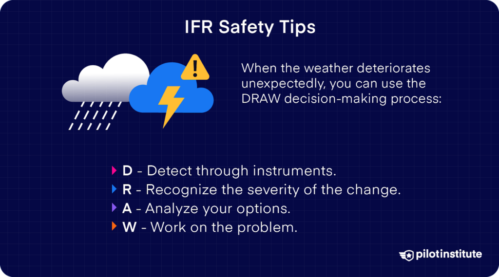
When the weather deteriorates unexpectedly, you should use the DRAW decision-making process:
- D – Detect.
- R – Recognize.
- A – Analyze.
- W – Work on the problem.
Start by detecting changes through instrument indications, visual cues, or updated weather reports. Recognize the severity of the change – is it a temporary situation or a developing trend?
Analyze your options while you still have time and fuel. Then, work on the problem by taking actions based on your analysis.
Imagine you are flying, and the weather starts to change rapidly. What should you do then? Here’s how to adapt when weather conditions aren’t going your way.
Ask ATC for a current weather brief. Check with PIREPs from the aircraft in front of you. If the weather becomes worse, you should deviate early. Remember the old saying: If you can see the thunderstorm, it can see you, so keep a distance of at least 20 Nautical Miles (NM) from the storm.
ATC Changes
ATC reroutes and delays require quick thinking and careful fuel management. Suppose you’re approaching your destination when ATC gives you unexpected new vectors or tells you to expect to hold. What’s your next move? First, check how this affects your fuel.
Ask for expectations from ATC. They won’t mind if you ask them to provide an estimated hold or delay time. Remember, you can always declare minimum fuel to alert ATC of your situation without declaring an emergency.
Safety Tips
Maintaining situational awareness of other aircraft while flying IFR requires you to use technology, radio communication, and visual scanning. While moving along the airways, ATC facilitates traffic separation. But you should look for traffic, especially when transitioning between IFR and VFR conditions.
Using TCAS
Your aircraft’s traffic avoidance systems serve as your first line of defense. The Traffic Collision Avoidance System (TCAS) and Traffic Advisory System (TAS) provide important information about other airplanes in the vicinity.
Note: These systems only detect aircraft with operating transponders.
Radio Communication
Actively listening on ATC frequencies will help you build a mental picture of the surrounding traffic. Pay attention to aircraft clearances, altitude assignments, and position reports, even when they’re not directed to you.
Visual Scanning
During the flight, use the block scanning method. Divide the windscreen into sections and scan each systematically. Pay particular attention to collision zones such as your flight path, ascending aircraft below, and descending aircraft above.
Conclusion
IFR flight planning requires you to be methodical and adaptable. As much as you plan, remember that flexibility can make or break an IFR flight.
Keep yourself grounded in what’s important, like checking NOTAMs, choosing realistic alternates, and brushing up on missed approach procedures.
While in-flight, stay aware of how conditions can change. Even if you’ve flown the same route a hundred times before, each flight can bring something new.
Being prepared but ready to adapt if needed. This will make every IFR flight far less stressful.
Keep refining your approach with each flight, because that’s where true confidence in IFR flying comes from.


